Claremont weighs wetlands overlay district to guide development
Claremont is considering a wetlands overlay that could add new review, setbacks and limits on buildable land, especially near wet areas along NH 12/103 and North Street.
Claremont is weighing a wetlands overlay district that could change where homes, additions, driveways and larger projects can go. If the city adopts the proposal, property owners and builders could face an added layer of review in wet areas or near them, especially where buffers, excavation, filling or construction come into play.
What the city discussed
The Claremont Conservation Commission took up the idea at a public meeting on Thursday, May 21, 2026, at 6:00 p.m. at the Planning & Development Department, 14 North Street. The concept is a Wetlands Overlay District, a zoning tool that would sit on top of existing rules and give the city more control over development in sensitive areas.
That matters because an overlay district is not just a planning exercise. In practice, it can affect whether a parcel can be built on as planned, how far a structure has to sit from a wetland, what kind of site work needs approval, and whether a project has to be redesigned before it can move ahead.
Why wetlands are back in the zoning conversation
The commission is already charged with preparing, adopting, reviewing and amending Claremont’s conservation and open space plan, including a natural resource inventory of open areas, swamps and wetlands, and areas of unique natural value or ecological importance. It also advises the City Council, municipal agencies, private groups and the public on how to carry out those plans.
That planning framework gives the wetlands overlay discussion a clear place in city government. It is not a standalone environmental gesture. It is part of how Claremont decides where growth should go, where it should be limited, and how to balance private land use with public protection.
The city’s broader planning history also matters. Claremont’s 2017 Master Plan was built from a public vision session in 2016, 230 surveys and more than 100 public subcommittee meetings. In other words, the current wetlands discussion is unfolding inside a planning culture that has already asked residents to weigh in on where the city should grow and what should be preserved.
What a wetlands overlay could change for property owners and builders
New Hampshire Department of Environmental Services guidance says wetlands serve several public purposes, including flood control, water quality, water storage and recharge, habitat, and economic and recreational value. The agency also says activities in wetlands and adjacent areas, including excavation, filling, dredging and construction, generally require wetlands permitting review under RSA 482-A.
That means the practical effect of a wetlands overlay could be significant even if it does not ban development outright. A property owner planning a garage, an addition, a retaining wall or a site driveway might have to show more clearly how the project avoids wetland impacts. A builder considering a larger subdivision or commercial site could face more constraints on layout, drainage and grading.
If the district is written broadly, it could also shape setbacks and reduce the amount of land that is actually buildable. That is where the policy shifts from simple protection to a real growth constraint. For some parcels, especially those near mapped wet areas, the overlay could preserve land that otherwise might have been used for development.
How broad the district could be
The state’s model ordinance language for a Wetlands Conservation Overlay District says the purpose is to protect public health, safety and welfare by preserving wetland ecosystems and water quality. It also says a district can cover surface waters, wetlands of any size and protective buffers around certain bogs and wetlands.
That is an important detail for residents trying to understand where the district might apply. A narrowly drawn rule might focus only on obvious wetlands. A broader overlay could also affect adjacent land that is not itself wet, but is close enough to require a protective buffer.
For abutters, that can mean more than a line on a map. It can affect view corridors, grading, runoff management and how close a neighbor can place fill or new construction to a wet area. For future projects, it could mean earlier coordination with the city and, in some cases, redesign before a permit application is complete.
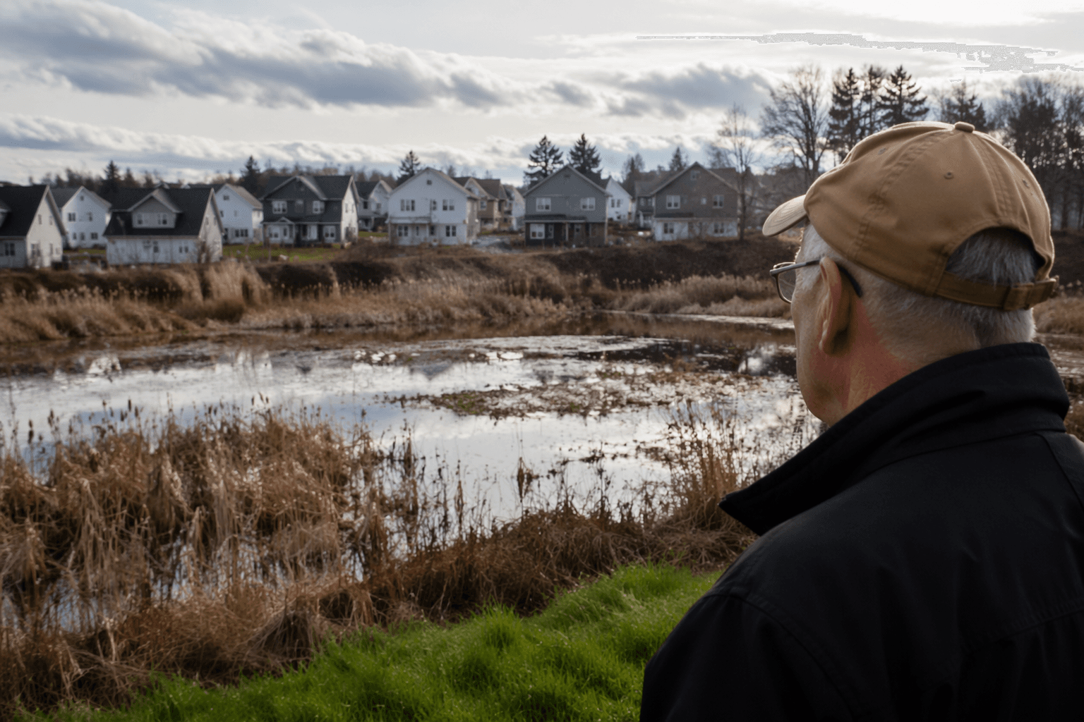
Where the first impacts may be felt
The clearest near-term connection appears to be along NH 12/103 and North Street. The Whitewater Reservoir Conservation Easement Stewardship Management Plan says Claremont is conserving land there to mitigate impacts tied to road improvements along those corridors because permanent proposed impacts exceeded 10,000 square feet in non-tidal wetlands.
That tells residents two things. First, Claremont is already managing wetland impacts tied to major infrastructure work. Second, the city has seen enough wetland sensitivity in these areas to justify conservation action. If the overlay advances, projects near those corridors are likely to feel the effects first, especially where road work, drainage changes or redevelopment touches wet ground.
Whitewater Reservoir itself sits inside that broader conservation picture. The stewardship plan shows that wetland mitigation is not abstract in Claremont. It is already linked to actual land use decisions and public works planning.
Protective update, growth constraint, or both
The best reading is that the proposal is both. It is protective because it aims to preserve wetland ecosystems, water quality and the city’s natural drainage systems. It is also a growth constraint because it can narrow where development can occur and increase the level of review for property owners and builders.
That dual role is exactly why zoning debates around wetlands can become so consequential. A wetlands overlay can help the city avoid future flooding, habitat loss and water quality problems. At the same time, it can limit shortcuts for development and reduce the buildable footprint on sensitive parcels.
For Claremont, the question is not whether wetlands matter. State guidance already makes that clear. The real question is how much legal weight the city wants to give that reality through zoning, and how much land it is willing to place behind a stronger protective line.
What happens next
The Conservation Commission’s role is advisory and planning-based, so any overlay would move through the city’s broader decision process before becoming part of local law. That makes the conversation at 14 North Street a first step, not the final word.
CCTV 10 listed the May 21 meeting in its public programming schedule, underscoring that the discussion was part of the city’s public record and not a backroom proposal. What emerges from here will show whether Claremont chooses a modest environmental guardrail or a more powerful land-use restriction, and the answer could shape how the city grows around its wetlands for years to come.
This article was produced by Prism’s automated news system from verified source data, official records, and press releases, then run through automated quality and moderation checks before publishing. The system is built and supervised by the people who set the standards it runs under. Read our full AI policy.
Know something we missed? Have a correction or additional information?
Submit a Tip