State groundwater checks underscore importance for drought planning, local water security
State geoscientists conducted field checks of groundwater monitoring wells on December 22, highlighting why continuous well records matter for drought assessments and drinking water planning in Sullivan County. Routine manual readings and temporary logger maintenance revealed technical hurdles and site vulnerabilities that affect how local officials track water availability during extreme weather.
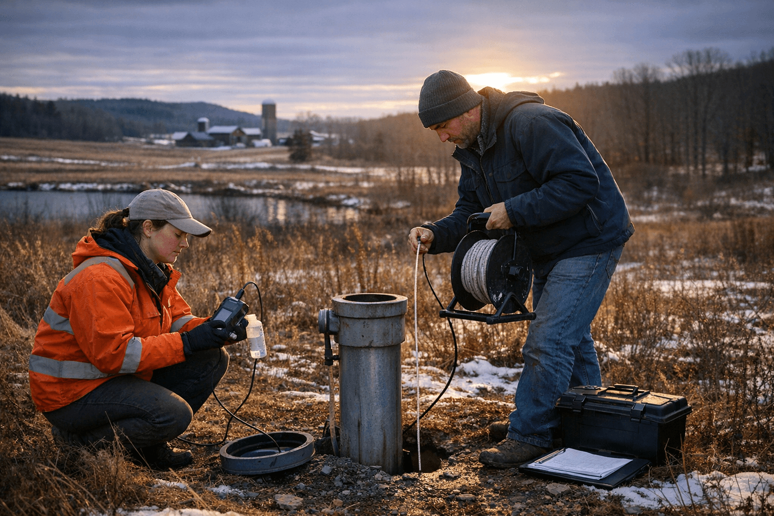
On December 22 state geoscientists visited monitoring wells across the region to take manual groundwater readings and to carry out routine maintenance on automated instruments. Senior geoscientist Mike Howley from the New Hampshire Geological Survey led the field work, using a probe and tape assembly to record water levels where automated loggers cannot be sited, and temporarily removing loggers for servicing. The checks underscored the practical and technical work that underlies regional drought and water supply assessments.
Groundwater monitoring wells provide continuous records that are used by state agencies and by national tools such as the U.S. Drought Monitor to assess the severity and extent of dry periods. Maintaining consistent site locations over decades allows scientists to distinguish normal seasonal swings from persistent changes in aquifer conditions. The December fieldwork illustrated why that continuity matters for Sullivan County residents who rely on private wells, municipal supplies, and surface water that can be influenced by underlying groundwater trends.
Field crews faced several routine challenges during the winter checks. Cold weather can interrupt automated data uploads, forcing technicians to collect manual readings. Development around monitoring sites sometimes requires relocating a well, which complicates long term records because a new site may not be directly comparable to the original. Those operational realities shape how quickly and confidently officials can diagnose emerging shortages and advise communities.
For Sullivan County the implications are local and immediate. Continuous groundwater records inform drought declarations, municipal planning, building permits, and decisions about emergency water supplies. Farmers, small businesses, and households with private wells depend on reliable monitoring to detect drops in water availability early enough to respond. Long term data also help planners understand how climate variability is reshaping seasonal water cycles.
State scientists said maintaining the network and addressing technical vulnerabilities will remain priorities. Continued field visits, instrument upkeep, and careful site stewardship are central to preserving the data needed to protect drinking water and to plan for future extremes that affect Sullivan County communities.
This article was produced by Prism’s automated news system from verified source data, official records, and press releases, then run through automated quality and moderation checks before publishing. The system is built and supervised by the people who set the standards it runs under. Read our full AI policy.
Did this article answer your question?


