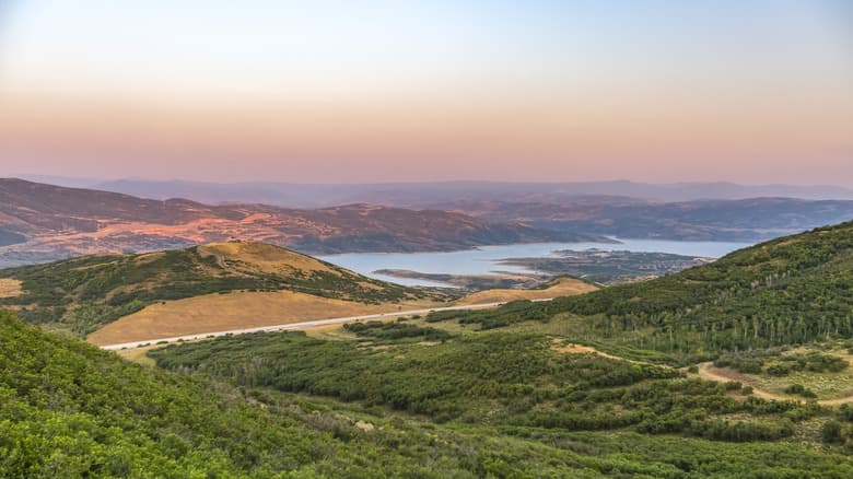
Spring Hikes, Loops and Scenic Drives to Explore in Summit County
Basin Recreation shut down Run-A-Muk by 11 a.m. daily this February as mud chewed through Park City trails; here's what's open now and what gets you ticketed.
Basin Recreation closed Run-A-Muk daily at 11 a.m. as recently as this February, citing extremely muddy conditions driven by an unusually warm winter — and that early-season damage is still the story on Summit County trails heading into April. Before you lace up boots or load the car for the Mirror Lake corridor, the conditions on the ground right now are more complicated than any best-of list lets on. Knowing which routes are actually open, what mud-season trail damage looks like, and which rules carry real consequences is the practical starting point for any spring outing.
What's closed and what's not: the honest picture
Highway 150 (the Mirror Lake Scenic Byway) is currently closed from Kamas to Evanston, Wyoming. The road typically opens to regular traffic from mid-May to mid-fall. That means the most iconic high-elevation destination in the region, including Mirror Lake Trail #223 and its network of alpine trailheads, is inaccessible by car until roughly mid-May at the earliest. The Uinta-Wasatch-Cache National Forest updates road status in real time; the district office can be reached at (307) 789-3194. Do not assume the gate is open based on a warm weekend forecast.
At lower elevations inside Park City, the situation is more nuanced. Paved and compacted gravel trails are the best option during mud season; lower-elevation and south-facing trails dry out faster than shaded or north-facing routes. Basin Recreation maintains a live trail-closure map online and posts signs at the closest trail junction when a route is shut; the agency is explicit that a dry-looking trailhead does not guarantee dry conditions further in.
What mud-season damage actually looks like
Mud damage in Summit County is not cosmetic. "After a full recon yesterday, it was a bit sad to see the amount of mud damage from foot traffic and bikes," Basin Recreation reported after an inspection. Repeated foot traffic and tire tracks on saturated soil compact the trail surface, widen ruts, and redirect drainage in ways that cost thousands of dollars and weeks of volunteer labor to repair. Basin Recreation's standing guidance is blunt: "If mud is sticking to your wheels or heels, it's time to turn around."
This year's damage potential is elevated. The warm winter that triggered Basin Recreation's February Run-A-Muk closures means snowpack arrived unevenly and is melting faster than normal, pushing mud season earlier and extending it at mid-elevation zones that would ordinarily be firmer in April.
Rules, restrictions and what gets you in trouble
Several regulations apply year-round but become especially relevant when spring crowds return:
- Overnight trailhead parking: Parking overnight at a trailhead or park is prohibited under Summit County Code Ordinance 981. This is enforced at Basin Recreation-managed facilities and is not a gray area.
- Off-leash areas: Run-A-Muk is designated for off-leash use but carries its own conditions-based restrictions. Basin Recreation has urged visitors to "help us protect our beloved off-leash area" by observing posted signage and avoiding muddy terrain. Ignoring closure signs at any Basin Rec facility puts you in violation of Summit County Code Ordinance 981, which exempts only Basin Recreation staff, law enforcement, and emergency services.
- Recreation area fees: Driving the Mirror Lake Scenic Byway is free once it opens, but stopping to use any recreation area requires a fee. America the Beautiful passes are honored at the Mirror Lake Scenic Corridor Recreation Area.
- Seasonal closures on soft-surface trails: Trail closure signs are not suggestions. Basin Recreation and the Uinta-Wasatch-Cache National Forest both close specific routes when conditions warrant; proceeding past a posted sign is a violation regardless of what the trail looks like at that moment.
Decision guide: where to go right now
The clearest way to choose a route in early April is by elevation and aspect:
- Muddy or uncertain conditions: Stay on paved or compacted gravel trails, or routes with a confirmed-dry Basin Rec status. Check the live Basin Recreation trail map before leaving the house, not the night before.
- Lower-elevation alternatives: Riley's Canyon and the Provo River Gorge corridor near Kamas offer river access, wooded sections and canyon scenery at elevations that shed snow and dry out ahead of mid-mountain trails. These are reliable backups when Park City's mid-mountain routes are still soft.
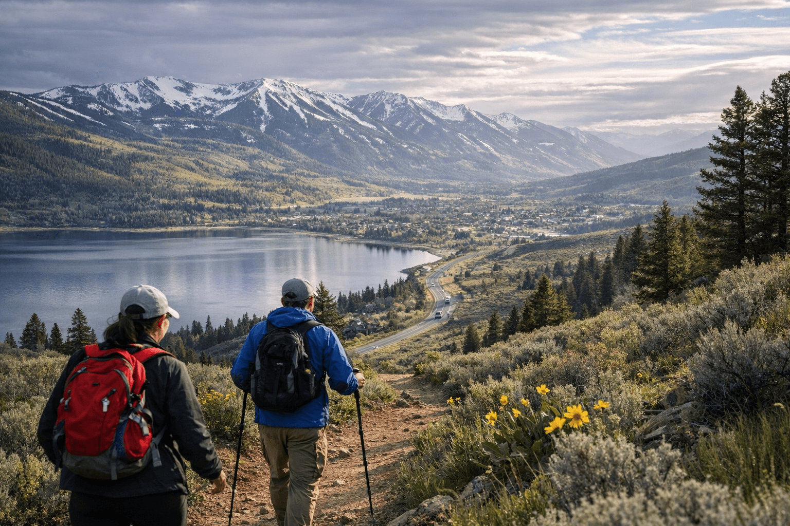
- Park City mid-mountain (when trails confirm dry): Routes including Spiro, Armstrong and Dawn's Trail provide strong views over the valley and town with moderate effort. Park City Mountain's trail pages list current conditions and remind users to carry water and sun protection; wildlife activity, including nesting, can also prompt temporary closures in spring.
- Avoid until mid-May or later: Mirror Lake Trail #223, the ~2-mile easy loop from Mirror Lake Campground, and all other Highway 150 trailheads. Bloods Lake and Silver Lake approaches at higher elevation can hold snow pockets in shaded sections well into May; microspikes and poles are advisable on early attempts even after access reopens.
What's worth the wait: Mirror Lake and the Kamas corridor
When Highway 150 does open, the Mirror Lake Scenic Byway earns its reputation. The route east of Kamas climbs through glacier-carved valleys into the High Uintas, passing alpine meadows that green quickly once snowmelt begins. Mirror Lake Trail #223 is among the most accessible introductions to the high country: an easy two-mile loop from the Mirror Lake Campground with unobstructed lake views that work for families and first-time visitors. Dozens of additional trailheads along the byway feed into the High Uinta Wilderness for those willing to go longer. Check the Uinta-Wasatch-Cache National Forest's Mirror Lake Scenic Byway page for the current gate status; it updates as conditions allow.
The practical checklist before you go
Spring in Summit County rewards the prepared and punishes the impatient. Before any outing above 7,000 feet, consult the Utah Avalanche Center for current snowpack conditions, check Basin Recreation's trail status map and the USFS Mirror Lake corridor page, and pack layers regardless of how warm it looks at the trailhead. Afternoon thunderstorms develop quickly over the Uintas from late spring onward, and creek crossings that look manageable at 9 a.m. can be a different proposition by afternoon as snowmelt peaks. The trails here are worth protecting, and the ones worth protecting most are the ones that close the fastest when hikers ignore the signs.
This article was produced by Prism’s automated news system from verified source data, official records, and press releases, then run through automated quality and moderation checks before publishing. The system is built and supervised by the people who set the standards it runs under. Read our full AI policy.
Did this article answer your question?