Texas County marker recalls Eureka school district consolidation history
Eureka’s marker shows how Texas County schools were built around distance, then pulled into consolidation as roads, cars and low enrollment changed daily life.
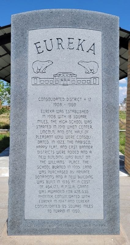
The marker listed as “Oklahoma, Texas County, Baker - Eureka - Consolidated District #12 - 1908-1969” records a school district that operated in Baker from 1908 to 1969. It shows how education, travel distance and population density shaped daily life across the Oklahoma Panhandle, where families often had to organize around miles of open country instead of a nearby town center. Its span tracks the rise of a rural district and the later consolidation that changed how children reached class, how schools were funded and how small communities stayed viable.
Why Eureka matters now
Texas County is one of the three Oklahoma Panhandle counties, created at 1907 statehood from Beaver County, the former Public Land Strip. It covers 2,041.3 square miles, and its 2024 population was 20,774, or about 10.2 people per square mile. School boundaries in the county had to follow where families lived, where roads ran and how far a child could realistically travel to school.
It records a district that emerged in an era when local schooling depended on small, scattered settlements and later gave way to a larger system that could serve more students with fewer duplicated facilities.
How a rural district formed
Eureka was established in 1908 with 18 square miles. In a county with low population density and long stretches between homes, a small local district was often the first practical answer for children who had to reach school without crossing too much open country.
Rural districts developed in response to geographic distance, large agricultural land sections and dispersed populations. In Texas County, those pressures were amplified by the county’s size and isolation in the Panhandle. Families could not rely on dense town networks the way residents in more compact parts of the state might have; education had to fit the land as much as the other way around.
What consolidation changed
The Eureka high school started in 1919 when Center, Lincoln and one-half of Plains consolidated. Consolidation meant larger attendance areas, longer travel for some students and a broader school structure that could offer higher grades and a more stable use of public funds.
For rural Texas County, consolidation altered who could stay connected to a local school and who had to travel farther each day. When small districts merged, the schoolhouse no longer sat at the center of every community in the same way. Instead, education began to follow a county-scale logic, shaped by roads, school buses and the need to stretch limited resources across a sparse population.
That pattern spread across southwestern Oklahoma. As motorized transportation improved, scattered one-room schools and tiny districts became harder to sustain on their own. Consolidation offered a way to keep public education functioning in places where enrollment was thin and distances were large.
A county shaped by distance
The county remains geographically large, thinly populated and heavily defined by movement across open space. School access was tied to whether a district could gather enough students without forcing impossible travel.
The county’s present-day towns sit inside that same broad geography. Even with better roads and modern vehicles, the basic reality remains: a large county with a small population has to decide how far a child can be expected to travel and what kind of school system can survive on a limited tax base. Those questions were already being asked more than a century ago in the Eureka district.
What disappeared, and what stayed behind
Eureka Consolidated District #12 lasted until 1969. The district’s disappearance removed a local institution that helped define community boundaries, property patterns and daily routines across a wide rural area. When a district disappears, the effect reaches beyond the classroom. It can change where families shop, where children make friends and how often a small place is visited by people who live beyond it.
The marker points to a broader shift in the economics of rural life. Consolidation often promised efficiency, but it also concentrated resources in fewer places and reduced the number of community schools that could anchor surrounding neighborhoods.
How to read the marker today
Texas County spans more than 2,000 square miles and holds fewer than 21,000 people. That scale creates hard questions about access, distance and public service delivery. Education was one of the first systems forced to confront those realities in Texas County.
This article was produced by Prism’s automated news system from verified source data, official records, and press releases, then run through automated quality and moderation checks before publishing. The system is built and supervised by the people who set the standards it runs under. Read our full AI policy.
Did this article answer your question?