Texas County Towns Hit 102°F in March, Worsening Drought and Fire Risks
Guymon, Hooker, and Goodwell hit 102°F on March 26 — in a county that hasn't seen a meaningful rain since before Thanksgiving.
Large portions of the Oklahoma Panhandle had already gone nearly four months without a quarter-inch of rainfall when Thursday turned brutal. Guymon, Hooker, and Goodwell all reached 102°F on March 26, placing them among the highest temperatures NWS Amarillo recorded anywhere across the region during one of the most extreme early-spring heatwaves the Plains has seen in recent memory.
Oklahoma was among the states swept up in the broader heat event, with temperatures hitting 90 degrees and higher across the region. Central states saw temperatures running 30 to 40 degrees above average for late March. At 102°F, Texas County sat at the upper end of that extreme, matching readings that echoed a 1907 temperature event across the region; the all-time Oklahoma March record remains 104°F, set in Frederick on March 27, 1971.
The heat arrived on ground already parched to a dangerous degree. In the far western Oklahoma Panhandle, some locations recorded 119 to 122 consecutive days without a 0.25-inch rainfall event, placing the last meaningful rain before Thanksgiving. Warm, dry, and windy conditions had been the rule across the southern Great Plains, leading to localized degradations in northwest Oklahoma and the Oklahoma Panhandle.
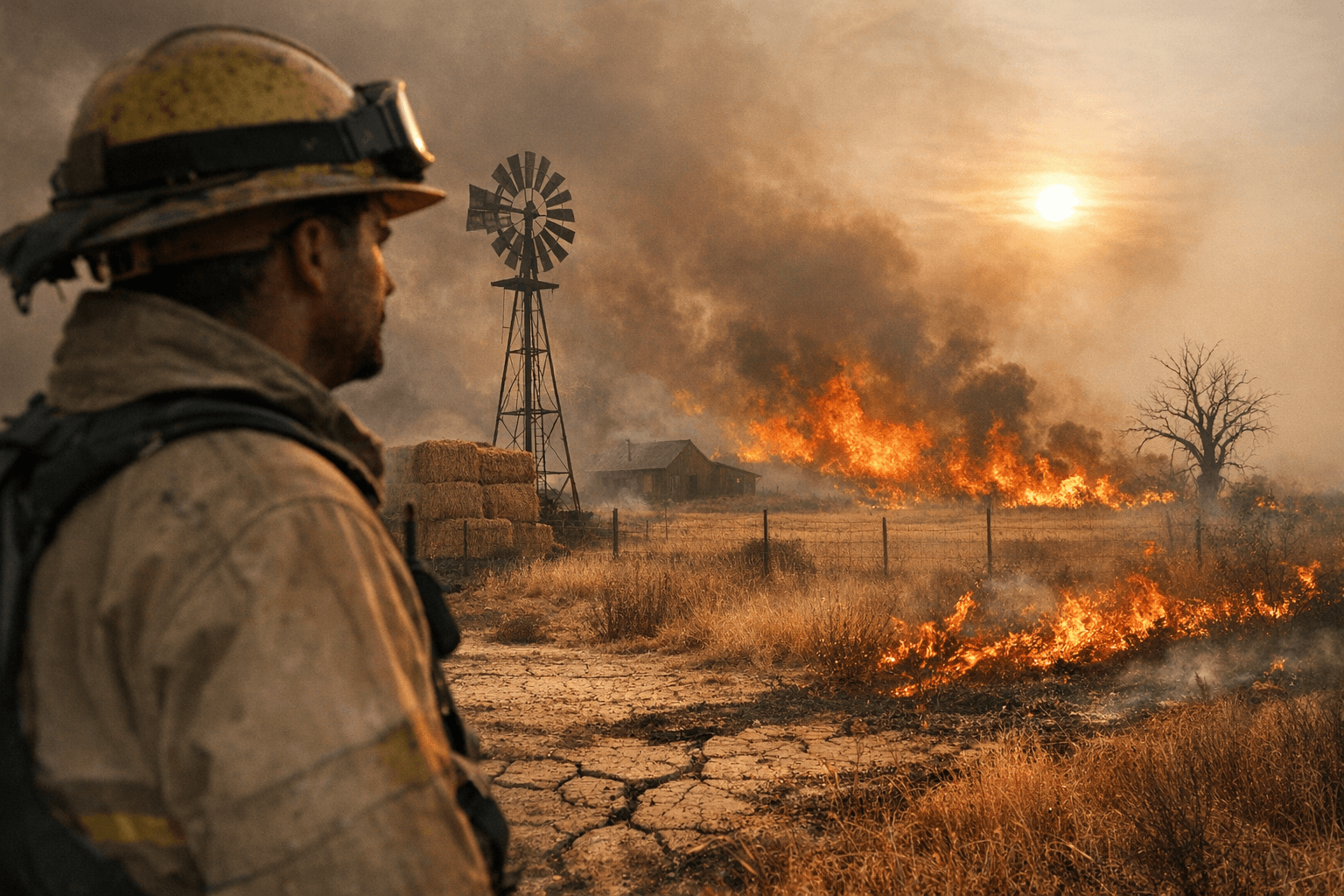
That dryness set the stage for weeks of elevated fire danger ahead of Thursday's peak heat. NWS Amarillo issued a Red Flag Warning for the Texas and Oklahoma Panhandles earlier in the month, with north winds of 35 to 45 mph and gusts up to 65 mph forecast while relative humidity dropped to around 15 percent. Fuels across parts of the region were reported in the 70th to 89th percentile of dryness, indicating elevated wildfire potential.
The Storm Prediction Center's Day 2 fire weather outlook had already highlighted critical fire weather conditions across the Texas and Oklahoma Panhandles and northwest Oklahoma, where low relative humidity and strengthening winds were expected to persist. Fire season in the southern High Plains typically peaks from February to April, driven by dormant grasses and seasonably low precipitation through winter months. This year, those baseline risks arrived on top of a drought that had been tightening its grip for months.
As of mid-March, approximately 94 percent of Oklahoma was under drought conditions. A majority of the South region had received less than half of normal precipitation, with a temperature departure of more than 6 degrees Fahrenheit above normal during the past 90 days. The March through May outlook shows below-normal precipitation is most likely, at a 40 to 50 percent chance, for the Oklahoma and Texas Panhandles.
For wheat farmers and ranchers across Texas County, the combination of record March heat, near-zero humidity, and a four-month rain deficit leaves pastures and crops in a precarious position heading into spring. Oklahoma's climatological winter of 2025 to 2026 had already entered the record books as the warmest in state history, leaving a trail of intensified drought and devastating wildfires in its wake. Thursday's 102°F readings were not an anomaly so much as the latest data point in a pattern that shows no sign of reversing soon.
This article was produced by Prism’s automated news system from verified source data, official records, and press releases, then run through automated quality and moderation checks before publishing. The system is built and supervised by the people who set the standards it runs under. Read our full AI policy.
Did this article answer your question?


