Texas County’s borderland roots trace back to 1907 organization
Texas County’s 1907 boundary lines still shape how people travel, shop, and do county business, with Guymon at the center of a wide Panhandle network.
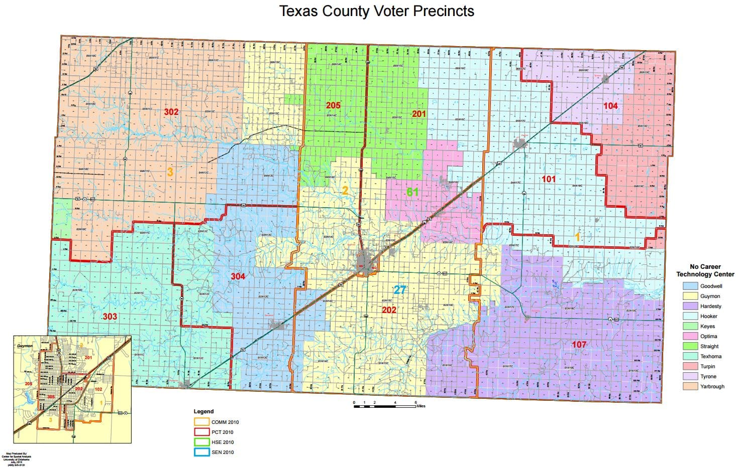
Texas County works the way it does because its boundary lines were set at statehood, not after decades of suburban growth or later annexation. Organized on July 16, 1907 from Beaver County, and one of three Oklahoma Panhandle counties carved from the old Public Land Strip, it was built for a borderland that still sends residents across county and state lines every day.
How statehood drew the county
Texas County is not just a name on a map. Its modern shape came out of the last stretch of Oklahoma statehood planning, when the Panhandle was being divided into local governments almost from scratch. The county was created from Beaver County, which had previously covered the Public Land Strip, and that origin still explains why Texas County feels like a crossroads rather than a compact center.
Its borders point outward in every direction. Texas County touches Baca County in Colorado; Beaver and Cimarron counties in Oklahoma; and Hansford, Morton, and Ochiltree counties in Texas, plus Seward and Sherman counties in Kansas. That border pattern matters because the nearest place to buy parts, see family, get to school events, or make a farm-related stop is often not inside Texas County at all, but in one of the neighboring counties just over the line.
Why Guymon became the county seat
Guymon is the county seat, and that decision still shapes how Texas County functions. The Oklahoma Historical Society places Guymon on U.S. Highways 54, 64, and 412 and State Highway 3, about ten miles southwest of Optima, a location that gives the city practical reach across the county’s wide open landscape. In a county built around long distances, the seat has to be reachable, visible, and connected to the main travel corridors.
That same highway position helps explain why Guymon is more than an office town. MHTC Guymon describes it as the largest city in the Oklahoma Panhandle and a retail hub for the region, which matches the way people across Texas County and beyond already use it. County government, shopping, and regional errands all converge there, so the seat functions as both an administrative center and a service center for a dispersed population.
A county built for distance
Texas County is the largest county in Oklahoma by land area, at 2,041.3 square miles. Census Reporter places the population at 20,774, which works out to just 10.2 people per square mile. Those numbers tell the story behind daily life: large spaces, fewer people, and a civic geography that depends on roads, not short drives.
That low density changes how local institutions operate. When a county is that large and that sparsely populated, public services, farm logistics, emergency response, and regular business all have to account for distance. It also means that Guymon’s role as the county seat carries extra weight, because a central location is not symbolic in a place like this, it is operational.
The county’s borders reinforce that reality. Residents live in a system where daily movement can cross from Oklahoma into Colorado, Texas, or Kansas and back again. That makes the county less like a sealed unit and more like part of a Panhandle network, with trade, family ties, and community routines spilling across lines that were drawn more than a century ago.
How the statehood map still shapes civic life
The old statehood decision still shows up in the most practical parts of county life. Records, meetings, and local administration center on Guymon because that is where the county seat is, while the county’s farthest communities remain tied to neighboring towns and highways that were never designed to keep people inside one jurisdiction. The result is a county identity built as much on movement as on place.
That is why Texas County’s early history matters now. The July 16, 1907 organization date marks more than a line in a history book, because it fixed the structure that still governs the county’s roads, its administrative center, and its relationship to the rest of the Panhandle. Texas County’s present-day civic life still follows the map drawn at statehood, and that map continues to define how the county works.
This article was produced by Prism’s automated news system from verified source data, official records, and press releases, then run through automated quality and moderation checks before publishing. The system is built and supervised by the people who set the standards it runs under. Read our full AI policy.
Did this article answer your question?