Best Spring Hikes and Day Trips in Union County
Plan a spring day trip that fits your time and stamina: low-elevation creek walks near Union, a quiet MERA loop two miles from La Grande, or a 1-hour drive for alpine wildflowers at Anthony Lakes.
easiest family outing: Catherine Creek State Park (best for short walks and wildlife)
Choose Catherine Creek State Park when you want a low-effort, ecologically meaningful outing close to town. The park sits on roughly 160–162 acres along Catherine Creek about 7.3 miles southeast of Union and offers creekside trails, footbridges, a campground/day-use area and easy picnic spots, so you can plan a half-day without a long drive. Restoration work in recent years — led by partners including the Grande Ronde Model Watershed, ODFW, OPRD and funders such as the Bonneville Power Administration — means you will often see newly fenced restoration sites or log structures placed to help spring Chinook and summer steelhead, so expect occasional access notices near streamside work areas. For logistics, factor in roughly a 20-minute drive from La Grande to Union plus forest and county-road time: many route notes and field guides estimate between 30 and 60 minutes from La Grande depending on which trailhead you use and seasonal road conditions.
best wildflower walk: Anthony Lakes Recreation Area (alpine meadows and blooms)
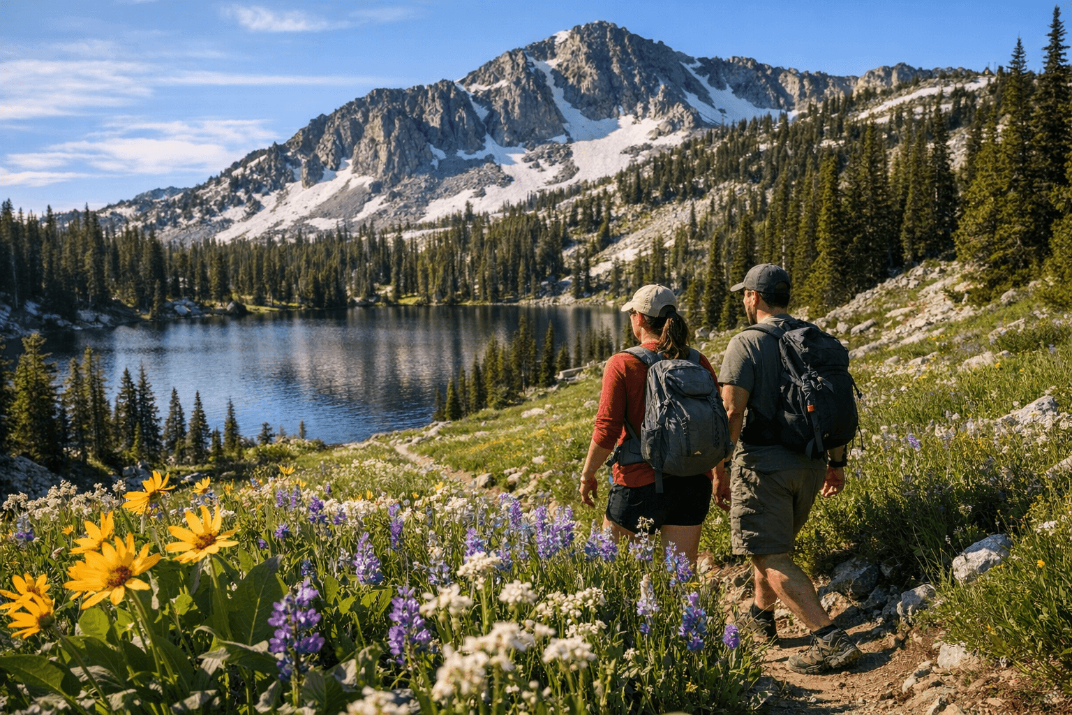
If your priority is a spring wildflower display and classic alpine scenery, Anthony Lakes Recreation Area in the Elkhorn Mountains is the regional choice. The Anthony Lake campground and day-use zone sit at about 7,000–7,100 feet elevation, so wildflowers at lower trailheads can be spectacular as snowline retreats, but high-elevation sections remain cool and occasionally snowy well into May; plan clothing and an earlier start. The Anthony Lake Loop is commonly described as an approximately 8.8-mile loop with about 1,580 feet of elevation gain, offering full-day hiking for fit families and hikers who want a true alpine feel. Practical access matters here: expect about a one-hour drive from La Grande to the Anthony Lakes area (roughly 44–46 road miles), and check Wallowa-Whitman National Forest or Anthony Lakes concession pages for seasonal road openings and pass/fee requirements — campgrounds and many high-elevation roads often open reliably in July through October during an average year.
quickest scenic drive: Jubilee Lake loop and approach
For a short scenic day that mixes trees and water without a long slog, drive to Jubilee Lake and walk the certified National Recreation Trail that loops the lake. The Jubilee Lake Recreation Loop is about 2.6–2.8 miles and circles a man-made lake created when an earthen dam was completed in the late 1960s; the trail is an easy 1–2 hour outing that stays low enough in elevation (around 4,700–4,760 feet) to clear earlier than Anthony Lakes in many years. Camping and day-use facilities at Jubilee Lake make it a reliable day-trip destination as spring conditions improve; the Umatilla National Forest site posts seasonal notes on facilities and boat restrictions (only electric and non-motorized craft allowed). Typical drive time from La Grande to Jubilee Lake is roughly 40–60 minutes depending on route and spring road conditions.
best higher-elevation option: alpine loops and late-spring planning
If you are chasing high-country solitude or extended wildflower ridges, plan for the Anthony Lakes alpine loops and know that these areas remain subject to late snow and variable road openings. Anthony Lakes’ elevation profile means snow lingers and facilities are often managed under special-use agreements with concessionaires such as ALORA/Anthony Lakes Mountain Resort; confirm campground openings and whether a Northwest Forest Pass or America the Beautiful annual pass is required for parking before you drive up. Mount Harris and other 5,300–5,360-foot summits in the county provide high-elevation views with shorter off-road approaches, but trail and route conditions vary — Peakbagger and USGS topo resources list Mount Harris around 5,300–5,360 feet. If you make a long day of it, expect a full day plus driving time when combining high-elevation hiking with a return to La Grande.
short local options: Mount Emily Recreation Area (MERA) and La Grande greenways
When time is limited or you want a reliable, lower-elevation outing, the Mount Emily Recreation Area (MERA) is the go-to: it sits roughly two miles north of downtown La Grande and contains thousands of acres with separate motorized and non-motorized networks, plus family-friendly loops such as the Red Apple TRACK Trail. MERA’s proximity makes it the fastest option for an after-work walk, an easy kid-friendly loop, or a dog walk while stores and cafés in La Grande stay open; Union County manages MERA operations and parking and Josh Ford is the county MERA/parks coordinator listed for questions about permits and conditions. La Grande’s fairgrounds, Riverside greenway connections and short urban trails provide dependable 30–90 minute outings without the remoteness of a national forest trail.
safety, access and practical tips
• Check conditions before you go: for USFS sites (Anthony Lakes, Jubilee Lake, Mount Emily areas) review Wallowa-Whitman and Umatilla National Forest recreation pages and Recreation.gov campground listings for the latest road and facility status. • Expect variable cell coverage: carry a physical map, extra water, and a charged phone; tell someone your route and expected return. • Passes and fees: many national forest trailheads require a Northwest Forest Pass or America the Beautiful pass for parking or fees at trailheads. • Respect closures and restoration zones: Catherine Creek restoration work directly supports ESA-listed salmon and steelhead; look for temporary fencing or signage near new plantings or log structures and avoid working areas. • Seasonality note: lower-elevation sites like Catherine Creek and MERA will be the most reliable through April and May; Jubilee Lake typically clears earlier than Anthony Lakes, which often favors July-October for full alpine access.
is the trip worth it this weekend? access cautions that matter
Decide by elevation and drive tolerance. If you have only a few hours, MERA and Catherine Creek deliver scenery, wildlife viewing and short loops with minimal risk of snow or closed roads. If you want alpine wildflowers or full Anthony Lake loop mileage, verify road plowing and campground openings first: the Anthony Lakes campground sits around 7,000 feet and commonly opens later in spring, so a trip there can turn into a long scenic drive with limited hiking if roads remain snowbound. Jubilee Lake gives a middle ground: lake access, a short loop trail and USFS camp amenities make it a succinct half-day that becomes more attractive as spring roads clear. Use the site-specific pages for real-time closures and plan contingency options in La Grande or Union.
why this matters locally
Trail seasons and visitor numbers matter beyond recreation: Union County’s small population — 26,196 at the 2020 Census and a 2024 estimate of about 26,058 — relies on spring and summer visitors to support restaurants, motels and concession operations. Total accommodation and food-services receipts were reported as $52,397,000 in 2022, a concrete economic stake that puts a premium on reliable access and clear management of facilities and restoration projects. Local institutions from county parks leaders like Josh Ford to forest managers at Umatilla and Wallowa-Whitman, and restoration partners such as GRMW, ODFW and BPA, play direct roles in when and how these places are safe and worthwhile to visit.
contacts and quick references
• Union County Parks and MERA Coordinator, Josh Ford, for local trail and permit questions. • Wallowa-Whitman and Umatilla National Forest recreation pages and Recreation.gov for Anthony Lakes and Jubilee Lake status and fee information. • Oregon Parks and Recreation Department for Catherine Creek State Park updates and campground notices. • Grande Ronde Model Watershed, ODFW and BPA for restoration project notices on Catherine Creek.
Finish your plan by matching the trip to conditions and stamina: pick MERA or Catherine Creek for guaranteed spring returns, Jubilee Lake for a compact scenic loop, and Anthony Lakes only after confirming road and trail openings.
This article was produced by Prism’s automated news system from verified source data, official records, and press releases, then run through automated quality and moderation checks before publishing. The system is built and supervised by the people who set the standards it runs under. Read our full AI policy.
Did this article answer your question?