Spring Outdoor Adventures Await in Union County, From Alpine Lakes to Scenic Byways
Campsites at Anthony Lakes open at $12 a night, but Forest Road 73 can stay snow-blocked past Memorial Day at 7,100 feet, making trip-timing the most important decision Union County spring hikers will make.
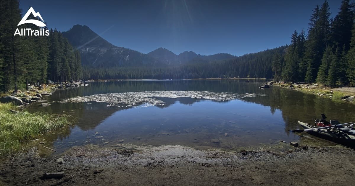
Anthony Lakes: The High-Alpine Destination That Rewards Patience
At 7,100 feet, Anthony Lakes Recreation Area is Union County's most dramatic spring destination and its most unforgiving one. The campground sits just below the lake's surface elevation of 7,140 feet, and snowpack at that altitude can linger well into May and even early June. Forest Road 73, the primary access route that climbs from North Powder (exit 285 off Interstate 84, then 25 miles east and up), is subject to seasonal closures and snow-related restrictions that the Wallowa-Whitman National Forest updates in real time. Before loading the car, check current road conditions directly with the Forest Service, because arriving at a locked gate 25 miles from the highway is a discouraging and preventable outcome.
When the road is open, the payoff is genuine. The lakeshore loop takes roughly 30 minutes and is accessible to most fitness levels, threading through subalpine forest with open views of the Elkhorn Range. For those wanting more elevation and mileage, the 8.2-mile Gunsight Mountain loop delivers panoramic ridgeline views that rival anything in northeast Oregon. Mountain biking and lake access round out the options once the resort transitions from its winter ski season to its summer recreation calendar.
Camping fees at the Anthony Lake Campground, managed under a Forest Service concession, run $12 per night for a standard single site, $20 per night for an RV site, and $6 per additional vehicle. Group sites are $100 per night; yurts range from $80 (up to five people) to $96 (up to eight people). Reservations are made through Recreation.gov, and a $10 fee applies to changes or cancellations. For peak July and August weekends, sites book out weeks in advance. On the water, only electric motorboats and non-motorized craft including canoes, kayaks, rowboats, and float tubes are permitted on Anthony Lake under Oregon State Marine Board rules.
One critical gap to plan for: cell service is unreliable to nonexistent in the Anthony Lakes basin. Download offline maps, share your itinerary with someone at home, and carry a paper copy of campground reservation confirmations before leaving the valley.
Ladd Marsh: Spring Migration Without the Elevation Hazard
For a spring outing with none of the snowpack uncertainty, Ladd Marsh Natural Area, located just outside La Grande, is one of the most rewarding and underused sites in the county. The marsh's short accessible loops and boardwalks put visitors directly into the habitat where spring migration is at its most intense from late March through May. Waterfowl, shorebirds, raptors, and songbirds funnel through the wetlands during breeding season, and the interpretive signage on-site gives novice birders enough context to make sense of what they are seeing.
Parking areas are clearly marked, and the flat terrain makes this a genuine option for families with young children or visitors who want a low-exertion outing. Bring binoculars and a field guide, or download a local bird checklist from Oregon Department of Fish and Wildlife's resources for the area. Unlike Anthony Lakes, Ladd Marsh is accessible spring through fall without any road-condition concerns, and it requires no reservation or camping fee.
Day Hikes Near La Grande: Calibrate to the Season
Union County's trail network spans a wide elevation range, which means spring conditions vary dramatically depending on where you start. Lower-elevation trails closer to La Grande, including routes that connect to interpretive and birding areas, are typically clear and hikeable by early April. Higher trails in the Elkhorn Range or toward the Wallowa-Whitman backcountry may carry several feet of snowpack and require microspikes or snowshoes, proper navigation tools, and layered clothing capable of handling a sudden weather shift.
Interactive trail maps for the Anthony Lake and Hoffer Lakes loop and other regional routes are available through trail apps and the Forest Service. The Hoffer Lakes trail, branching off the Anthony Lakes complex, is a particularly popular short option once the road opens. Regardless of which trail you choose, picking a route that matches the day's expected weather window and your group's fitness level is more important than chasing the most scenic option.
The Elkhorn Scenic Byway: A Spring Drive Worth Planning Around
The Elkhorn Scenic Byway threads through some of Union County's most dramatic high-country terrain and connects several key recreation sites, including the Anthony Lakes area, into a single scenic loop accessible by passenger vehicle when roads are clear. The byway is best approached as a spring-to-fall route rather than a reliable early-season drive; segments at higher elevations can remain snow-covered or subject to sanding and reduced visibility into late spring. Confirm current road status with ODOT TripCheck or the Wallowa-Whitman National Forest before treating it as a full loop.
When conditions cooperate, the byway functions as both a destination and a trailhead access road, putting hikers, anglers, and photographers within reach of multiple Elkhorn Range viewpoints and Forest Service recreation sites in a single day.
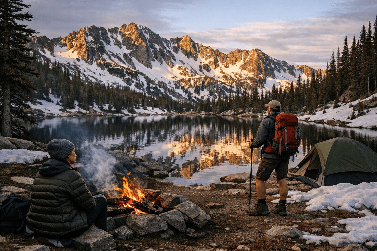
What Union County Search and Rescue Sees Every Spring
The Union County Sheriff's Office Search and Rescue team is an all-volunteer organization that responds to between 16 and 20 callouts per year. The team's secondary mission, beyond the rescues themselves, is public education on outdoor hazards and proper preparation. The most preventable spring mistakes follow a predictable pattern: hikers underestimate how quickly conditions change at elevation, overestimate cell service coverage in the backcountry, and head out without telling anyone their specific route or expected return time.
Before any spring outing in Union County's high country, use this checklist:
- Check road and trail conditions with the Wallowa-Whitman National Forest and ODOT TripCheck before leaving home
- Download offline maps for your specific route; do not rely on cell service above the valley floor
- Share your itinerary, including trailhead name, planned route, and expected return time, with someone who will call for help if you do not check in
- Pack layers, rain gear, and sun protection; weather at 7,000 feet can cycle from warm sun to snow squalls within hours
- Carry a paper copy of any Recreation.gov reservation confirmation, as cell service may not be available at the campground check-in area
- Keep dogs leashed where required and follow Leave No Trace protocols throughout the Wallowa-Whitman National Forest
- Confirm current fire restrictions before any campfire or camp stove use
Union County's outdoor economy, from the lodges and outfitters in La Grande to the guides who work the Wallowa-Whitman backcountry, runs on visitors who come prepared and come back. The volunteers who staff the county's SAR team would rather spend a spring weekend training than responding to a preventable callout at elevation.
This article was produced by Prism’s automated news system from verified source data, official records, and press releases, then run through automated quality and moderation checks before publishing. The system is built and supervised by the people who set the standards it runs under. Read our full AI policy.
Did this article answer your question?