Union County Day Hikes Offer Trails for Families, Birders and Runners
Five distinct trail systems sit within an hour of La Grande, from Ladd Marsh's boardwalk birding loops to Anthony Lakes' alpine ridgelines, all doable without overnight gear.
From the edge of La Grande, a single tank of gas opens up riparian wetlands, alpine lakes, canyon wilderness and working ranch country. Union County's trail network, spread across city parks, Oregon Department of Fish & Wildlife land and the Wallowa-Whitman National Forest, delivers genuine variety without requiring a multi-day commitment. Whether you're chasing spring warbler migrations at a boardwalk marsh or pushing up a high-country ridgeline in August, the geography here rewards the effort.
Mount Emily and Gangloff Park
The easiest entry point for La Grande residents is the Mount Emily and Gangloff Park corridor, where short trails and viewpoints deliver sweeping panoramas of the Grande Ronde Valley with minimal technical demand. Trips run anywhere from one to three hours, the terrain ranges from easy to moderate, and the area includes picnic spots and interpretive signage that make it a natural first outing for families with young children. Access holds up well from late spring through fall; winter viability depends on snowfall, so check conditions before heading out in December or January.
Ladd Marsh Wildlife Area
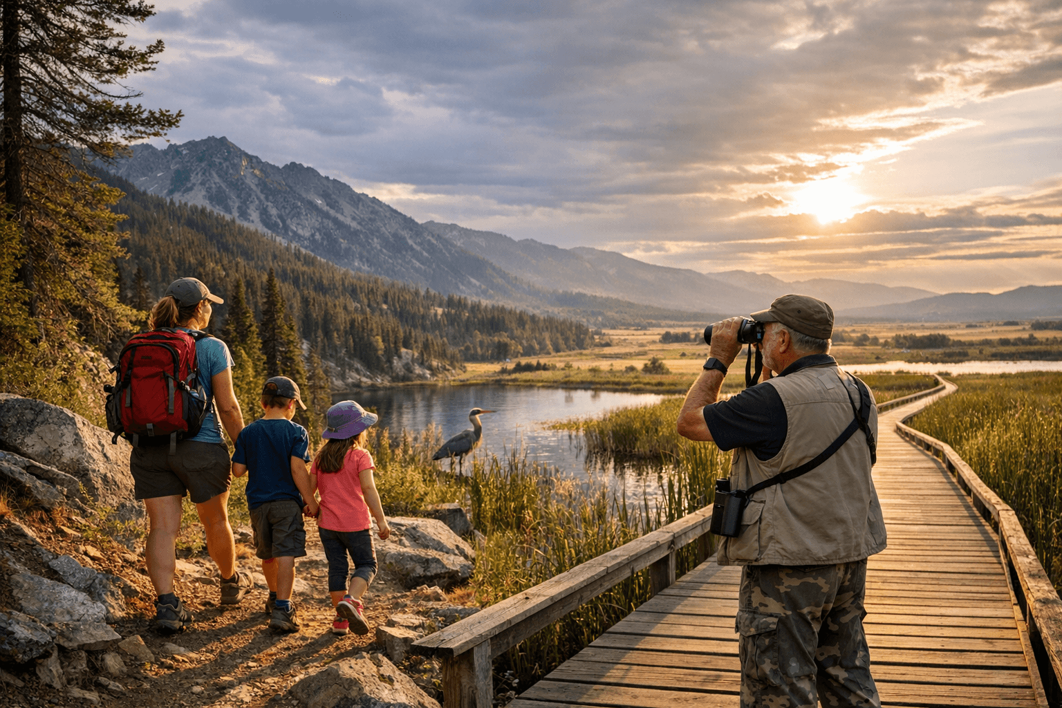
North of La Grande, Ladd Marsh Wildlife Area stands out as the county's premier birding destination. Boardwalks and short loops keep the terrain flat and accessible for all ages, and a 30-minute stroll is enough to reward patience with herons, waterfowl and shorebirds depending on the season. Spring and fall migrations are especially productive, and a field guide paired with binoculars will make the visit considerably richer. Facilities are limited, so bring your own water and insect repellent, and check with the Oregon Department of Fish & Wildlife ahead of time for seasonal gate closures that occasionally restrict access.
Anthony Lakes Recreation Area
For those willing to gain elevation, Anthony Lakes Recreation Area in the high country east of La Grande offers the most dramatic scenery in the county's day-hike portfolio. Alpine lakes, open meadows and ridgeline views anchor the experience, with summer wildflowers and fall color providing reasons to return across multiple seasons. Multiple trailheads allow both loop and out-and-back configurations, and the difficulty ranges from easy lakeshore walks to strenuous ridge routes, so the area scales to almost any fitness level. The elevation works against you in one respect: cooler temperatures and the possibility of late-season snow mean extra layers and flexible timing are worth building into any plan here.
Wenaha-Tucannon Wilderness Approach Trails
The northeast approach trails into the Wenaha-Tucannon Wilderness, within the Wallowa-Whitman National Forest, push the day-hike envelope into genuinely backcountry territory. Canyons, streams and quiet ridges characterize the terrain, and while no permit is required for day use, route planning and a reliable map are essential. These are moderate to strenuous trails suited to experienced hikers who want solitude and classic canyon country without committing to an overnight trip. Leave No Trace principles apply throughout.
Catherine Creek and the Union Area
Closer to the town of Union, the Catherine Creek trail corridor offers an entirely different pace. Short walks along riparian corridors make for relaxed family outings or quick trail runs, with wildlife viewing opportunities built into the scenery. The difficulty stays in the easy to moderate range and most routes clock in under three hours, making this a dependable option when you have a half-morning rather than a full day.
Planning Around the Seasons
The calendar shapes every outing in Union County. Spring and early summer bring muddy trails and lingering snow at higher elevations; waterproof footwear and layered clothing are practical necessities, not optional extras. Summer opens up the high country but intensifies mosquito pressure near wetlands, particularly around Ladd Marsh, so pack repellent and start high-country hikes early to avoid the hottest midday hours. Fall offers the best combination of color, cooler air and reduced crowds, though shorter days mean a headlamp belongs in every pack from September onward. Winter closes most high-country routes under snow but leaves lower-elevation walks accessible for those prepared for cold and icy conditions.
Safety and Preparedness
Cell coverage is unreliable across much of the county's trail network, which makes basic preparedness non-negotiable. Carry water, snacks, a map or downloaded offline GPS route, sun protection and extra layers on every outing regardless of distance. Tell someone your destination and expected return time before heading out. For current trail and road conditions, the La Grande ranger district of the Wallowa-Whitman National Forest is the most reliable source before venturing into higher-elevation terrain. Many trails in Union County cross or run adjacent to private lands and active grazing areas; respect fencing, gates and livestock at every intersection.
Stewardship and Land Management
Union County's trails thread across a patchwork of jurisdictions: La Grande city parks, county land, Oregon Department of Fish & Wildlife wildlife areas and the U.S. Forest Service all manage pieces of the network. Each agency posts its own rules and seasonal restrictions, including wildlife closures during sensitive breeding periods and access changes during hunting seasons. Paying attention to posted signage is both a legal and an ethical obligation. The Wallowa-Whitman Forest Service and local land trusts periodically organize trail maintenance workdays and restoration events; participating in those efforts directly supports the quality of the trails everyone uses.
Where to Get Current Information
Three primary sources cover the county's trail network:
- The Wallowa-Whitman National Forest La Grande ranger district office for official trail maps and seasonal road and trail notices
- The City of La Grande parks and recreation department for local park maps, including Gangloff Park details
- The Oregon Department of Fish & Wildlife for Ladd Marsh access rules and wildlife-area conditions
The combination of riparian lowlands, alpine high country and river-canyon wilderness within a short drive of La Grande is genuinely unusual for a county of Union County's size. The investment required is a full water bottle, a downloaded map and a free morning.
This article was produced by Prism’s automated news system from verified source data, official records, and press releases, then run through automated quality and moderation checks before publishing. The system is built and supervised by the people who set the standards it runs under. Read our full AI policy.
Did this article answer your question?