Union County explains how Mt. Emily Recreation Area became MERA
MERA is more than trail space: Union County bought 3,669 acres in 2008, then built rules to balance recreation, elk winter range, and public oversight.

Mt. Emily Recreation Area became MERA because Union County chose to turn a contested landscape into a publicly managed one. The county bought the 3,669-acre property in November 2008 for recreational values and resource management opportunities, and it did so with money aimed at both access and restoration: a $4.4 million ATV grant from Oregon State Parks and Recreation and a $250,000 Blue Mountain Habitat Restoration Grant.
How MERA entered county hands
The land was not an empty park waiting to be named. Union County’s master plan says the property had long been timberland and grazing ground, and before the purchase the county was weighing timber-sale options under a purchase-and-sale agreement with Forest Capital Partners, LLC. A countywide advisory vote settled the bigger question of public ownership, with 62% supporting acquisition.
That vote set the tone for what came next. A 2008 court order declared MERA a public park and recreational area for county management purposes, and the Board of Commissioners created two advisory committees, one motorized and one non-motorized, to make recommendations on planning, development, management, and maintenance. The result is a land base that is not just open to visitors, but governed through a structure built around competing uses and public input.
Where MERA sits and what the land looks like
County documents place MERA about 2 to 3 miles north of La Grande, on the slopes of Mount Emily in the Blue Mountains. The master plan describes a varied landscape that runs from valley foothills to steep slopes, which explains why the site functions as both a trail system and a working management area.
That mix of terrain matters on the ground. The hillside setting creates contour routes, steep climbs, and seasonal exposure, while the lower edges connect to the Grande Ronde Valley. MERA is close enough to La Grande to serve daily recreation, but large enough and rough enough to require active oversight across its full footprint.
Who helps steer the place
Union County’s current MERA page says the advisory committees are meant to represent the public broadly, and the roster reaches beyond one user group. Representation includes bicyclists, hikers, the general public, the Grande Ronde Bowman Club, Oregon Parks and Recreation, the U.S. Forest Service, Oregon Department of Fish and Wildlife, Oregon Department of Forestry, and livestock grazing interests.
Those committees are not ceremonial. They serve four-year terms, usually with 10 to 12 members, and operate as a public forum that makes recommendations to the County Commissioners, who make the final decisions. Recent committee agendas show the range of issues now moving through the system: parking program updates, archaeology reports, trail proposals, trail ratings, and additions to the trail network. A 2021 committee meeting also discussed funding for operations and maintenance, along with changes to the motocross track to make riding safer and more fun.
What to expect on the non-motorized side
MERA’s non-motorized trail system is built around specific trailheads and route types, not a single loop around the property. All non-motorized routes begin at Owsley Canyon Trailhead, and the county also identifies Fox Hill and Igo Lane as access points. That setup makes the site practical for repeat use, because visitors can choose different entry points depending on the route and the kind of outing they want.
- Trail 600 Archer Lane is a 1-mile one-way route, or 2 miles out and back, and is suited for walkers and strollers.
- Trail 700 Red Apple is a 2.4-mile loop.
- Trail 710 Rock Garden can be paired with Red Apple for a 3.5-mile outing.
- Trail 724 MERA Loop stretches 7.5 miles and is described as a contour trail.
- Trail 755 Sasquatch adds another route option.
The route descriptions are unusually precise:
The non-motorized system allows hiking, running, bicycling, and horseback riding. The county says the trail system has added 20 miles of non-motorized trail over the past five years, and a 2025 committee minute says MERA now has 52 non-motorized trails, with 12 adopted by Blue Mountain Singletrack Club and 7 adopted by other people. That adoption model matters because it shows how the county extends maintenance responsibility without losing public control.

Seasonal rules are part of the landscape
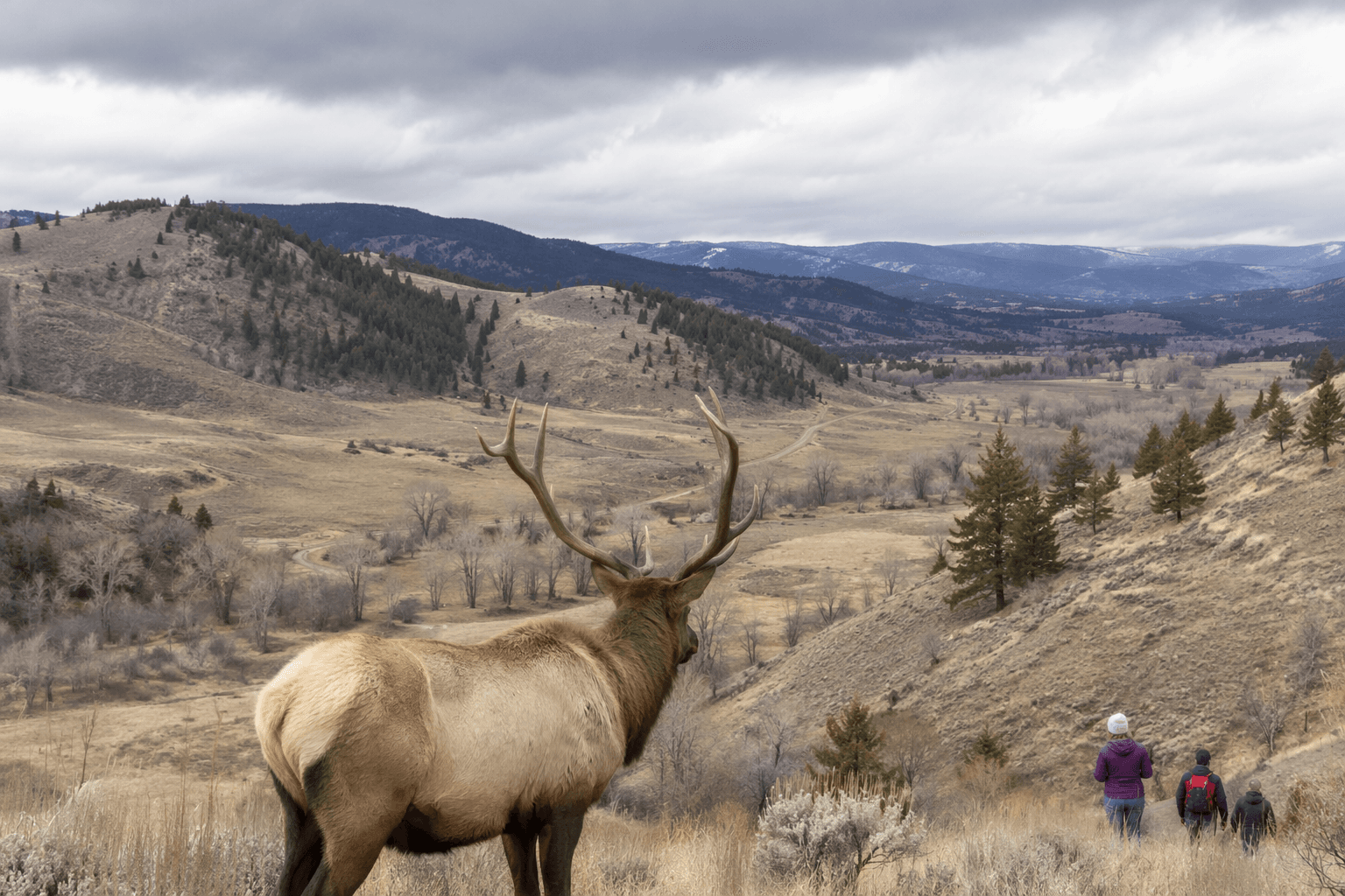
MERA changes with the season, and the county’s rules make that explicit. The eastern corridor and trails east of the rim are seasonally closed to motorized use from October 1 to March 31 because the area serves as winter range for a large number of elk. Trail 409, the Igo Extension, is the seasonal motorized access route through the eastern half of the park during the open season.
The purpose of that closure is not abstract habitat language. The county says the restriction is intended to encourage elk to winter on MERA and stay out of agricultural fields in the valley. In practice, that means the same ground can serve different publics at different times: motorized users in season, wildlife in winter, and snow users when conditions allow. The county also notes that snow turns the park into a place for cross-country skis and snowshoes, which makes the closure part of a broader year-round access plan rather than a simple prohibition.
Why MERA is still being managed, not just visited
MERA remains an active management project because the county has not treated the 2008 purchase as the end of the story. The master plan was adopted in December 2010 after the two advisory committees met multiple times to shape it, and more recent planning continues to focus on the land’s condition and use. Union County is currently planning a forest management treatment of about 550 acres on MERA to reduce mortality and fuel buildup through sanitation and salvage harvest.
That forestry work sits alongside recreation, trail growth, and wildlife protection, which is exactly what makes MERA a useful local case study. It is a county-owned landscape where trail access, habitat protection, grazing history, archaeological review, volunteer maintenance, and seasonal closures all run through the same public process. The county’s challenge is not simply to keep the trails open, but to manage when they open, who uses them, and what the land can sustain while it does.
This article was produced by Prism’s automated news system from verified source data, official records, and press releases, then run through automated quality and moderation checks before publishing. The system is built and supervised by the people who set the standards it runs under. Read our full AI policy.
Did this article answer your question?