Laughlin AFB Radar Outage Pushes Restoration to 8 PM, San Angelo Fills Gap
Laughlin AFB's radar went down Sunday, with restoration pushed to 8 p.m. pending a Brackettville fix while San Angelo fills coverage across the Edwards Plateau.
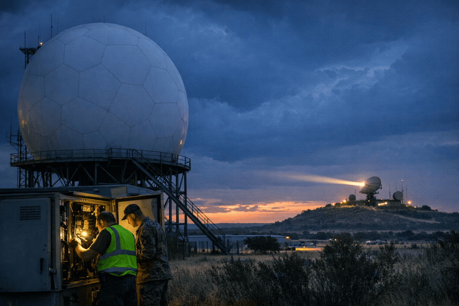
The radar at Laughlin Air Force Base was down Sunday, and by midday technicians had pushed their restoration estimate to approximately 8 p.m., contingent on whether a parallel fix at the Brackettville station succeeded. Until then, the National Weather Service advised users across the Southern Edwards Plateau to track weather using the San Angelo radar as a backup.
The outage left Val Verde County and much of the broader Edwards Plateau without their primary low-level radar coverage. The Laughlin installation, situated on the Del Rio air base, plays a central role in the EWX network managed by the National Weather Service's Austin/San Antonio office, which monitors a wide swath of south-central Texas. That coverage area extends across Hill Country communities including Kerrville, Fredericksburg, and Hondo, as well as the I-35 Corridor and communities along the Rio Grande.
The San Angelo radar, positioned well to the north, offers limited coverage of the Southern Edwards Plateau at lower altitudes due to the geometry of radar beam elevation over distance. For residents and emergency managers in Val Verde County accustomed to the Laughlin station's closer range, the San Angelo sensor represents a functional but reduced substitute.
The 8 p.m. restoration window hinged entirely on progress at Brackettville, east of Del Rio. A complication there would push the timeline further, leaving San Angelo as the sole active radar resource for the region through the evening hours. The NWS Austin/San Antonio office, based at 2090 Airport Road, continued monitoring conditions and updating the restoration forecast as technicians worked the problem.
This article was produced by Prism’s automated news system from verified source data, official records, and press releases, then run through automated quality and moderation checks before publishing. The system is built and supervised by the people who set the standards it runs under. Read our full AI policy.
Did this article answer your question?