Tornado reported south of Del Rio as severe weather targets region
A tornado was reported just south of Del Rio in northern Coahuila as NWS offices kept severe-weather alerts active across the border region.

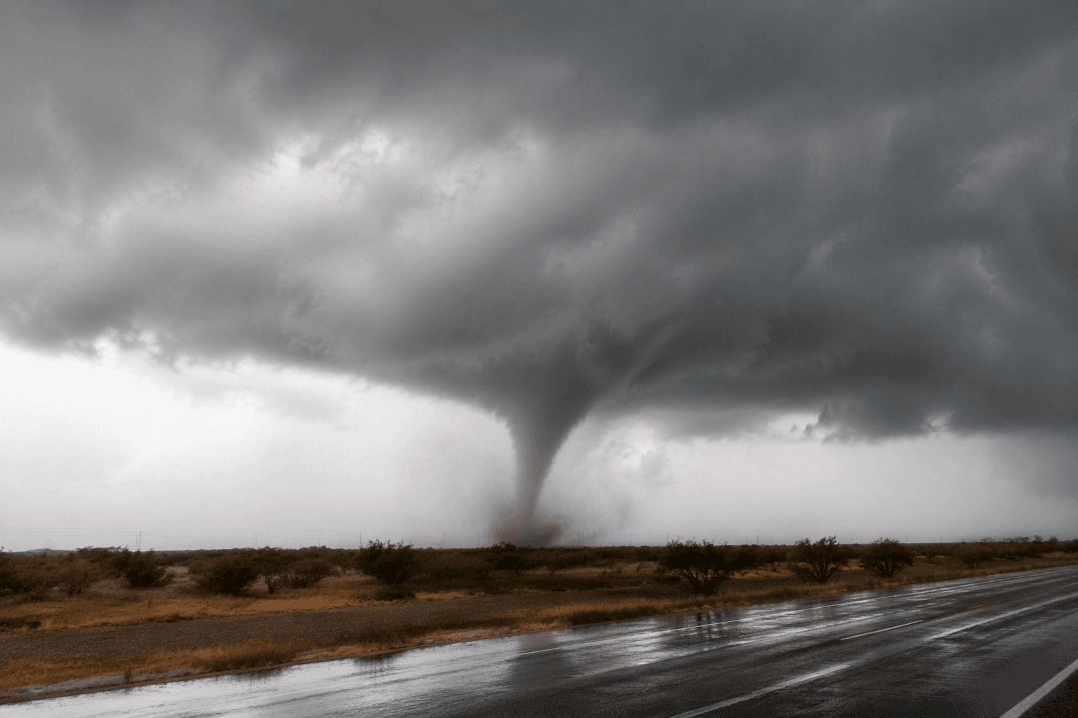
A tornado was reported May 26 just south of Del Rio in northern Coahuila, Mexico, as meteorologists tracked strong velocity couplets and a broader severe-weather outbreak moved across the region. For Val Verde County, the immediate concern was not just the storm south of the border, but whether the same system would push dangerous wind, heavy rain, and rotation toward the Texas side.
The National Weather Service’s Austin/San Antonio office, which handles Del Rio forecasts, kept radar products, severe thunderstorm warnings, flash flood warnings, and area forecast discussions active for the region. The Weather Prediction Center said May 27 that rounds of heavy rain and thunderstorms continued across much of the Southern U.S., while the Storm Prediction Center’s tornado totals summary showed Texas had already recorded 145 preliminary tornado reports through May 25. That placed the Del Rio area in an especially active stretch of tornado season before the Coahuila report even developed.
On the Mexico side, the Servicio Meteorológico Nacional said May 26 that conditions for torbellinos or tornados were expected in northern Mexico, including Coahuila. The radar signature tied to the reported tornado matched the kind of Doppler evidence forecasters use to spot rotation, with NOAA’s National Centers for Environmental Information maintaining Level-II and Level-III NEXRAD archives that capture reflectivity, mean radial velocity, and spectrum width. Those radar records are part of the standard public weather infrastructure used to confirm rotation and track storm structure in real time.
What remained unclear late May 27 was whether the Coahuila tornado caused any verified damage on the Texas side of the river. No confirmed Texas-side damage report was found in the records reviewed, even as storm spotters and weather experts continued sharing radar imagery and concern about the system’s potential path. A severe thunderstorm shelf cloud was also reported near Del Rio on May 27, underscoring that the threat had not passed when the tornado report came in.

The public-record picture leaves Del Rio and Val Verde County in an active warning environment: a border-region storm with confirmed rotation south of town, continuing thunderstorm coverage from the National Weather Service, and no verified evidence yet of major Texas-side damage.
This article was produced by Prism’s automated news system from verified source data, official records, and press releases, then run through automated quality and moderation checks before publishing. The system is built and supervised by the people who set the standards it runs under. Read our full AI policy.
Did this article answer your question?