Geologic Studies Reframe Local Archaeology, Emergency Planning for Valencia County
New findings from geological studies of recent deposits show how landscapes formed over the past thousands of years, and how those findings underlie major archaeological discoveries such as Clovis. The work matters for Valencia County because it affects land use decisions, cultural resource protection and planning for future earthquakes.

Recent geologic research that focuses on deposits formed in the past thousands of years is sharpening understanding of both archaeological evidence and seismic risk that affect communities across Valencia County. By tracing how soils, springs and lakebeds formed and changed, scientists are able to link human artifacts to the natural settings in which they were left, and to better estimate the frequency of past earthquakes that could recur in the future.
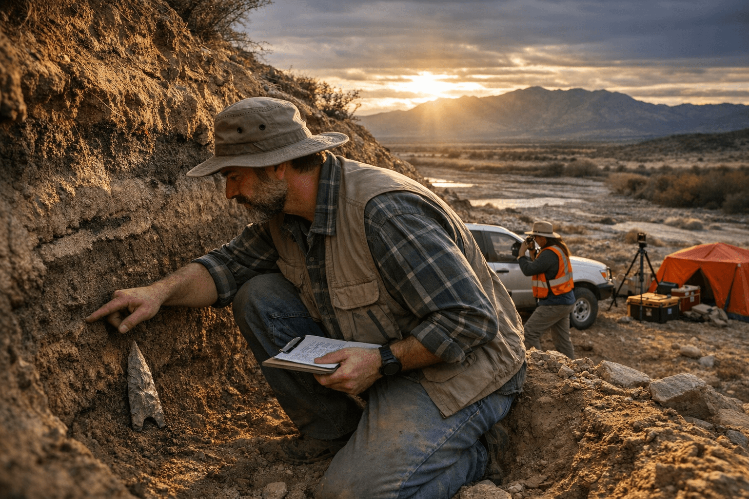
Geologic investigations were central to establishing the context for one of New Mexico's best known archaeological discoveries at Blackwater Draw near Clovis. Early in the twentieth century a worker reported very large bones that did not match cattle, prompting scientific excavation that began in 1927 and continues to this day. Studies of northern glaciation and local deposits showed that the Clovis area was once more humid and that a spring fed lake supported large mammals including mammoth. Excavations have since recovered numerous mammoth remains and hundreds of human tools, and a Clovis point was found in the ribcage of a mammoth, establishing that people hunted large animals in that landscape.
Key to these conclusions is reliable dating. Radiocarbon dating relies on the predictable decay of the radioactive isotope Carbon 14 into Nitrogen 14 at a known rate, with a half life of about 5,730 years. That method requires organic samples such as charcoal or plant remains that contain carbon, and critically depends on careful sample collection. Geologists and archaeologists must confirm that any dated material comes from the same stratigraphic layer as artifacts, and that it was not moved by water wind or animal activity.
For Valencia County policymakers and residents, these technical details translate into concrete decisions. Land use and development approvals must account for buried cultural resources that may be preserved in recent deposits. County planning departments and cultural resource officers should ensure that permit processes require professional geologic and archaeological assessments, and that sample collection and chain of custody standards are enforced when investigations are conducted prior to construction.
Seismic planning is also affected. Research methods that reconstruct past earthquake frequency from recent deposits inform emergency management, influence building code priorities and guide where to invest in mitigation. Funding choices made by county commissioners and state representatives will determine the level of monitoring and the capacity of local emergency planners to incorporate new geologic findings.
The work bridging geology and archaeology therefore has immediate civic relevance. Valencia County officials, preservation advocates and voters will need to weigh competing priorities for development conservation and safety as new scientific findings refine the story of the landscape.
Know something we missed? Have a correction or additional information?
Submit a Tip