Route 66 shaped Los Lunas as a migration corridor and main street
Route 66 once turned Los Lunas into a busy migration corridor. Its 1937 rerouting still explains who prospers, who gets bypassed, and why Main Street matters.

Route 66 made Los Lunas a passing point and a paycheck
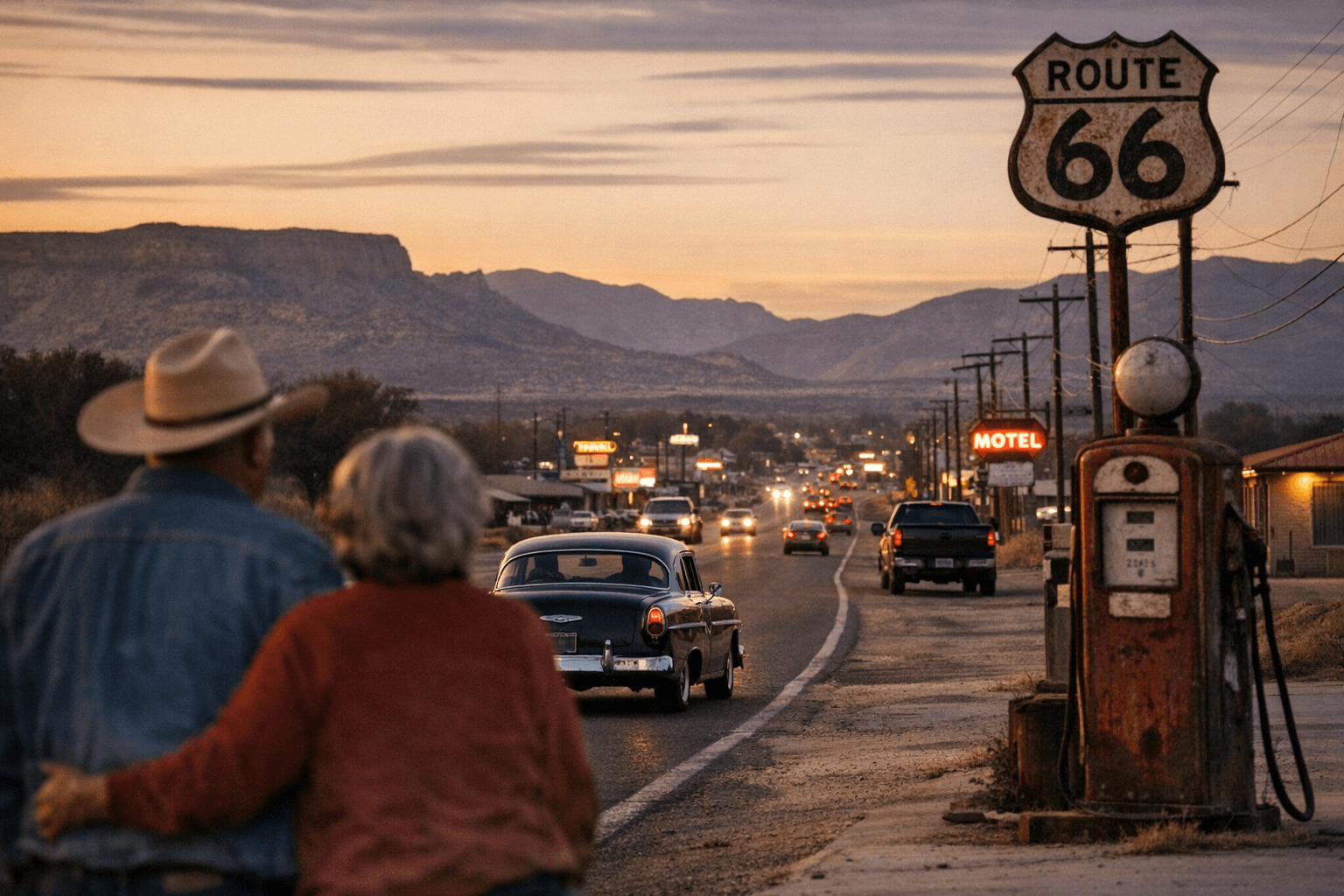
For 11 years, Route 66 ran straight through Los Lunas, across the Rio Grande bridge, down Main Street and west toward Laguna, Arizona and California. That stretch turned a small Rio Abajo town into a crossroads for tourists, Dust Bowl migrants, merchants, laborers and veterans moving with the great east-west flow of the 20th century.
The scale was striking for a community that had just 466 residents in 1928. Traffic in the early 1930s could reach 300 to 400 vehicles a day, a heavy stream for a place of that size and a reminder that the Mother Road was not simply a ribbon of pavement. It was an economic engine, a social filter and, for Los Lunas, a main street with national reach.
A road built on older corridors
Route 66 did not appear in a vacuum. In New Mexico, the highway followed travel routes long used before the automobile age, including the Santa Fe Trail and the Camino Real. That older geography helps explain why Los Lunas sat on a corridor with lasting importance: long before Route 66, movement through the Rio Abajo was already shaping local life.
The U.S. National Park Service says Route 66 launched in 1926 as part of the first federal highway system. In New Mexico, it linked communities from Santa Rosa through Romeroville and Santa Fe, then south through Albuquerque to Los Lunas and Isleta Pueblo. The road’s early path made Los Lunas a visible stop on a route that connected the American interior to the Southwest and beyond.
The Dust Bowl turned the highway into a river of migration
In the early 1930s, drought and dust storms pushed thousands west in search of work and stability. Route 66 became a symbolic river of migration, carrying families whose futures were uncertain and often temporary. Peter Dedek’s observation that fewer than 8 percent of migrants remained in California for more than a year captures the instability of that era: the road promised movement, but not always permanence.
Los Lunas saw the human side of that flow every day. Travelers arrived hungry, low on fuel and often short on cash. Local businessmen sometimes gave them money for gas or food so they could keep moving, a practical kindness that also reflected the hard arithmetic of a road town. Help them along, and they would clear out for the next stop, whether Laguna or Grants.
Edward Otero bet on Route 66’s future
Not everyone saw the traffic as a burden. In March 1932, Edward Otero, a wealthy landowner in Valencia County, began building a store, restaurant and “super” service station at the corner of U.S. 85 and U.S. 66 in Los Lunas. That project was more than one man’s business decision. It showed that local capital was being aimed at the highway, with the expectation that the road would continue to define commerce in town.
That kind of investment matters because it reveals how route-driven growth works in real time. Businesses cluster where cars already are. Services follow the flow. A road becomes a market, and a market becomes a pattern that can outlast the pavement itself. In Los Lunas, Route 66 was not only carrying outsiders through town. It was also shaping where local money went.
The 1937 realignment changed who benefited
Then politics and commercial interests altered the map. In 1937, New Mexico’s section of Route 66 was significantly shortened and straightened. The major S-shaped detour that had run northwest from Santa Rosa to Romeroville and Santa Fe, then south through Albuquerque to Los Lunas, was removed from the route’s main alignment.
That change had immediate consequences. Communities that had counted on through traffic saw fewer travelers, fewer spontaneous stops and less money moving past storefronts. Other corridors gained. The Rio Puerco Bridge, part of the post-1937 alignment, shows how the road was not fixed in place but was continually redirected toward new priorities. Route 66’s history in New Mexico is, in part, a story of who got connected and who got skipped.
Why the old road still matters in Los Lunas today
The Route 66 story is not just about nostalgia. It helps explain the development logic that still shapes Los Lunas. Roads determine foot traffic, business placement and the places where public attention settles. When a route shifts, so do opportunities. When a town remains on a visible corridor, it keeps an advantage that can echo for decades.
That is why the Route 66 centennial has become a local catalyst in Los Lunas. The Village of Los Lunas and Los Lunas schools have tied celebrations to the town’s Mother Road identity, including the closure of Luna Avenue from Main Street to Santa Fe Avenue for a community event. The anniversary is more than a historical marker. It is a statement about where the town wants energy, memory and investment to gather now.
What remains visible from the boom-bust era
Today, the strongest traces of Route 66 in Los Lunas are not only in maps and archives. They are in the logic of Main Street, in the memory of a road that once carried hundreds of vehicles a day, and in the way local celebrations still center the same corridor. The route’s legacy is visible in the idea that a main street can also be a migration lane, a business district and a political instrument.
The broader Route 66 landscape reinforces that legacy. More than 250 Route 66 buildings, districts and road segments are listed on the National Register of Historic Places, showing how deeply the road is woven into the national story. In Los Lunas, that history lands close to home: traffic created opportunity, rerouting shifted it elsewhere, and the lesson is still plain. Prosperity follows the road until the road moves, and the communities left behind feel that choice for generations.
This article was produced by Prism’s automated news system from verified source data, official records, and press releases, then run through automated quality and moderation checks before publishing. The system is built and supervised by the people who set the standards it runs under. Read our full AI policy.
Did this article answer your question?