Valencia County highway turns 4.5 billion years of Earth history into a drive
A 4.5-mile stretch of NM 314 turns a routine Belen-to-Los Lunas drive into 4.5 billion years of Earth history, with volcanoes and rift valley geology in plain view.

How a short drive becomes deep time
The first surprise on NM 314 is simple: every 10 feet you drive represents about one million years of Earth history. That means the 4.5-mile run from Main Street in Belen to the Valencia County administration building in Los Lunas compresses the full 4.5 billion years of the planet into a trip most people could make in minutes.
That scale is what makes the route memorable. It is not just a novelty for geology fans; it is a practical way to read the county’s landscape, from the broad valley floor to the volcanic hills that frame it. The road turns an ordinary corridor between two county hubs into a moving timeline, with each mile carrying readers farther from Earth’s molten beginnings and closer to the valley they know today.
What the timeline shows along NM 314
The drive starts at the moment Earth was still cooling after forming from a cloud of dust and gas around the sun. From there, the route marks the moon’s formation, the first signs of life preserved as stromatolite algae layers, and the later rise of oxygen-rich conditions that remade the planet’s atmosphere.
As the miles pass, the timeline moves through the assembly of supercontinents such as Rodinia, then into the brutal glaciations nicknamed Snowball Earth. By the time you reach the later part of the route, the road has also carried you through the Cambrian explosion, when complex life forms appeared in greater abundance. The point is not just to memorize milestones, but to see how much history has been packed into a landscape that most drivers treat as an everyday shortcut.
Why this stretch of road matters now
NM 314 is not just any back road. The state highway runs 18.523 miles overall, connects Belen to I-25 by way of Isleta Pueblo, and follows an old alignment of US 85. North of Los Lunas, it is also part of a historic US 66 routing, which helps explain why it has long served as one of the county’s visible travel corridors.
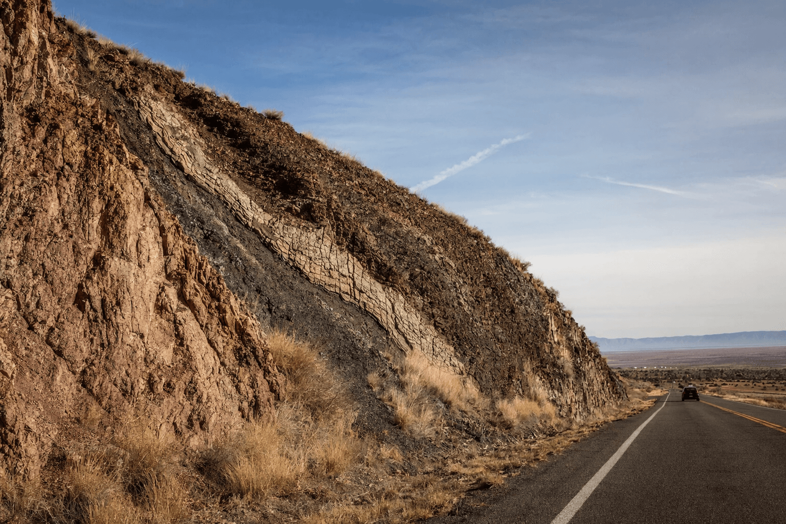
That older transportation role matters because the road sits inside a landscape shaped by geology, not just pavement. The Belen area lies along the Rio Grande rift, in a zone the New Mexico Geological Society describes as unusually diverse because the Basin and Range sit to the west and the Great Plains lie to the east. In other words, the highway is crossing a geologic boundary zone, where the valley’s shape reflects rifting, volcanism and sedimentary deposition over vast stretches of time.
The volcanic landmarks hidden in plain sight
One of the most striking reminders of that geologic history is the Los Lunas volcano complex. The New Mexico Museum of Natural History and Science says it is not a single volcano at all, but several separate eruption sites ranging from about 3.5 to 1.2 million years ago. In geologic terms, that is recent, which makes the visible volcanic features around the valley even more revealing.
The Cat Hills add another layer to the story. The museum says these volcanoes, west and south of Belen and Los Lunas, are part of a line of small volcanoes in the rift, and they are slightly younger than the Los Lunas volcanic sites. When you look out across the valley, those cones are not just scenery. They are evidence that the ground around Valencia County has been repeatedly reshaped long after the planet itself formed.
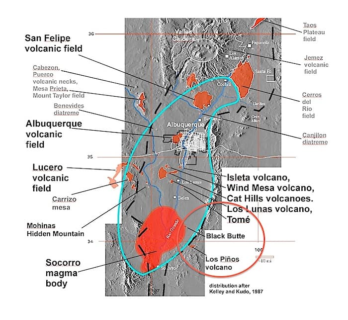
The U.S. Geological Survey adds more context from the wider region, describing a 1:50,000-scale geologic map area tied to the Pueblo of Isleta that spans about 2,000 square kilometers in the central part of the Albuquerque Basin and reaches into the late Paleogene-Neogene Rio Grande rift south of Albuquerque. That broader setting shows why the county’s geology is part of a much larger story. The road may feel local, but the land beneath it belongs to one of the Southwest’s most active and instructive geologic frameworks.
A county lesson that fits local life
This route also fits Valencia County’s own educational tradition. The Valencia County Historical Society says it sponsors lectures and tours and works with local school officials to help teachers use local resources in classroom materials. That kind of public education matters because it makes the county’s history accessible outside a classroom or museum.
The NM 314 drive does the same thing in a different form. Families, students and casual explorers can follow the route from Belen north toward Los Lunas and see how the county’s everyday geography connects to much older forces. The highway becomes a field trip without the bus, and the lesson is written into the landscape itself.
What looks like a simple run between two familiar county landmarks is actually a guided tour through Earth’s past and Valencia County’s present. The road ends at a government building, but the story it tells reaches back to a planet still forming, and forward to a valley whose shape still reflects the forces that built it.
This article was produced by Prism’s automated news system from verified source data, official records, and press releases, then run through automated quality and moderation checks before publishing. The system is built and supervised by the people who set the standards it runs under. Read our full AI policy.
Did this article answer your question?


