Flash flooding closes U.S. 50, SR 683 in Vinton County
Flash flooding closed parts of U.S. 50 and SR 683 in Vinton County, and drivers were told to check OHGO as storms kept pounding the county.
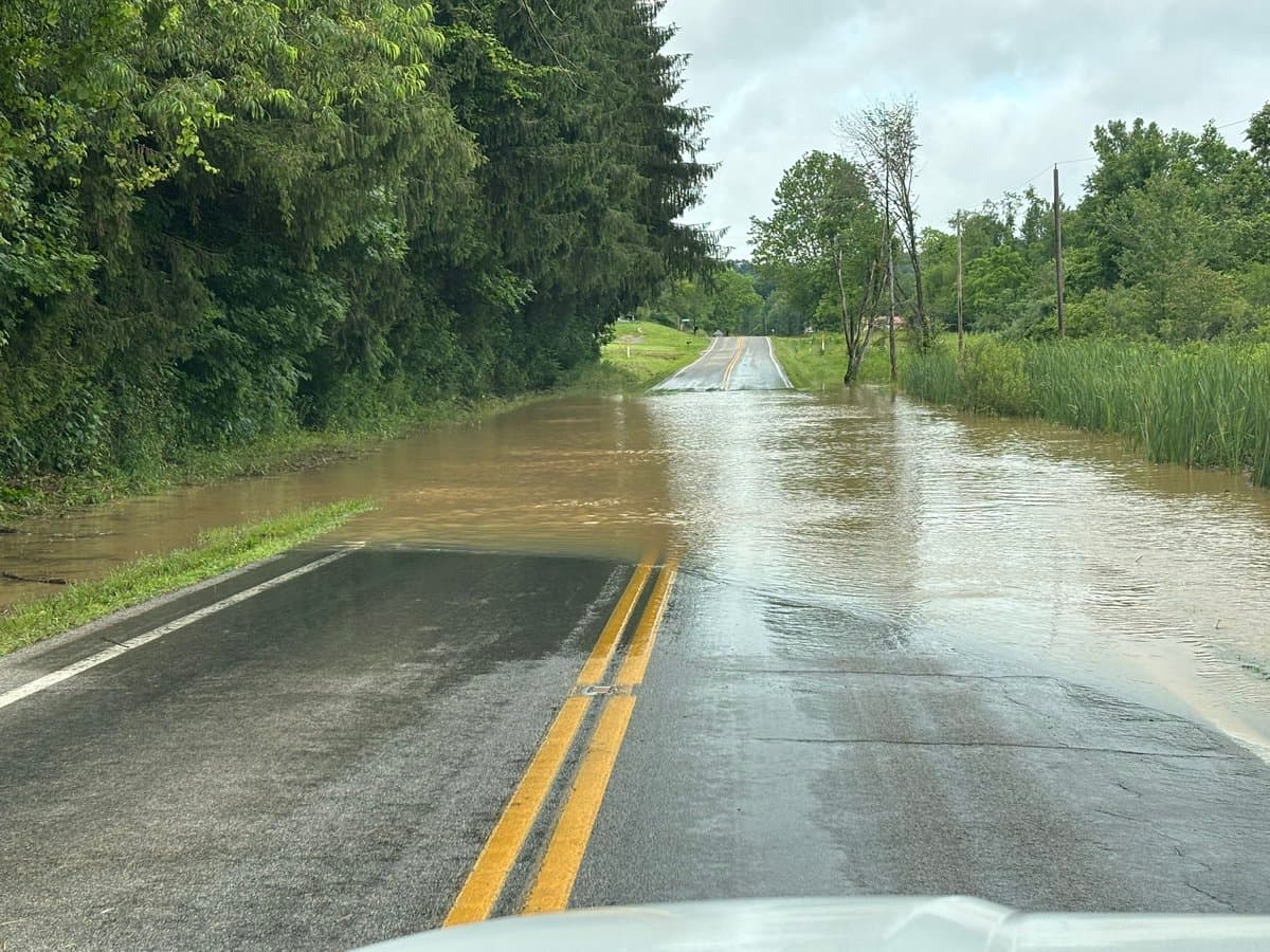
Flash flooding closed parts of U.S. 50 and State Route 683 in Vinton County, sending drivers to Vinton County EMA and the Ohio Department of Transportation for updates as thunderstorms kept dumping rain across the county. In a rural corner of southeast Ohio with few alternate routes, those closures cut into commutes, school travel and access for emergency services, making real-time traffic checks the safest option for anyone trying to move through the area.
The National Weather Service had already put the county under a Flash Flood Warning from 3:17 a.m. EDT until 6:45 a.m. EDT, then kept a Flood Warning in effect from 9:38 a.m. EDT until 1:45 p.m. EDT. A Tornado Watch also covered Vinton County from 4:35 a.m. EDT until 11:00 a.m. EDT, underscoring how quickly the morning storm system turned dangerous. The NWS Charleston, West Virginia office serves Vinton County, and its forecast area continued to flag locally heavy rain and severe thunderstorms through the day.
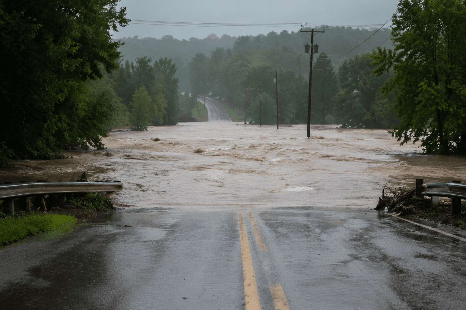
At OHIO U/ATHEN-ALBANY (KUNI), current conditions showed heavy rain and fog or mist, with temperatures around 68 degrees, another sign that visibility and road conditions were deteriorating at the same time. Drivers heading toward the county’s low-water crossings and narrower rural roads faced the highest risk, especially where detours are limited and quick rerouting is not always possible.

ODOT said it posts traffic advisories for state, federal and interstate routes, while OHGO is the state’s real-time site for road restrictions and closures. For Vinton County residents, that meant checking before leaving home was not optional. The closures on U.S. 50 and SR 683 had the potential to separate parts of the county from one another, delay workers and school transportation, and slow response times for fire, EMS and other critical services.
The day’s road problems were part of a broader regional storm outbreak. The Weather Prediction Center and National Weather Service hazard maps showed widespread rainfall and thunderstorm threats across the region, and NWS summaries for the Charleston forecast area note repeated heavy rain and flooding in January 2023 and February 2024. In Vinton County, where every major route matters, that history made the June flooding more than a passing weather event.
This article was produced by Prism’s automated news system from verified source data, official records, and press releases, then run through automated quality and moderation checks before publishing. The system is built and supervised by the people who set the standards it runs under. Read our full AI policy.
Did this article answer your question?