Severe thunderstorm warning in effect for Vinton County until 5:15 pm
A severe thunderstorm warning covered Vinton County until 5:15 p.m. Monday, with wind and hail the main threats. Tuesday brought more rain and a renewed flooding concern.
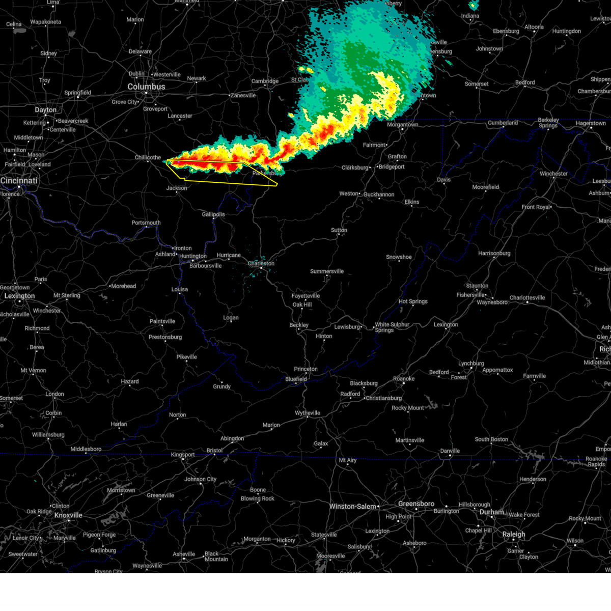
Vinton County was under a severe thunderstorm warning until 5:15 p.m. Monday, as storms swept across the county seat of McArthur and the surrounding Hocking Hills region with the strongest concern centered on damaging wind and hail.
WOWK 13 News reported the alert as hazardous weather moved through the area, and the National Weather Service in Wilmington said strong to severe storms were possible through Monday afternoon and evening. The weather service said strong winds were the primary concern, a threat that can quickly turn dangerous on rural roads, near trees and in neighborhoods with exposed power lines.

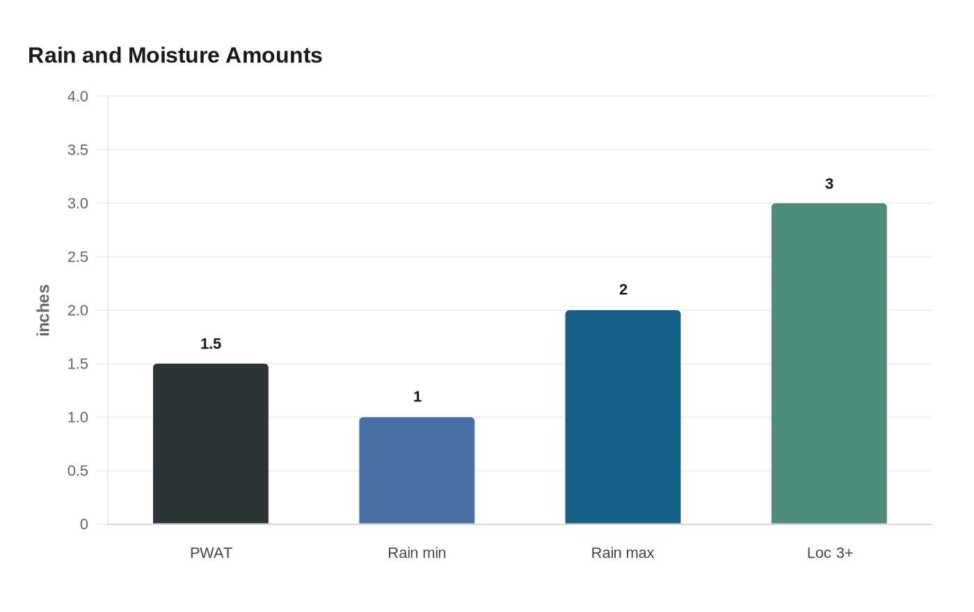
By Tuesday morning, the pattern had not fully cleared. The National Weather Service said scattered showers and storms were still continuing, with heavy rainfall creating localized flooding concerns. The agency also said the region’s atmosphere was unusually moist, with a 00Z sounding measuring precipitable water at 1.5 inches, enough to break the daily record for that sounding time.
That moisture kept the flood risk elevated. Forecasters said another 1 to 2 inches of rain could fall in local swaths, with locally 3-plus inches possible Friday and Friday night. For a county of about 12,645 residents, the biggest day-to-day impacts are likely to show up first on low-lying roads, drainage ditches and small creeks that can rise fast during repeated rounds of rain.

The threat comes on top of an active spring storm pattern that has already hit the region hard. The National Weather Service’s significant weather archive includes severe weather and tornado events on April 14, March 26, March 22 and March 11 of this year, along with major multi-day severe weather and flooding episodes in 2025, 2024, 2023, 2022 and 2021. That record underscores how often the Ohio Valley and southeastern Ohio can face back-to-back rounds of damaging weather once storms begin to track through the area.
Residents in and around McArthur should keep phones charged, move loose outdoor items inside, and be ready to avoid flooded roads if water rises again. With more rain possible later in the week, the most dangerous conditions could come from fast-moving water, repeated lightning and sudden wind gusts even after the warning has expired.
Know something we missed? Have a correction or additional information?
Submit a Tip