Low Falls Lake levels expose hazards, raise boating safety concerns
Falls Lake sat about four feet below normal, exposing shoals, rocks and stumps just as more Wake County boaters headed out for spring recreation.
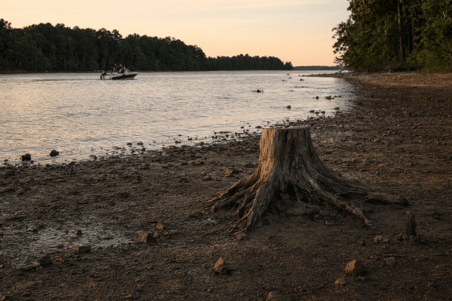
Falls Lake is low enough that boaters can see the danger now. The reservoir sits about four feet below normal for this time of year, exposing shoreline, shoals, rocks, tree stumps and other hazards that are usually hidden beneath the surface.
That drop has turned a familiar Wake County recreation spot into a place where speed and routine can quickly become a problem. Boaters on the lake said conditions can change fast in short stretches of water, with one describing a section that shifted from about 10 feet deep to about 2 feet. Another said the lake had already been falling through the fall and then dropped another foot or two in recent weeks.
The danger is not limited to damaged propellers or stranded boats. Families heading out for tubing, fishing and weekend recreation now face a greater risk of running into unseen obstacles, even in areas they know well. With shallower water near the surface, the margin for error narrows for anyone launching from ramps, cutting across coves or navigating closer to shore.

The low water also reflects a wider drought problem affecting North Carolina. Raleigh officials said Falls Lake had dropped about 2 feet in late April, an unusually low level for this time of year, and noted that the last comparable drop came during the 2007-2008 drought. By May 6, the U.S. Army Corps of Engineers said the lake’s water-supply pool was at 78 percent, down 2 percentage points from the previous week. Another ABC11 report said Falls Lake remained under Stage 1 water restrictions and had 84 percent of its water-supply pool remaining.

Falls Lake matters across Wake County and Durham County because it is more than a scenic destination. Falls Lake State Recreation Area stretches across the reservoir with seven access areas and more than 300 campsites, making it one of the region’s most heavily used outdoor resources.

The Army Corps’ Falls Lake reporting pages track daily stage and flows, along with historic monthly maximum and minimum elevation, flow and rainfall data going back to 1984. That long record gives a clear backdrop for the current drop, which comes as the U.S. Drought Monitor continues to show below-normal rainfall and ongoing drought impacts across parts of North Carolina.
This article was produced by Prism’s automated news system from verified source data, official records, and press releases, then run through automated quality and moderation checks before publishing. The system is built and supervised by the people who set the standards it runs under. Read our full AI policy.
Did this article answer your question?