Yuma road report details striping, ADA ramp work and lane closures
Fresh striping, ADA ramp work and two HAWK beacon projects are reshaping key Yuma corridors, with the heaviest delays likely near Giss Parkway and 24th Street.
What is changing around town
Yuma drivers are facing a mix of fresh paint, sidewalk closures and lane restrictions that will affect daily routes through early July. The city’s latest road report points to one citywide striping effort and two active ADOT projects that are doing more than slowing traffic: they are changing how pedestrians cross, how sidewalks connect, and where commuters will need to leave extra time.
The city describes its road report as a weekly summary of city projects or encroachment permits issued by the City of Yuma. In practical terms, it is the city’s heads-up on where normal travel is most likely to be interrupted. The biggest immediate message for drivers is simple: watch for wet paint, stay off freshly painted markings, and follow the posted traffic control signs and cones.
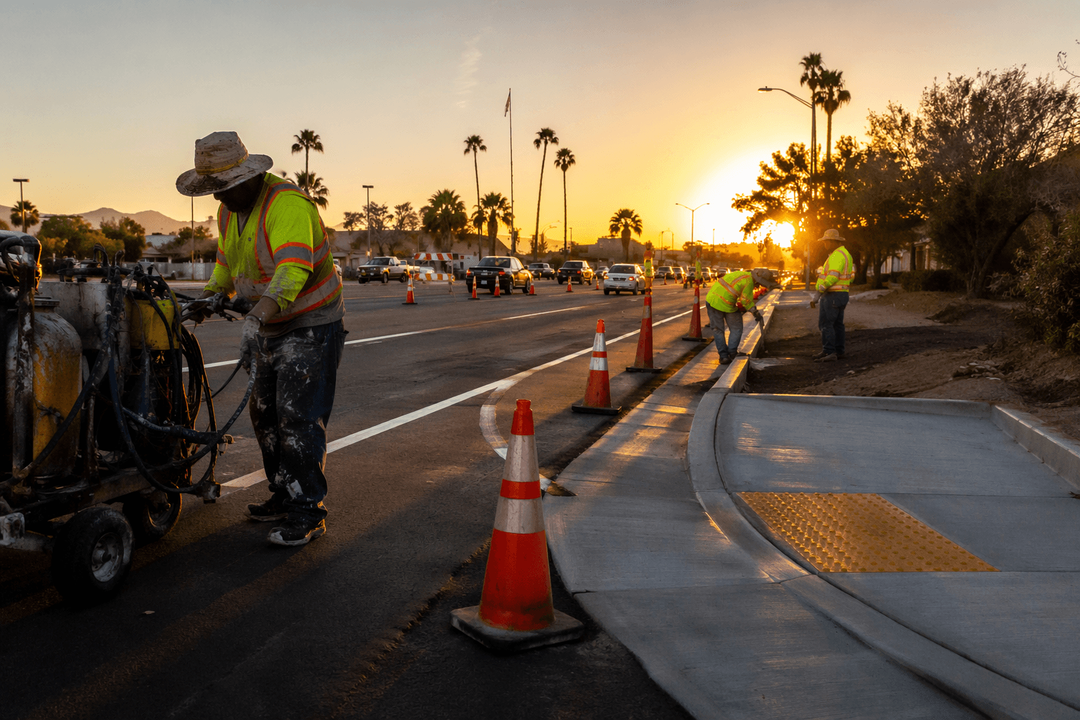
Striping work is the quiet but widespread disruption
The citywide road striping project may not look dramatic from a distance, but it can touch a lot of routines at once. Fresh striping is meant to improve roadway safety and visibility, which matters on roads that depend on clear lane markings for turns, merges and night driving. For anyone on school runs, delivery routes or repeat commutes, the work can create short delays, especially if traffic has to slow while paint is drying.
This is the kind of project that can ripple across the day without closing a single major intersection. The safest assumption is that any newly marked lane line, turn arrow or crosswalk needs room to cure before tires roll over it. Drivers who try to save a minute by cutting across active work areas are the ones most likely to create extra delays for everyone behind them.
Giss Parkway is the most likely trouble spot
The most consequential work zone in the report is on Giss Parkway, where an ADOT contractor began work on May 18 installing ADA ramps and a pedestrian hybrid beacon between Madison Avenue and 1st Avenue. Sidewalks on the north and south sides of Giss Parkway are closed between Madison Avenue and 1st Avenue during the project, and intermittent partial and full lane closures are expected on Giss Parkway between Madison Avenue and 2nd Avenue.
That combination makes Giss Parkway the place most likely to affect the average commute, especially for anyone moving between residential streets, nearby schools or commercial destinations. Sidewalk closures matter just as much as lane closures because they force pedestrians to detour, and they can change how people reach bus stops, driveways and crossings along the corridor. The city expects the work to be finished by early July, so the most disruptive stretch should be temporary, but not brief.
If you travel this route often, the best window to avoid surprises is during the normal rush periods when lane shifts and equipment can create stop-and-go conditions. The presence of ADA ramp work also means curb access can change block by block, which is important for strollers, wheelchairs and anyone who depends on a smooth sidewalk connection.
24th Street has a similar pattern, with its own pinch points
A second ADOT contractor began work on May 18 on 24th Street at 6th Avenue, where crews are installing ADA ramps and a pedestrian hybrid beacon. The city says sidewalks on the north and south sides of 24th Street are closed between 6th Avenue and 7th Avenue during the project, and intermittent partial lane closures are expected on 24th Street between 4th Avenue and 8th Avenue.
This corridor is likely to matter to a different set of daily trips: school runs, neighborhood errands and east-west movement through one of Yuma’s more active street networks. The closure pattern is broader in road terms than the beacon installation itself, which means the real impact will come from the traveling work zone rather than the single intersection. Like the Giss Parkway project, completion is expected by early July.
For drivers, 24th Street is the kind of route where one blocked turn or slowed lane can back traffic up several blocks. For pedestrians, the sidewalk closures mean crossing plans may need to change even when the road surface still looks passable. In a corridor with intermittent lane shifts, the shortest path is not always the fastest one.
Why the HAWK beacons matter beyond construction
Both active projects involve pedestrian hybrid beacons, also called HAWK beacons, and that makes them more than routine concrete-and-striping jobs. ADOT says these devices are designed to help pedestrians safely cross busy or higher-speed roadways at marked but unsignaled crossings. The Federal Highway Administration describes them as an intermediate option between a flashing beacon and a full pedestrian signal, with positive stop control.
That distinction matters because the crossing type often determines whether a person walking feels exposed at a given intersection. FHWA says nearly 74 percent of pedestrian fatalities occur at non-intersection locations, and vehicle speed is often a major contributing factor. ADOT says pedestrian hybrid beacons were adapted in Arizona to increase motorists’ awareness of pedestrian crossings at uncontrolled marked crosswalks.
The state’s own research also ties the device to Arizona history: the PHB was developed in Tucson and later approved for optional use in the 2009 MUTCD. In other words, the hardware now going in on Giss Parkway and 24th Street is part of a broader safety strategy that has been tested, studied and folded into traffic design over time.
What to expect between now and early July
The May 21 road report closely matches the city’s May 14 update, which suggests these are ongoing projects rather than brand-new disruptions. That is good news in one sense: the timeline is already visible, and the main lanes of impact have been identified. It also means the city’s warning is not a one-day advisory but a standing signal that these corridors will remain active work zones for several more weeks.
- Giss Parkway is the likeliest place for the heaviest delay because it combines sidewalk closures, lane closures and beacon work.
- 24th Street will also create real congestion, especially around 4th Avenue through 8th Avenue.
- Fresh striping can slow traffic citywide in short bursts, even if the effect is less visible than a closed lane.
- Early July is the milestone to watch if you are waiting for sidewalks and lanes to reopen.
The practical read for residents is straightforward:
For a city where many trips are short but frequent, the difference between a normal drive and a delayed one can come down to one lane shift or one closed sidewalk. The road report is essentially giving Yuma a map of where to slow down, where to reroute and where the city’s safety upgrades are taking shape.
This article was produced by Prism’s automated news system from verified source data, official records, and press releases, then run through automated quality and moderation checks before publishing. The system is built and supervised by the people who set the standards it runs under. Read our full AI policy.
Did this article answer your question?