94 mph gust hits Iowa as severe storms threaten Midwest
A 94 mph gust hit Marshall County before sunrise as forecasters warned Illinois and Indiana faced the day’s highest tornado risk.
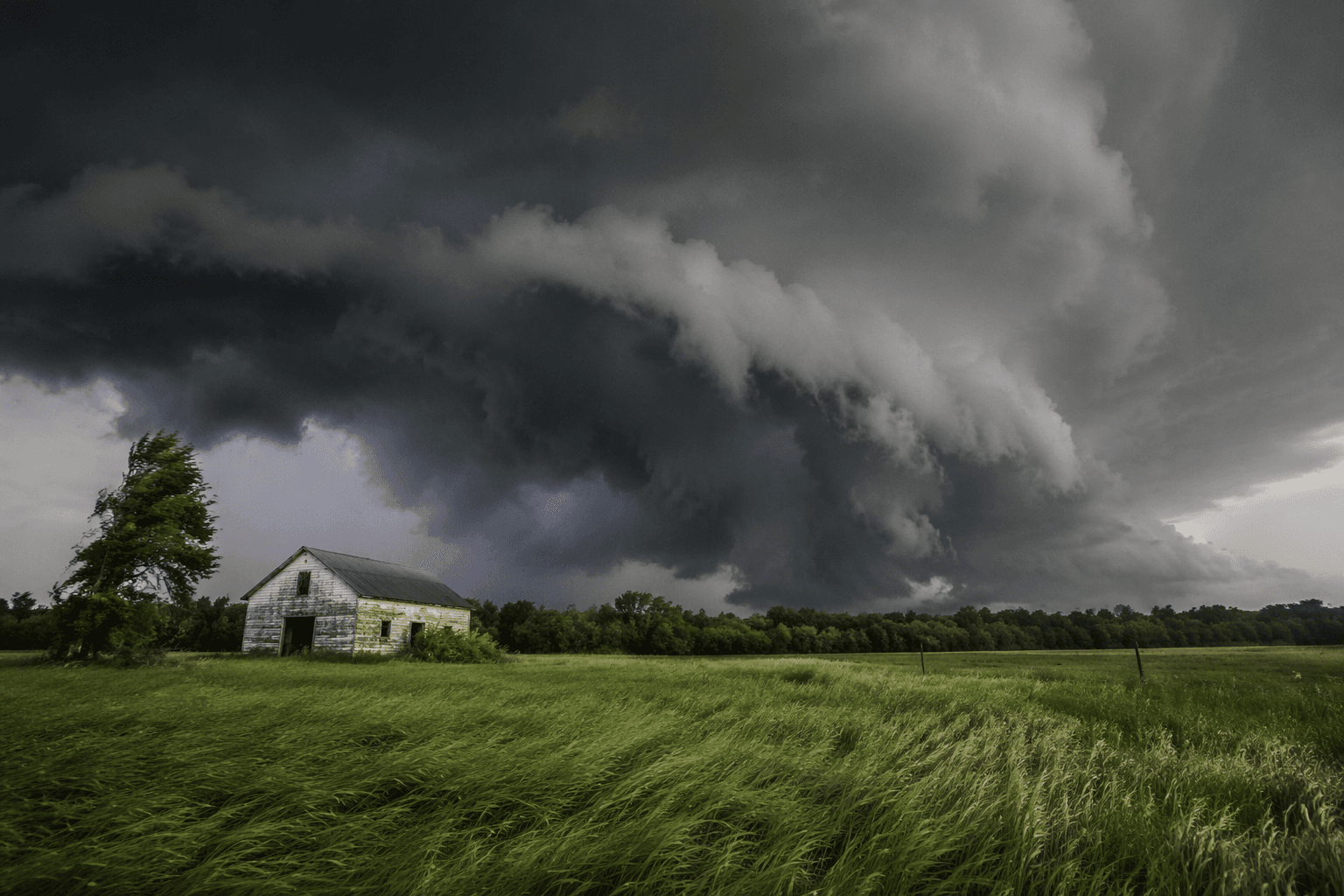
A 94 mph gust ripped through Marshall County, Iowa, before sunrise Wednesday as a line of severe storms surged southeast toward Illinois, where forecasters said the day’s most dangerous weather would concentrate. The National Weather Service Storm Prediction Center warned that an outbreak of severe thunderstorms was expected from Wednesday into tonight, with Illinois and Indiana at the center of the threat.
The setup carried several hazards at once. Forecasters said several intense tornadoes were possible, along with swaths of damaging wind gusts over 75 mph and wind-driven large hail. That means the tornado risk was not the only concern: the broader storm line could produce destructive straight-line winds, while separate rotating storms could spin up tornadoes later in the day. The Storm Prediction Center said the region remained very active and potentially dangerous across Illinois, Indiana, Missouri and Ohio.
The first round had already hit Iowa hard. Local reports said the strongest gusts and damage stretched from Webster City to Tama, semis were blown over on US-20 near Jolley in Calhoun County, trees were uprooted in Marshall County, and the 94 mph gust was measured at Marshalltown airport. The storm line was expected to keep moving southeast into Illinois, and forecasters said new severe storms could develop later in the day in Indiana and then Ohio as the atmosphere stayed primed and a warm front lifted north.
That combination matters because morning storms did not erase the threat; they helped set the stage for more trouble. Behind the early complex, forecasters said conditions could support isolated tornadic supercells farther east, especially where heating and the advancing warm front could sharpen the atmosphere again. For Illinois and Indiana, the highest risk window was the afternoon into tonight, with Missouri and Ohio also in the danger zone as the system evolved.
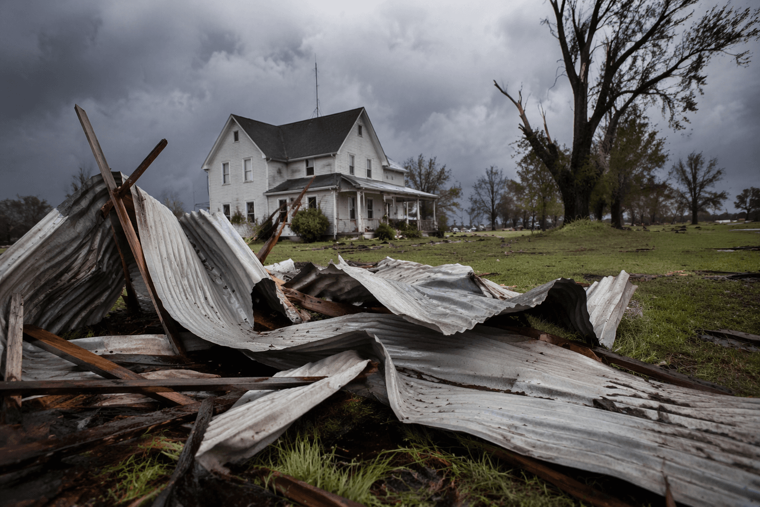
The warning came just days after another violent stretch of weather hit the region. On June 11, the National Weather Service in Chicago said at least 20 tornadoes were confirmed across northern Illinois and northwest Indiana, including preliminary EF-3 tornadoes near Streator, Illinois, and Kouts, Indiana. That outbreak damaged buildings, knocked out power to more than 221,000 customers in Illinois by Friday morning, and delayed or canceled more than 1,000 flights in and out of Chicago. One death was reported in Iowa, underscoring how quickly the Midwest can swing from heavy rain to life-threatening storms.
This article was produced by Prism’s automated news system from verified source data, official records, and press releases, then run through automated quality and moderation checks before publishing. The system is built and supervised by the people who set the standards it runs under. Read our full AI policy.
Know something we missed? Have a correction or additional information?
Submit a Tip