Best Parks, Trails and Lake Access in Kootenai County
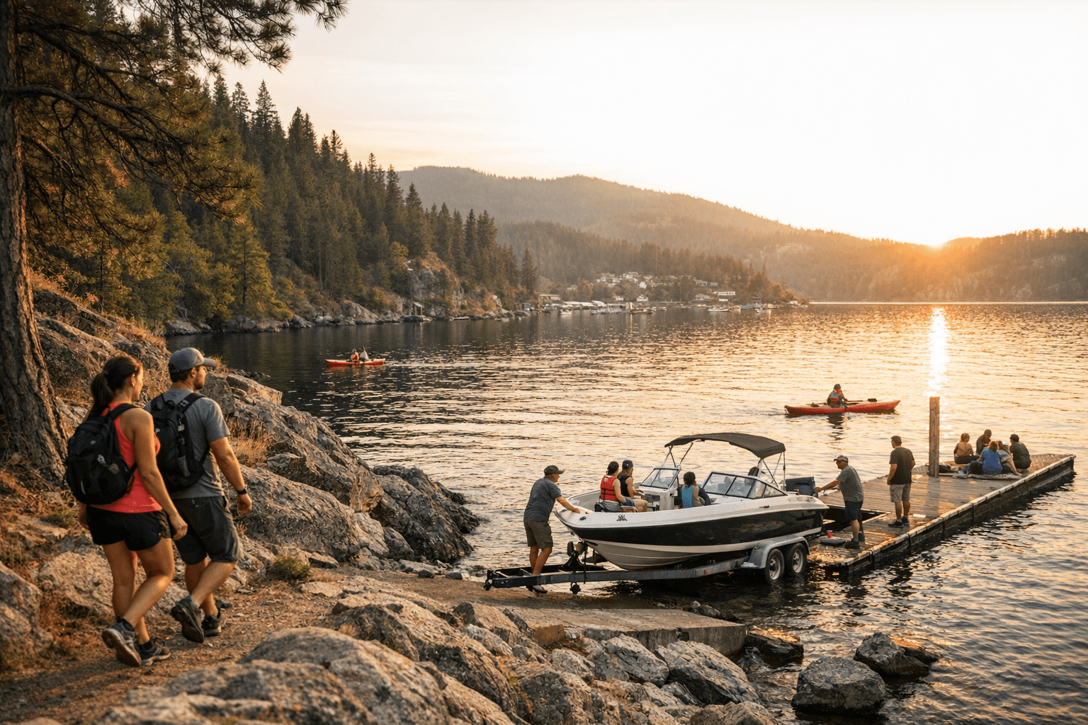
Bayview offers a free Kootenai County boat launch next to Boileau’s Resort, but parking is limited; Tubbs Hill’s 120-acre lakefront forest puts shoreline trails steps from downtown Coeur d’Alene.
Tubbs Hill’s 120-acre pocket of lakefront forest sits right in downtown Coeur d’Alene and provides immediate access to picturesque shoreline trails, while the North Idaho Centennial Trail’s Higgins Point section delivers a 10-mile (16 km) paved lakeside route for walkers and cyclists. Komoot’s regional listings, last updated February 7, 2026, also highlight longer options like the 7.8-mile Prairie Trail and report over 40 hiking routes in Kootenai County with an average community rating of 4.8 out of 5 stars.
Komoot’s user guidance answers a common question about training resources directly: "Yes, Kootenai County offers several long, relatively flat trails that are perfect for running." That community sentiment is reflected across city and state-managed sites that point to both gentle lakeside paths and steeper ridge climbs for varied fitness goals.
Farragut State Park remains the county’s multiuse hub. From Athol on U.S. Highway 95, turn west on Idaho State Highway 54 and travel four miles to the main entrance just past the traffic circle; the visitor center is on your right and has maps, campground information and interactive displays about wildlife and geology. Farragut is open year-round and lists activities that include camping, boating, sailing, canoeing, kayaking, scuba diving, fishing, swimming, picnicking, hiking, biking, horseback riding, wildlife viewing, horseshoe and volleyball games, model aircraft flying, target shooting, disc golf, and a museum tour. Trails in the park range from less than a mile to all-day adventures of 20 miles or more, and the Squirrel Cache Nature Trail is noted as a self-guided interpretive route.
Lake access around Bayview and Idlewilde Bay serves motorized and nonmotorized visitors. Bayview features "a free, public boat launching facility managed by Kootenai County" in a narrow slot next to Boileau’s Resort; the launch is crowded by private property and parking is limited. Eagle Boat Landing is described as a large, modern facility just south of Blackwell Point on the west side of Idlewilde Bay and accommodates most vessel types. Bayview’s shoreline also carries layers of local history, including early limestone kilns from the area’s cement industry.
East and north of Coeur d’Alene, day hikes and summits offer contrast. Mineral Ridge National Recreation Trail is a 3.3-mile loop east of Coeur d’Alene and is praised for rewarding views of Lake Coeur d’Alene; Cityofkootenai lists it as approximately 45 miles from Kootenai. Near Sandpoint, the Mickinnick Trail via the Woodland Drive trailhead is described as a more challenging 3.5-mile hike that ascends over 2,000 feet and sits roughly 5 miles from Kootenai, while Schweitzer Mountain Resort, about 12 miles northwest of Kootenai, offers a summer network of trails for hiking and mountain biking.
For wildlife viewing and accessible loops, Visit North Idaho highlights the Kootenai Wildlife Refuge’s "scenic auto tour road" as a 4.5-mile one-way gravel road that travels along wetlands and grasslands and is flat, packed gravel and wheelchair accessible. Lower Roman Nose Lake "is one of the only accessible mountain lake trails in Idaho. It has a boardwalk leading to the lake," though reaching the Roman Nose trailhead requires about an hour on two-lane gravel and the snowbound window often keeps the lake inaccessible until late June-early July; Visit North Idaho advises using Snow Creek and Caribou Creek roads rather than GPS-suggested McCarthey Lake and Ruby Creek Road, which was found impassable on one reported visit. Myrtle Creek Falls offers an accessible parking space and a paved trail from the lot to the bridge.
Practical takeaways for local users include the Farragut visitor center’s map sales for extensive trail networks, awareness that Bayview launch parking is limited, and seasonal cautions for Roman Nose Lakes and mountain trail access. Komoot-reported route counts and ratings provide a snapshot of user experience as of February 7, 2026, while city and park pages detail directions, facilities and the multiuse character of Kootenai County’s parks, trails and lake access.
Know something we missed? Have a correction or additional information?
Submit a Tip