Blizzard warnings span Delaware to Connecticut, including New York City
National Weather Service warns 13–18 inches or more in NYC; more than 14 million under blizzard warnings and coastal flood watches start Sunday evening.

Blizzard warnings were issued Saturday for a broad swath of the East Coast, including New York City, where the National Weather Service warned that 13 to 18 inches or more of snow could fall and that the storm would make travel "dangerous, if not impossible" as winds and heavy snowfall reduce visibility.
The alerts, which federal and local forecasters said would begin Sunday, cover coastal communities from Delaware through Connecticut and extend inland in spots of the Mid-Atlantic and Northeast. CBS reported that more than 14 million people were under blizzard warnings, underscoring the scale of the threat. Local forecasts cited by the USA Today Network said the storm was expected to begin Sunday morning, Feb. 22, and continue through 6 p.m. Monday, Feb. 23.
Forecasts vary by source and by corridor. The Weather Service figure for New York City, Long Island and coastal Connecticut of 13 to 18 inches was reported by The New York Times. Reuters cited the NWS as projecting up to 1.5 feet, or 46 centimeters, in and around New York City, including Long Island. CBS and the Associated Press said 1 to 2 feet of snow was possible in many areas, while AccuWeather told USA Today that coastal areas from Philadelphia through New York City to Boston could get six to 12 inches of heavy, wet snow. Forecasters warned that rates could be intense: USA Today said snowfall rates of more than 1 inch per hour are expected, and CBS reported rates of 1 to 2 inches per hour by Sunday night with higher bursts possible.
Winds are expected to amplify the storm's danger. The Weather Service forecast sustained winds of 25 to 35 miles per hour, and Reuters quoted the NWS saying winds of 25 to 35 mph with gusts of 45 to 55 mph were expected Sunday night. Local reporting flagged gusts up to 55 mph along the coast. The Weather Service cautioned that the combination of wind and heavy snow could down tree limbs and cause power outages, and it warned that "low-lying buildings near the waterfront were at risk of moderate flooding. Cars parked near the waterfront would probably be submerged, it said."
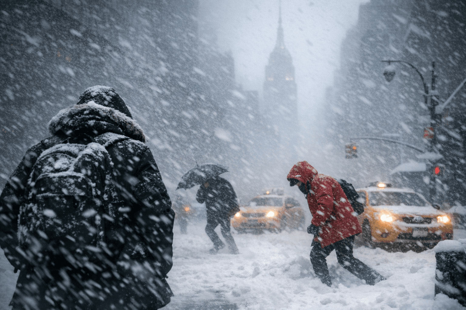
Forecasters emphasized the potential for whiteouts and nearly impossible travel during the worst of the storm. Jonathan Erdman of Weather.com warned readers not to be surprised "if more winter storm watches are converted to blizzard warnings in the upcoming hours." Carl Erickson, director of forecasting operations at AccuWeather, said, "The storm will be incredibly disruptive and dangerous," adding that "Blowing snow and near-zero visibility will make travel nearly impossible during the worst of the storm."
The National Weather Service and forecasters noted that the storm had strengthened offshore into a rapidly intensifying nor'easter and that forecast confidence had increased after days of model uncertainty. Reuters and CBS identified this as the first blizzard warning for New York City since 2017, marking an uncommon event for the city.
Authorities advised residents in the warning areas to monitor official NWS products and local emergency announcements for updated start times, county-level warnings, flood-watch specifics and any municipal directives as the system approaches.
This article was produced by Prism’s automated news system from verified source data, official records, and press releases, then run through automated quality and moderation checks before publishing. The system is built and supervised by the people who set the standards it runs under. Read our full AI policy.
Did this article answer your question?