California, Arizona and Nevada unveil sweeping Colorado River water-saving plan
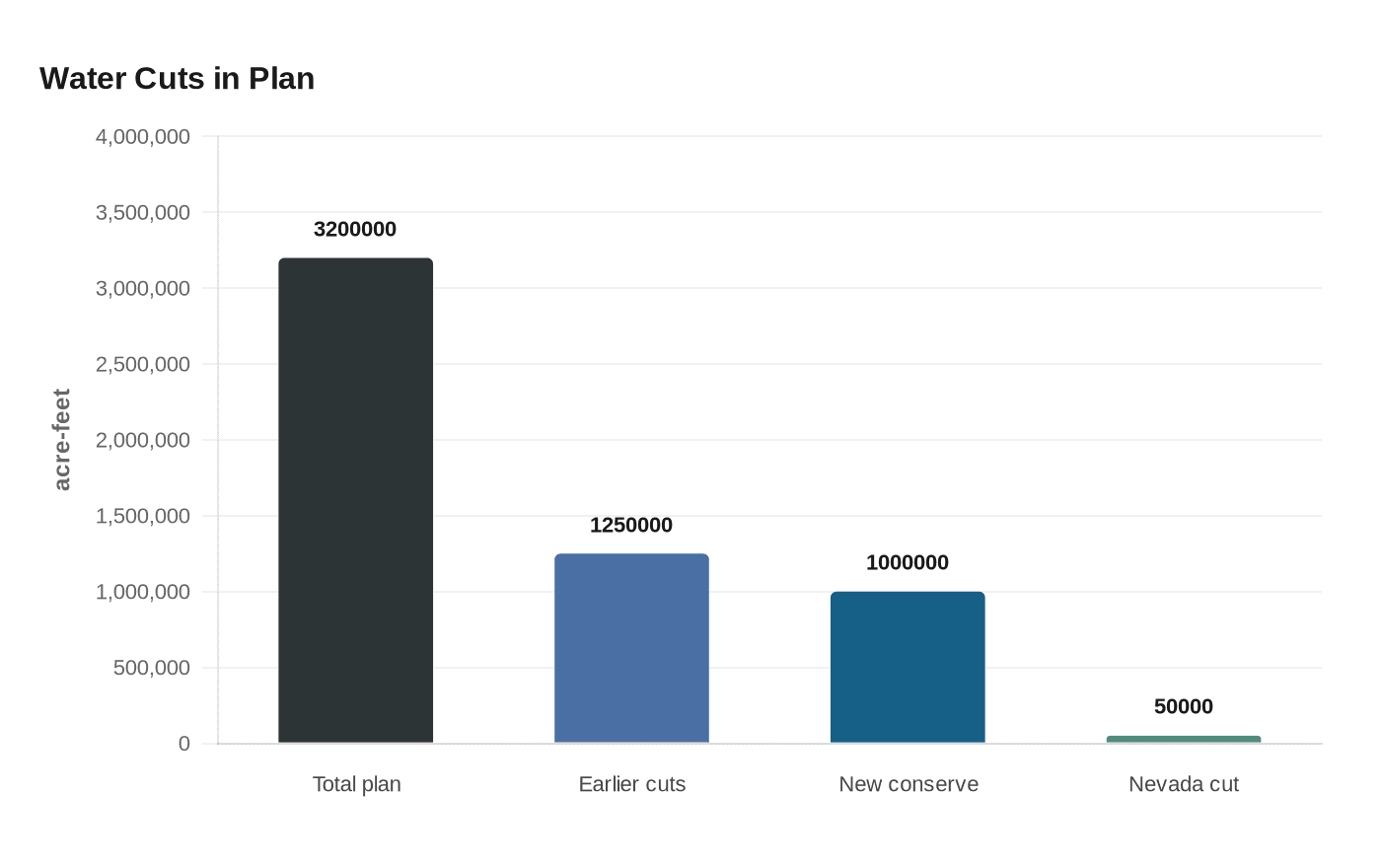
Arizona, California and Nevada pledged up to 3.2 million acre-feet of savings through 2028, as Nevada weighed a 50,000 acre-foot cut to its share.
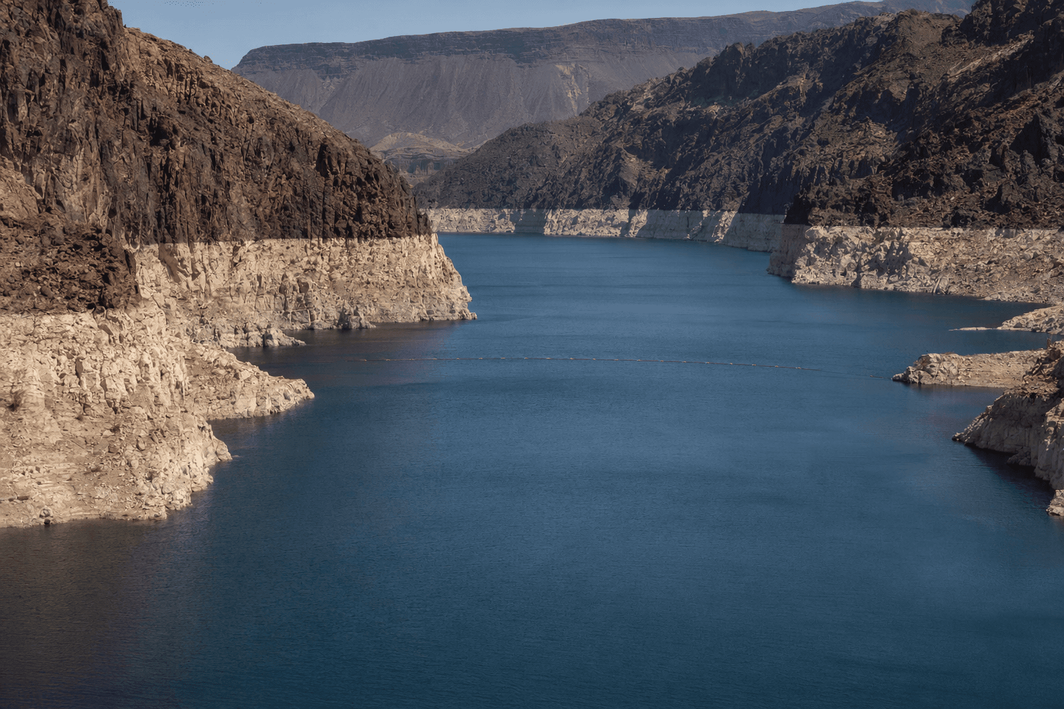
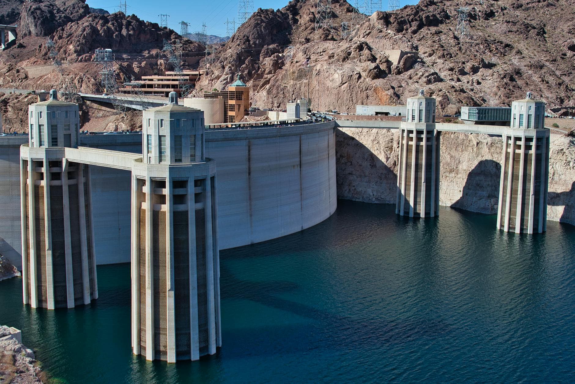
The three Lower Basin states moved to tighten Colorado River use with a plan they said could stabilize the system through 2028, even as emergency federal drought measures were already underway to keep Lake Powell and Lake Mead from slipping lower. California, Arizona and Nevada said the package could produce up to 3.2 million acre-feet of water savings, a scale that shows how little slack remains in a river that serves nearly 40 million people, irrigates 5.5 million acres of farmland and supplies 30 federally recognized Tribal nations.
The new proposal builds on earlier Lower Basin reductions of 1.25 million acre-feet a year and adds up to another 1 million acre-feet of conservation. Nevada, the smallest Colorado River user under the 1922 compact, said it could accept a cut of about 50,000 acre-feet a year from its roughly 300,000 acre-foot allocation over the next two years. California and Arizona did not publish a comparable split in the material provided, but officials said the burden would fall across farms, cities and water agencies, with every water user in the basin pressed to conserve more.
That is the core tradeoff. Less water for irrigation means tighter supplies for agricultural districts that depend on the river to keep fields productive. Less water for fast-growing suburbs means more pressure on local conservation rules, recycling programs and imports. And because the river also supports hydropower, any deeper drawdown in storage can ripple into electricity generation, recreation and the reliability of the whole Southwest water grid.
The states framed the plan as a more integrated fix than the piecemeal emergency steps that have dominated recent years. The package ties together Lake Powell releases, Upper Initial Unit operations, Lower Basin reductions, additional conservation, use of Intentionally Created Surplus and infrastructure improvements. That is a notable shift from the 1922 compact’s original allocation structure, which split 7.5 million acre-feet a year between the Upper and Lower Basins but never solved the reality of long-term overuse in a shrinking river.
The pressure is acute because the current post-2026 operating framework must be replaced by August 2026. Reclamation’s draft environmental impact statement drew 18,127 submissions before the comment period closed on March 2, and the Interior Department began emergency drought measures in April, including releases from Flaming Gorge Reservoir and lower flows into Lake Mead to protect Lake Powell. Upper Basin states have pushed for third-party mediation, while Lower Basin officials have argued that the moment demands immediate, measurable cuts. The new plan is bigger than a temporary patch, but it still hinges on cooperation, funding and enforceable reductions before the basin’s next deadline arrives.
This article was produced by Prism’s automated news system from verified source data, official records, and press releases, then run through automated quality and moderation checks before publishing. The system is built and supervised by the people who set the standards it runs under. Read our full AI policy.
Did this article answer your question?


