Daniel Boone National Forest Offers Owsley County Trails, Campgrounds, Lake Access
Daniel Boone National Forest offers Owsley County residents trails, campgrounds and lake access close to home. Plan ahead for reservations, fees and site status before you go.
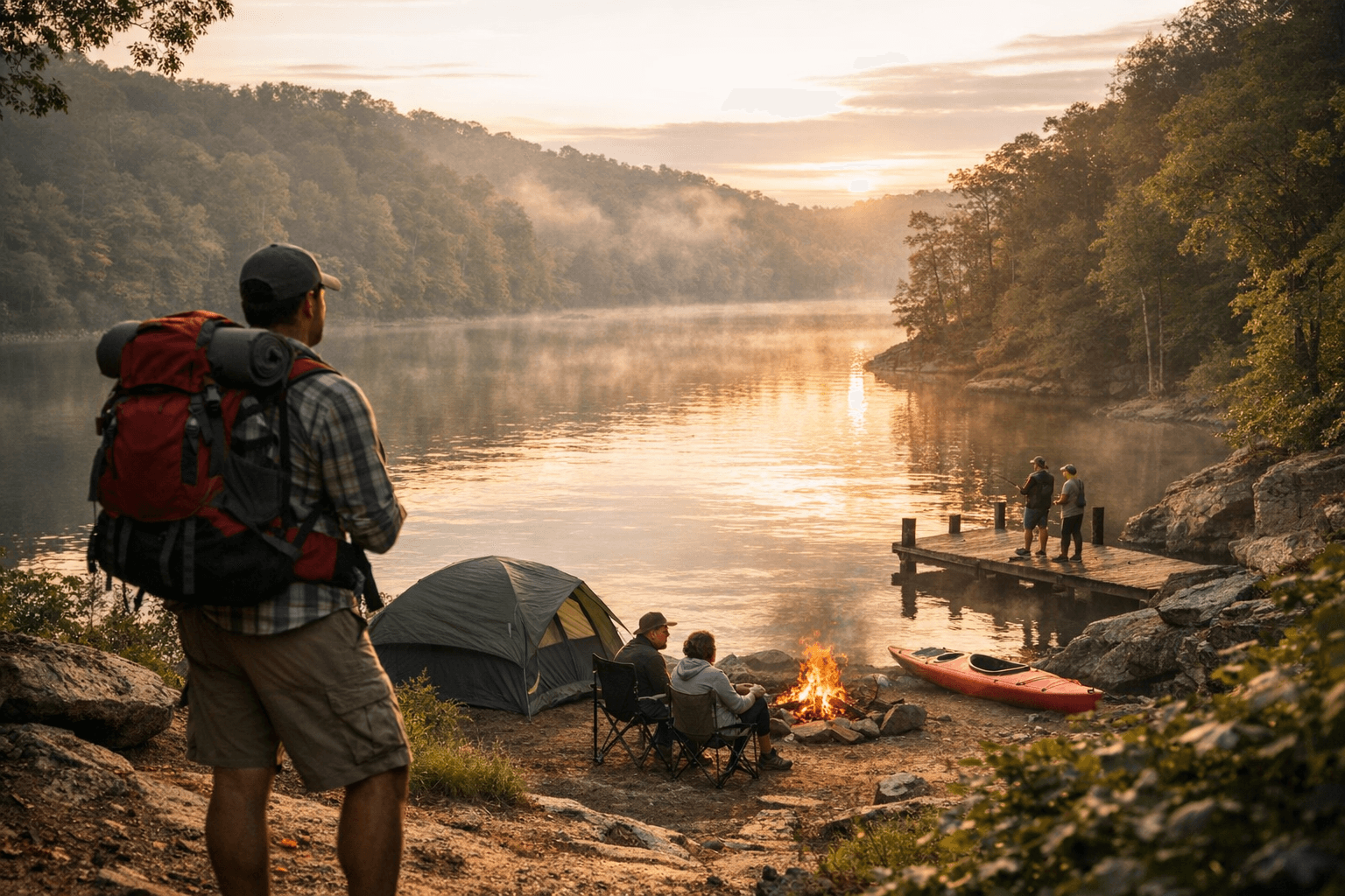
Daniel Boone National Forest is the nearest large federal public-lands recreation area for Owsley County residents, offering more than 600 miles of trails, developed campgrounds, multiple lakes and a raft of outdoor activities that draw more than one million visitors to the forest each year. For families, hunters and day trippers in Owsley County, the forest provides close-to-home options for hiking, fishing, rock climbing, horse riding, OHV use and group camping.
The forest’s trail network includes the Sheltowee Trace National Recreation Trail, which stretches almost 290 miles (470 km) from northern Kentucky to Pickett CCC Memorial State Park near Jamestown, Tennessee. Across the forest there are approximately 100 developed recreation areas with a combined capacity to accommodate 15,830 visitors at-a-time, and eight campgrounds explicitly listed: Boat Gunnel Group Campground; Craigs Creek Group Area; Claylick Boat-In Campground; Grove; Holly Bay; Koomer Ridge Campground; Twin Knobs Campground; and Zilpo. Zilpo Recreation Area also offers cabins and group lodging options.
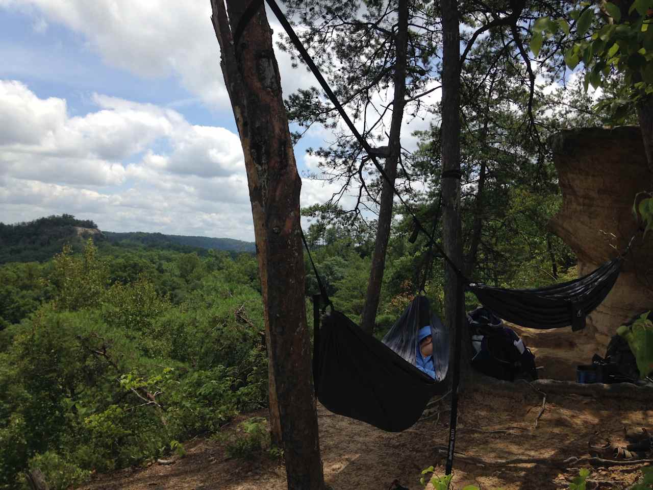
Water access includes Laurel River Lake, described as 5,600 acres of clear, deep water with nearly 200 miles of tree-lined shore, Cave Run Lake and Buckhorn Lake, plus three large pristine lakes noted in visitor materials. The forest contains special-designation areas such as Red River Gorge, a National Natural Landmark known for sandstone cliffs and world-class rock climbing, and wilderness units including Beaver Creek Wilderness (4,877 acres, set aside in 1975) and Clifty Wilderness (12,646 acres). Pioneer Weapons Wildlife Management Area covers 7,610 acres near Cave Run Lake and limits hunters to muzzleloaders, bow and arrow, or crossbows.
Visitors should note a number of specific sites and operational details shown on Forest Service pages. Appletree Shooting Range is listed as "Site Open" and is located off Appletree Shooting Road (Forest #6152) just east of US 27; it has two large, sheltered benches with target holders at 25, 50 and 100 yards. Bald Rock Picnic Area is "Site Open" and sits off KY 192 north of Laurel River Lake; a Bald Rock Fire Lookout Tower stood on that site from 1936 to 1970. Bangor Boat Ramp is "Site Open" on Bangor Boat Dock Road just off KY 1274 and "provides access to a narrow portion of Cave Run Lake." The source material contains the note: "Fishing is not allowed from the boat ramp, but once you are in the…" which is preserved as provided. Barren Fork Heritage Trailhead is also listed as "Site Open."
Practical rules and logistics matter for local users. "Daniel Boone National Forest offers various amenities and facilities, including developed campgrounds with restrooms, picnic areas with tables and fire rings." Visitors are advised to "Plan accordingly and carry necessary supplies such as food, water and toiletries when exploring less developed areas." Pets "are welcome but must be kept on a leash at all times. It's important to be mindful of other visitors and the wildlife in the forest. Always clean up after your pets and follow the forest's regulations regarding pet access to specific areas." Some activities require permits and fees; Kentucky tourism guidance notes that "fees for boat ramps and shooting ranges, camping in the Red River Gorge, driving on off highway vehicle (OHV) trails, and to rent equipment from a park office" may apply, and that "America the Beautiful passes and Golden Passports are accepted in the forest." Recreation.gov serves as the reservations gateway: "Recreation.gov is your gateway to explore America's outdoor and cultural destinations... a one-stop shop for inspiration and ideation, trip planning, information sharing, and reservations."
Daniel Boone National Forest is managed by the U.S. Department of Agriculture Forest Service from its office near Winchester, Kentucky; the listed contact phone is 859-474-5093 and GPS coordinates for the forest entry are 37.993583, -84.214053. For Owsley County readers planning trips, the forest offers a wide mix of nearby day-trip and overnight options, but capacity, fees and seasonal restrictions mean early planning and checking Forest Service site pages and Recreation.gov are important next steps.
Sources:
Know something we missed? Have a correction or additional information?
Submit a Tip