Geographer exposed U.S. bombing of North Vietnam’s Red River dikes
Yves Lacoste used maps and field observation to argue U.S. bombing of North Vietnam’s Red River dikes was deliberate, threatening millions downstream. He died June 20 at 96.
Maps, field notes and a geographer’s eye helped Yves Lacoste argue that U.S. strikes on North Vietnam’s Red River dikes were deliberate, not random, and could put hundreds of thousands of people at risk. Lacoste, who died June 20 at 96, turned geography into evidence in a war that was also being fought over terrain, water and civilian survival.
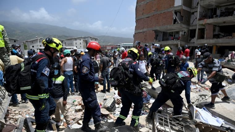
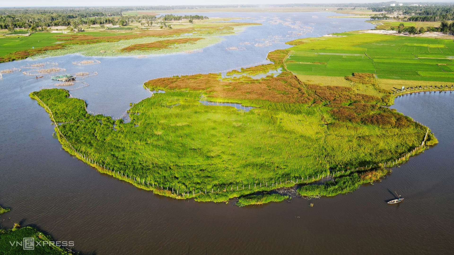
In 1972, Lacoste traveled to the Red River Delta as an investigator for the International Commission of Inquiry into U.S. War Crimes in Indochina. He used firsthand observation, maps and an integrated reading of physical and human geography to show that the bombing pattern took account of local topography, hydrology and settlement patterns. France24 later described the field study as evidence that the attacks on the Red River were not random.
The stakes were enormous. Contemporaneous TIME reporting described North Vietnam’s dikes as a 2,500-mile flood-control network protecting about 15 million people in the delta. Lacoste’s work focused on the vulnerability of that system, which held back floodwaters from some of the country’s most populated and productive land. A severe August 1971 flood had already shown the danger: CIA material on the dike-bombing issue said the disaster killed about 100,000 people and seriously flooded roughly 1.1 million acres of riceland.
That context made the bombing of dikes more than a military tactic. It raised the possibility that civilian infrastructure was being targeted with an understanding of what failure would mean for the delta’s farmers, villages and cities. Lacoste’s analysis fed a broader debate later described in a 2013 scholarly article as one about political deception and geographical warfare, the idea that maps and terrain knowledge could be used to expose state violence rather than conceal it.
The 1972 Vietnam study also became the first investigation associated with Hérodote, the journal Lacoste founded. It helped shape the intellectual foundation for his 1976 book La géographie, ça sert, d’abord, à faire la guerre, which made him a central figure in French geopolitics and helped establish what became known as the French school of geopolitics. Hérodote said in its obituary notice that he profoundly influenced French geography and geopolitics. Béatrice Giblin, among others, described him as the scholar who brought politics back into geography.
This article was produced by Prism’s automated news system from verified source data, official records, and press releases, then run through automated quality and moderation checks before publishing. The system is built and supervised by the people who set the standards it runs under. Read our full AI policy.
Know something we missed? Have a correction or additional information?
Submit a Tip