Georgia wildfires grow past 31 square miles, emergency declared statewide
The Pineland Road Fire surged to 32,003 acres in southeast Georgia as crews battled drought, wind and hurricane debris. A statewide emergency and 30-day burn ban now cover 91 counties.
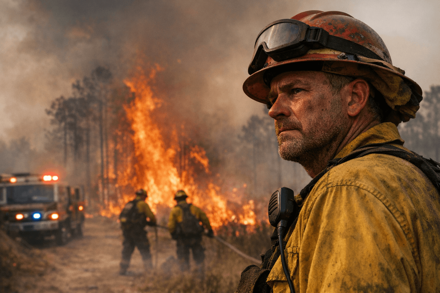
The Pineland Road Fire surged across Clinch and Echols counties to about 32,003 acres, or more than 49 square miles, and remained only about 10% contained, putting nearby residents on alert for possible new evacuations as conditions stayed dry and windy. The Highway 82 Fire in Brantley County also kept growing, topping 7,500 acres after burning more than 5,000 acres earlier in the week, with homes destroyed and evacuation zones expanding as officials urged residents to leave when ordered.
Governor Brian Kemp declared a state of emergency for 91 Georgia counties on April 22 and the Georgia Forestry Commission imposed a 30-day ban on outdoor burning in the same area. State officials said the response had already stretched across more than 90 wildfires since April 18, an outbreak fueled by extreme drought, gusty winds and woody debris left behind in South Georgia by Hurricane Helene. The Forestry Commission said 98% of Georgia’s land area was in moderate to exceptional drought, and it called the burn ban the first mandatory outdoor-burning ban in the agency’s history.
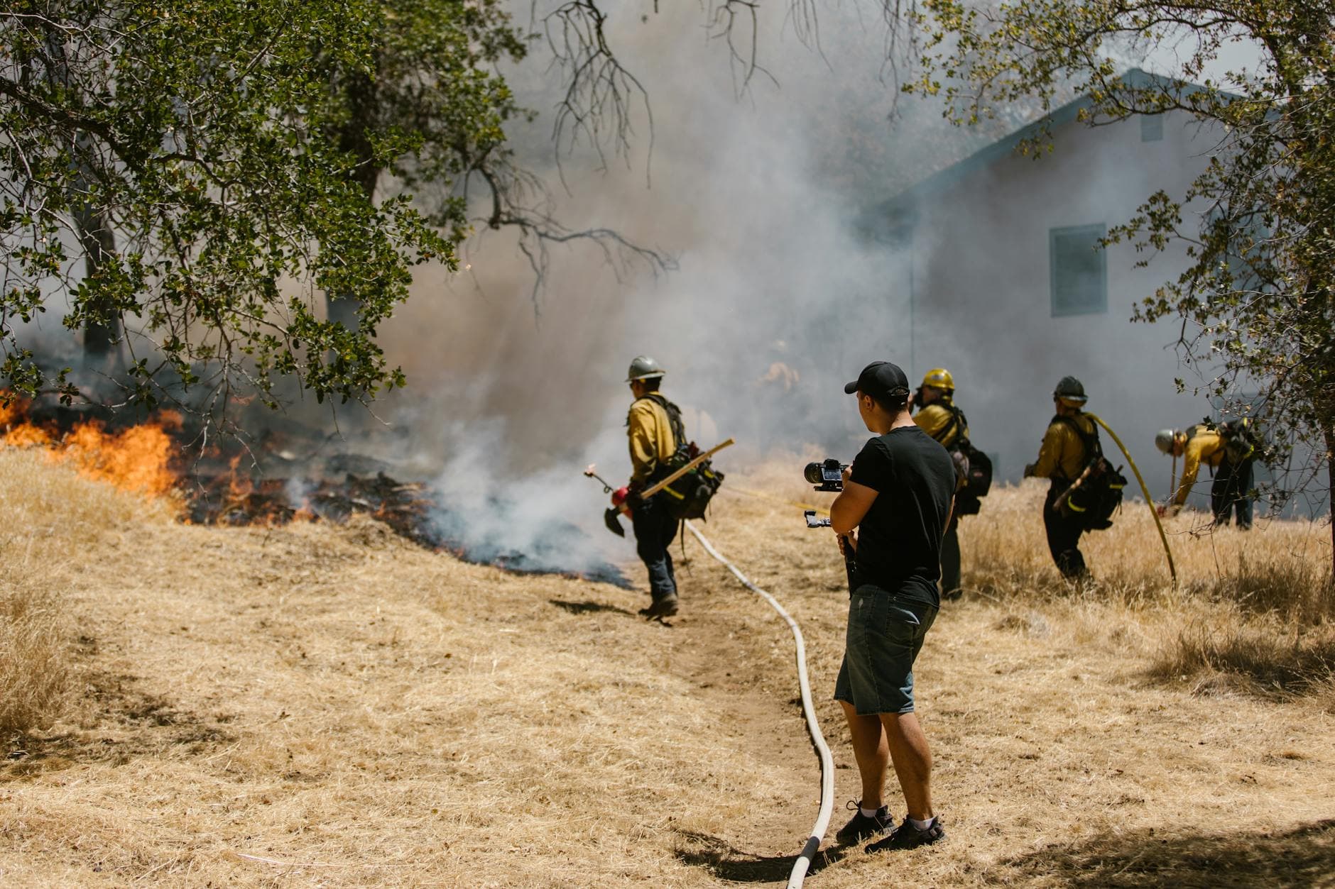
The emergency response has widened quickly. Federal Emergency Management Agency Fire Management Assistance Grants were approved for both the Pineland Road Fire and the Highway 82 Fire, and a federal incident management team was being called up to help coordinate the effort. The Georgia Forestry Commission said the fires posed major threats to property, critical infrastructure, natural resources, communities and public safety. County emergency management offices and the Brantley County Sheriff’s Office were listed as points of contact for evacuation updates as local officials moved to keep residents out of harm’s way.
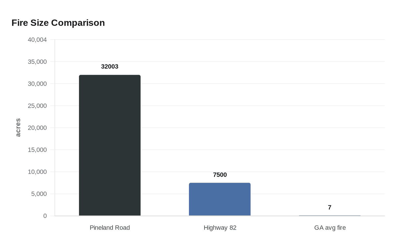
The scale of the outbreak is unusual even for a state that averages more than 2,300 wildfires a year, most of them much smaller and often linked to careless debris burning. Georgia’s average wildfire is about 7 acres, far below the tens of thousands of acres now burning in the southeast corner of the state. Officials said April’s fire totals had already climbed above Georgia’s five-year average, and Kemp said the wildfires had surpassed the state’s five-year average as the spring blaze activity deepened. The current fires have turned southeastern Georgia into an outlier, showing how wildfire risk now reaches far beyond the western states long associated with the problem.
This article was produced by Prism’s automated news system from verified source data, official records, and press releases, then run through automated quality and moderation checks before publishing. The system is built and supervised by the people who set the standards it runs under. Read our full AI policy.
Did this article answer your question?