Greensboro activates full snow-and-ice response ahead of forecast storm
The city will activate its full emergency snow-and-ice plan at 11 p.m. Saturday as crews pre-treat roads and mount equipment; this affects travel, school and work commutes across Guilford County.
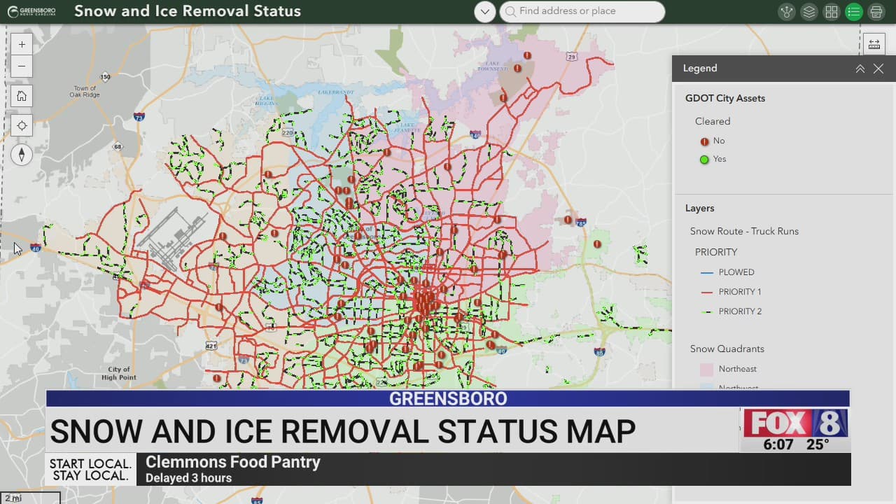
Greensboro is moving to full emergency operations ahead of a forecast of frozen precipitation, with the city announcing on Jan. 16 that its snow-and-ice response plan will be activated at 11 p.m. Saturday, Jan. 17. The decision puts crews and departments on alert and sets citywide targets for clearing key routes once the event ends.
City crews have already completed several preparedness steps. Bridge and overpass surfaces were pre-treated, many miles of roadway and crosswalks received anti-icing treatment, and snow-removal equipment was mounted and readied for deployment. The advance work is intended to reduce initial icing and speed the transition to plowing and removal once freezing precipitation begins and accumulates.
The city’s release also lays out service-level targets for clearing Priority 1–3 routes within specified windows after the event. Those priorities guide where crews focus first and how quickly major arterials, critical connectors and secondary streets will be cleared as conditions allow. Multiple city departments will operate 24 hours during the response to maintain roads, manage traffic, and support emergency services throughout the event.
For drivers and commuters in Guilford County, the activation means elevated potential for travel disruptions during the Saturday night and Sunday morning travel periods. Treated surfaces can refreeze, and initial plow operations may focus on high-priority corridors before secondary streets are cleared. Expect slower travel, limited on-street parking during operations in some neighborhoods, and the possibility of delayed transit or municipal services depending on storm intensity.

Residents are directed to monitor city weather updates for evolving conditions, road-closure notices, and guidance on service changes. Officials advise allowing extra travel time, avoiding unnecessary trips while crews are operating, and keeping sidewalks clear where feasible to support pedestrian safety. Businesses, schools and employers should confirm plans with their own channels as the event progresses.
The activation underscores the city’s layered approach to winter storms: pre-treatment to limit ice formation, rapid deployment of equipment once precipitation arrives, and staged clearing based on route priority. How quickly neighborhoods return to normal will depend on storm severity, temperatures, and equipment access.
What this means for readers: expect active street operations overnight into Sunday, prioritize safety over speed on untreated surfaces, and stay tuned to official city updates for closures or service changes as crews work to restore safe travel across Greensboro.
Sources:
Know something we missed? Have a correction or additional information?
Submit a Tip