Hernando County springs, boat ramps and water access: locations, safety, resources
Hernando County operates ten boat ramps, including 24/7 access at Hernando Beach (4 launching lanes), Rogers Park (7244 Shoal Line Blvd) and Bayport Park (4140 Cortez Blvd).
Overview Hernando County is home to springs, rivers and Gulf access that drive recreation and tourism, with Weeki Wachee River and Weeki Wachee Springs State Park among the best known. The county operates a system of launch points intended to serve both fresh and salt water boating, and a 2020 county plan frames those facilities as central to nature-based visitation and local business activity.
County planning and management The county codified its approach in the Coastal Boat Ramp Master Plan, dated April 2020. The plan states: “The Hernando County Board of County Commissioners operates ten (10) boat ramp facilities providing for watercraft access to both fresh and salt water areas within the County.” It also declares policy goals for coordinated parks and waterway access, noting that “This master plan is being developed using direction from several guidance documents to support sustainable commercial and recreational use of the coastal waters of Hernando County.” The Comprehensive Plan is invoked to manage growth and to set objectives, including 7.01 on the County Park Plan and 7.02C on Waterway Access, and the plan includes a prescriptive Strategy 7.01A(1): “Hernando County will consider developing and maintaining a countywide master plan for parks, park facilities and open space that includes, at a minimum: a.an evaluation of the parks system in conjunction with annual budgetary allocations, capital funding and adequate facilities; b.development of a long-term strategy for parks and major facilities that will meet identified needs for both the permanent and visitor population;” The plan adds that “Hernando County encourages access to and responsible enjoyment of its waterways resources including rivers, springs, bays and the Gulf of Mexico, including a system of waterway access into its parks system.” It also recommends active upkeep: “The County should expand, enhance and maintain boat ramps, kayak launches, public docks and other [...]” with specific language truncated in the excerpt available.
How the facilities work today The master plan makes clear facility capability varies: “These boat ramp facilities ability to launch different size vessels and provide parking vary from site to site.” Operational details published in local visitor guides supplement that planning language. Multiple Hernando Beach area ramps are described as open round the clock, and the visitor guide for Hernando Beach lists amenities such as launching lanes, courtesy docks, parking fee kiosks and restrooms for specific launches.
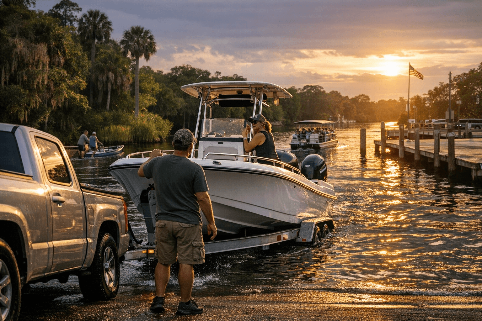
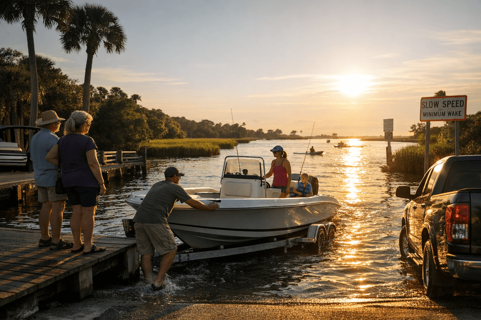
Key ramps and practical details Hernando Beach Boat Ramp, listed as open 24/7, is the most prominent local Gulf launch point. The site copy reads: “The public boat ramp in Hernando Beach offers 24-hour access to the Gulf of Mexico, making it easy for visitors to explore the area’s stunning waterways. The public ramp has 4 launching lanes with courtesy docks. Across the street from the boat ramp is plenty of room for parking. The parking lot has a parking fee kiosk to pay parking fees. Restrooms are also in the same parking lot.” Those four launching lanes and the courtesy docks make Hernando Beach a primary choice for anglers and day-trippers seeking direct Gulf access.
Rogers Park Boat Ramp provides mixed freshwater and saltwater options and local park amenities. The listing reads: “Rogers Park provides access to both freshwater and saltwater areas, making it an ideal spot for boating and fishing. Visitors can launch their kayaks or canoes from the park, or take a boat towards the Gulf of Mexico. Manatees are often seen in the area, so boaters are advised to take extra caution.” The park is at 7244 Shoal Line Boulevard, Spring Hill, FL 34607, and also “offers a playground, single picnic tables, grills, sand volleyball court, and restrooms. Parking fees are collected via a kiosk system.”
Bayport Park is positioned for power boaters and trailers. The site copy states: “Bayport Park provides power boaters with extensive facilities, including a lighted dock area and two paved ramps. The park offers ample parking for vehicles and boat trailers, and the launch facilities are open 24 hours a day. Visitors can easily access the flats from this park and enjoy a variety of activities, including fishing, sightseeing, and exploring.” Its address is 4140 Cortez Boulevard, Spring Hill, FL 34607.
Driving directions to two inland ramps Published driving directions from the Lake Wateratlas provide turn-by-turn approach notes that remain useful when planning inland launches. For Mountain Lake Ramp #71 the directions read exactly as published: “Hernando MOUNTAIN LAKE -RAMP #71 MOUNTAIN LAKE FROM THE INTERSECTION OF I-75 AND SR 50 EAST OF BROOKSVILLE, TRAVEL WEST ON SR 50 FOR 4.0 MILES TO CR 541 (SPRING LAKE HWY). TURN LEFT AND GO 2.8 MILES TO MOUNTAIN LAKE ROAD. TURN RIGHT AND GO 0.4 MILE TO THE RAMP.” For the Withlacoochee River launch the Lake Wateratlas entry reads: “Citrus WITHLACOOCHEE RIVER - RAMP #51 WITHLACOOCHEE RIVER FROM THE INTERSECTION OF US 41 AND SR 200 IN HERNANDO, TRAVEL NORTH ON SR 200 FOR 6.5 MILES. TURN LEFT ON CR 39 (E WITHLACOOCHEE TR.) AND GO 1.2 MILES TO E SEMINOLE LN. TURN RIGHT AND GO 0.2 MILE TO RIVERSIDE WAY. TURN LEFT AND GO 0.3 MILE TO THE RAMP ON THE RIGHT.” Use those directions to plan routes, and confirm whether a ramp sits in Hernando County jurisdiction or a neighboring county before assuming management responsibility.
- Follow posted parking fee kiosk instructions at Hernando Beach and Rogers Park.
- Expect restrooms and courtesy docks at Hernando Beach and restroom facilities at Rogers Park.
- Respect lighting and trailer parking rules at Bayport Park, which lists “ample parking for vehicles and boat trailers” and a lighted dock area.
Safety, wildlife and local rules
The Hernando Beach listings flag wildlife and safety specifics at Rogers Park: “Manatees are often seen in the area, so boaters are advised to take extra caution.” That caution is a direct operational note boaters should treat as a legal and safety concern in manatee habitat. County and state agencies publish manatee zone maps and speed restrictions; consult Florida Fish and Wildlife Conservation Commission maps for exact no-wake zones and seasonal rules before launching. Practical safety items tied to the site details include:
Fees, hours and verification you should check Multiple facility listings state 24-hour access. Hernando Beach Boat Ramp and the Rogers Park and Bayport Park entries repeat “OPEN 24/7.” The county plan is dated April 2020 and the visitor guide carries a 2025 copyright in its footer, so verify current hours, closures, and fee schedules prior to travel. The Hernando Beach Visitor Guide header lists a contact number as (478) 287-2123 and the site footer shows “© 2025 Creative Webdesign LLC & CWD Hosting, All Rights Reserved.” For management-level questions, the Coastal Boat Ramp Master Plan identifies the Hernando County Board of County Commissioners as the operating body.
Economic and civic stakes The master plan links boat ramp infrastructure to local economic activity, noting that “These boat ramp facilities generate significant local economic activity within Hernando County benefiting local businesses such as bait shops, marinas,” with the sentence truncated in the excerpt but pointing to a direct economic connection between launches and local commerce. Objective-driven language in the Comprehensive Plan and the county master plan shows elected officials framed waterway access as part of longer-term park, budgetary and growth planning. As facilities are upgraded, decisions about funding, maintenance and siting will influence small business revenue, traffic patterns and habitat protections.
What to know before you go Bring documentation for your vessel, verify posted hours and fees at the kiosk before parking or launching, watch for wildlife signs especially in Rogers Park, and use the Lake Wateratlas driving directions for inland ramps to avoid last-mile detours. When planning larger group trips or commercial activity, contact Hernando County Parks or the Hernando County Board of County Commissioners for confirmation of ramp capacity and any permit requirements.
Conclusion Hernando County’s network of springs, rivers and Gulf access points is backed by a county planning framework and on-the-ground 24/7 ramps that serve both everyday recreation and the local economy. Keep the master plan’s objectives and the published facility details in mind, verify hours and rules before you launch, and treat local wildlife protections as enforceable safety measures as county leaders follow through on ramp maintenance and expansion.
Know something we missed? Have a correction or additional information?
Submit a Tip