Kōkeʻe and Waimea Canyon State Parks: Prepare for Weather, Trail Conditions
Plan for rapidly changing weather and variable trail conditions at Kōkeʻe and Waimea Canyon State Parks; residents and visitors should prepare for fog, rain, muddy trails and possible road or lookout restrictions.

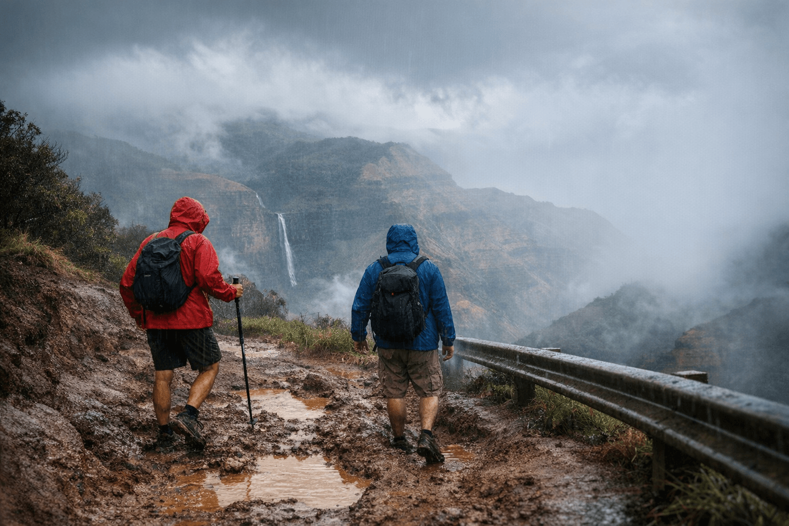
Kōkeʻe State Park and the adjacent Waimea Canyon State Park on Kauaʻi’s west side are reminding visitors to prepare for quickly changing weather and variable trail conditions that affect safety and access. The parks, reached by Waimea Canyon Drive (Highway 550) and accessed via narrow, winding Kōkeʻe Road, host high-elevation lookouts, popular trails and sensitive native forest habitat, conditions can shift from clear to foggy or rainy with little warning.
Key lookouts include Puʻu o Kīla and Kalalau Lookout; Puʻu o Kīla provides panoramas of the Kalalau Valley and the Na Pali Coast. Main lookouts generally offer parking and restroom facilities, but space can be limited when weather drives more people to sheltered vantage points. Trail options range from short, family-friendly walks such as Cliff Trail and the Kōkeʻe Nature Trail to strenuous routes including Awaʻawapuhi, Alakaʻi Swamp and Nualolo. Many routes feature steep drop-offs and sections that become muddy and slippery after rain; hikers are advised to carry water, rain gear, sturdy footwear and a map, and to stay on marked paths.
Operational management and public safety rest with the state Department of Land and Natural Resources and State Parks. Visitors should check the DLNR Kōkeʻe/Waimea pages for current trail conditions, closures, permit and fee updates, and notices about road repairs or seasonal restrictions that may affect access to specific lookouts or trailheads. Road repairs and seasonal limits on access can change parking patterns and traffic on Highway 550 and Kōkeʻe Road, with knock-on effects for emergency response times and local businesses that depend on park visitors.
Beyond immediate safety, the parks serve as critical habitat for native forest species and endangered birds. Compliance with signage, not feeding wildlife and following Leave No Trace principles are essential for protecting those resources. Policy choices about funding for road and trail maintenance, staffing for enforcement and interpretive services, and permit structures will shape both visitor experience and habitat protection. Those decisions are influenced by state and county budgeting and management priorities, meaning civic engagement and feedback to elected officials and DLNR can affect long-term outcomes for access and conservation.
For residents and visitors, practical steps matter now: allow extra travel time on Highway 550 and Kōkeʻe Road, check DLNR pages before heading upcountry, carry appropriate gear, and expect conditions to change. How the community balances recreation, visitor safety and habitat protection will determine whether these parks remain a sustainable resource for local residents and future generations.
Sources:
Know something we missed? Have a correction or additional information?
Submit a Tip

-1.webp&w=1920&q=75)