Lewis and Clark Water Quality District Posts Groundwater Map, Testing Ended
The county posted an interactive groundwater-level map and related reports while the county-run free arsenic and uranium testing program has ended; private well test kits remain available from Public Health.
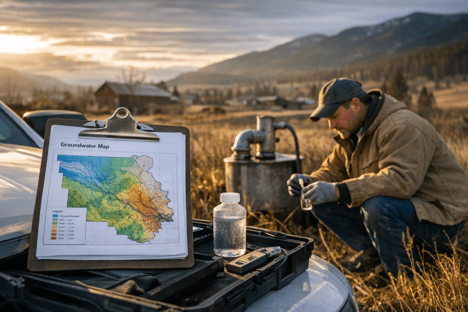
Lewis and Clark County’s Water Quality Protection District has published a new suite of resources for residents concerned about groundwater levels and local water quality, including an interactive groundwater-level map and several project summaries. The district’s web materials also include a Tenmile Hydrologic Outlook labeled January 2026, and summaries of ongoing work such as the Grizzly Gulch Placer Mine reclamation project and the Unionville 2023 Water Quality Study.
The new materials are maintained by Lewis & Clark County Public Health and provide county residents with a centralized place to check basin conditions, see current monitoring data, and review active reclamation and study efforts. The groundwater-level map is designed to give well owners and land managers a visual sense of water-table trends across the county, while the Tenmile outlook offers a basin-conditions snapshot that can affect surface water and shallow groundwater users during spring runoff and through the irrigation season.
A notable change for private well owners is that the county-run free arsenic and uranium testing program has ended. County pages note that Public Health offices still distribute private well test kits, and residents who want screening for those contaminants can obtain kits through Public Health. The shift from a free county program to kit distribution means individual well owners may need to arrange testing themselves rather than rely on a county-run screening campaign.
The Water Quality Protection District page also lists board membership and meeting information. A WQPD board meeting was posted for Jan. 27, 2026, with meeting details and a Zoom option, offering a near-term opportunity for residents to ask questions about monitoring results, reclamation progress at Grizzly Gulch, and the Unionville study findings. Contact information for county hydrogeology and outreach staff is provided on the site for people seeking technical help or guidance about well testing and interpreting map data.
For the local community, these developments matter in practical ways. Well-dependent households should pay attention to the groundwater-level map and the Tenmile outlook to spot trends that could presage low-yield conditions or changes in water quality. Property owners near mine reclamation sites should monitor reclamation summaries to understand potential impacts on nearby springs and wells. With the county’s free arsenic and uranium program ended, picking up a private well test kit from Public Health and scheduling appropriate lab analysis will be the most direct way to know whether a home’s drinking water requires treatment.
What comes next is participation and vigilance: review the posted maps and reports, consider attending the Jan. 27 board meeting or contacting county hydrogeology staff, and secure a private well test kit if you rely on groundwater for drinking. These steps will help Lewis and Clark County residents keep a close eye on water security and local reclamation impacts as the season progresses.
Sources:
Know something we missed? Have a correction or additional information?
Submit a Tip