Lightning-sparked Stoner Mesa Fire burns San Juan National Forest northeast of Dolores
Lightning ignited the Stoner Mesa Fire, which scorched roughly 10,243–10,249 acres in the San Juan National Forest and forced campground closures and Level Two evacuations.
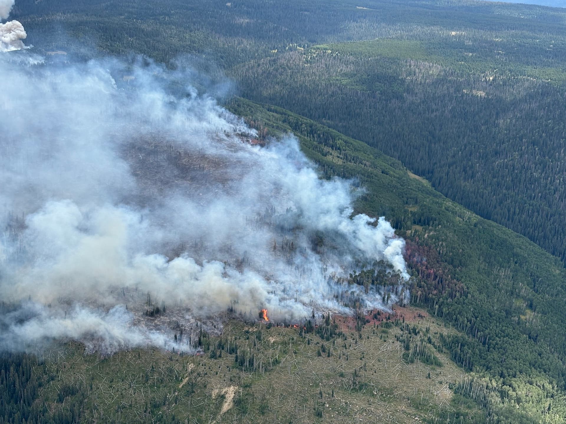
The lightning-sparked Stoner Mesa Fire burned through mixed conifer, aspen and heavy oak underbrush in the San Juan National Forest northeast of Dolores, growing to roughly 10,243 acres in Montezuma County’s incident snapshot and to 10,249 acres in a late August state summary, with containment reported between about 42 and 43 percent in those official tallies. Montezuma County listed the incident location as 11 miles northeast of Dolores and reported 799 personnel assigned to the suppression effort; state updates noted Colorado Division of Homeland Security and Emergency Management support amid multiple regional fires.
Initial Forest Service and county updates described extreme fire behavior during the blaze’s early days, with multiple airtankers, an air attack aerial supervision plane and two helicopters operating overhead and aircraft dropping retardant on the western flank. Ground crews worked to strengthen lines, cut a secondary line from near the Stoner RV campground up toward the mesa top, and install sprinkler systems and hose lays around cabins and buildings in the County Road 38 and Colorado Highway 145 corridors. In his morning briefing, Operations Section Chief Matt Weakland said “structure protection groups have been working hard in the County Road 38 and Colorado Highway 145 corridors.”
Evacuations and closures affected backcountry and popular recreational sites. Dolores County issued mandatory closures for Forest Service Roads 686 (Stoner Mesa Road) and 545 (Taylor Mesa Road) and closed Mavreeso, West Dolores and Burro Bridge campgrounds; Ksjd and county postings placed County Road 38 from the Dolores County line north to West Dolores Campground in Level Two - Set status, and identified the Lower Stoner Trailhead and Road 40.1 in evacuation warnings. Dolores and Montezuma County sheriffs coordinated evacuations, and helicopters assisted in moving recreators out of remote areas. For public information officials listed an incident phone line, 970-341-8668, and the incident email address 2025.stonermesa@firenet.gov.
Air quality and weather concerns complicated the response. The Colorado Department of Public Health and Environment issued an air quality health advisory for southeastern Dolores and northeastern Montezuma counties after monitors registered very unhealthy conditions during the fire’s intense phases; local forecasts warned of shifting conditions as a surge of monsoonal moisture could bring thunderstorms with lightning and winds of 20 to 30 mph, followed by a higher likelihood of steady soaking rain the next day. Montezuma County advised expected rainfall amounts near 0.20 inches would allow fuels to absorb moisture and keep fire activity limited to smoldering and creeping unless a prolonged hot, dry and windy period returned.

Local incident management shifted resources as needed. San Juan Team 8, a Type 3 incident management team, was reassigned to Stoner Mesa after wrapping operations on the Elkhorn Fire north of Durango, and county briefings described structure protection teams moving south toward the junction of Colorado 145 and Forest Road 38.1 while crews cleared brush and set up pumps and hose lays around homes along County Road 40 in Stoner Canyon. Ksjd noted that “crews continue to face tough conditions, with hot and dry weather fueling flare-ups along the fire’s western edge.”
Community meetings and public notices were used to share updates with residents and visitors. Brad Pietruszka presented an update at a Rico town meeting and a public meeting was scheduled at the Dolores Community Center, 400 Riverside Ave; county advisories reminded the public that “If you fly, we can’t” when it comes to unauthorized aircraft over active incidents, and Facebook updates emphasized that, at the time of that post, “The fire has not reached Stoner Creek at this time.” Officials urged people to follow Dolores County Sheriff emergency alerts and county incident communications for the latest evacuation and air quality information.
Sources:
Know something we missed? Have a correction or additional information?
Submit a Tip