Maurice River granted federal Wild and Scenic designation for 35.4 miles
Federal Wild and Scenic protection now covers 35.4 miles of the Maurice River (pronounced "Morris"), safeguarding bluffs, wild rice marshes and habitat through Millville, Vineland and Maurice River Township.

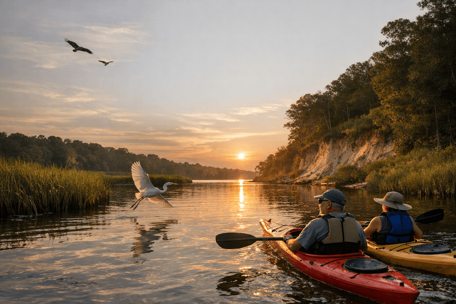
Federal protection now covers 35.4 miles of the Maurice River (pronounced "Morris"), a coastal plain watercourse that meanders roughly 50 miles through Southern New Jersey and through Millville and Vineland into the Delaware Bay. The U.S. Congress and President Bill Clinton designated the Maurice River and three tributaries as Wild and Scenic Rivers on December 1, 1993, marking a longstanding local-federal conservation partnership that traces back to a National Park Service study begun in 1986.
The NPS study was conducted in cooperation with the Cumberland County Department of Planning and Development and produced recommended management alternatives and a proposed river management plan that included municipal conservation zone language. Maurice River Township formalized support during the local process: Maurice River Township Resolution 56-90 stated, in part, “Maurice River Township through its. Township Committee shall seek inclusion into the National Wild and Scenic River System for the designated waterways known as the Maurice River, Manumuskin Creek, Muskee Creek and the Menantico Creek for the entire river corridor study area subject to, but not limited to the conditions as set forth in Resolution No. 26-90 of the Maurice River Township Planning Board which Resolution was adopted by the Planning Board on August 1, 1990, and which Resolution is made apart hereof as if specifically set forth here at length.”
The corridor’s ecological value underpinned the designation. The Maurice River “draws from a drainage area of 385 square miles” and contains about 20 small lakes, the largest of which is Union Lake at 950 acres. The river supports New Jersey’s largest stand of wild rice, provides critical stopover and nesting habitat for osprey and bald eagles at the Maurice River Bluffs Preserve, and sits on a migration route identified as part of the Atlantic flyway. Local materials note that the river supports “53 percent of the animal species that New Jersey has recognized as endangered, excluding marine mammals,” and that the watershed is “home to more than half of the non-marine mammal animal species that the state has recognized as endangered.”
Three tributaries were included in the Wild and Scenic designation alongside the Maurice River: the Manumuskin River, Menantico Creek, and Muskee Creek. The Manumuskin is singled out as “one of only two rivers designated as pristine in the [Pinelands] Reserve,” and, despite a dam that creates Cumberland Pond, the Manumuskin’s entire length was included in the classification because of its unspoiled nature. The watershed links the southwestern Pinelands National Reserve and the Delaware Estuary, and municipal boundaries for the designated corridor include the cities of Vineland and Millville and the townships of Maurice River, Commercial, and Buena Vista.
Local management and economic planning have been central to protection. The Comprehensive Management Plan states, “Clearly, Cumberland County has assumed a leadership position in the protection of the Maurice River corridor,” and that “Cumberland County consistently demonstrated strong support throughout the study, designation, and subsequent planning processes and has established its position as the primary local responsible organization in resource protection in the river corridor.” Cumberland County’s Ecotourism Plan was folded into the CMP; the CMP notes, “The Ecotourism Plan offers specific recommendations on how visitors can enjoy the significant resources of the County without adversely affecting them. Much of the information contained in the Ecotourism Plan is incorporated into this Comprehensive Management Plan.”
Designation carries use and development limits. The NPS wrote that “designation as a National Wild and Scenic River would not be compatible with new large-scale industrialization of the river corridor, rather that such designation would support and foster traditional commercial, industrial, and recreational uses of the river, including fishing, seafood processing, commercial navigation, and tourism.” Conservation groups remain active locally: The Nature Conservancy’s 525-acre Maurice River Bluffs Preserve sits along the designated 35.4-mile corridor, and the organization has said, “The Nature Conservancy prides itself on protecting the Maurice River Bluffs Preserve.”
Public access remains limited; local guidance points out that “the best place to view the river is from the bridge in Mauricetown. Boat access is available at Millville’s Fowser Road Boat Ramp or at a marina.” The 1986 NPS study, municipal resolutions from August 1990, and the December 1, 1993 federal designation form the core timeline of the corridor’s protection and the management framework that Cumberland County, conservation groups, and the NPS continue to implement.
Sources:
Know something we missed? Have a correction or additional information?
Submit a Tip