Navigate Four Corners Route Maps: Stay Legal, Protect Sensitive Lands
BLM, USFS and tribal maps use different route labels across the Four Corners; learn to read route classes and permit rules to stay legal and protect sensitive soils and cultural sites.
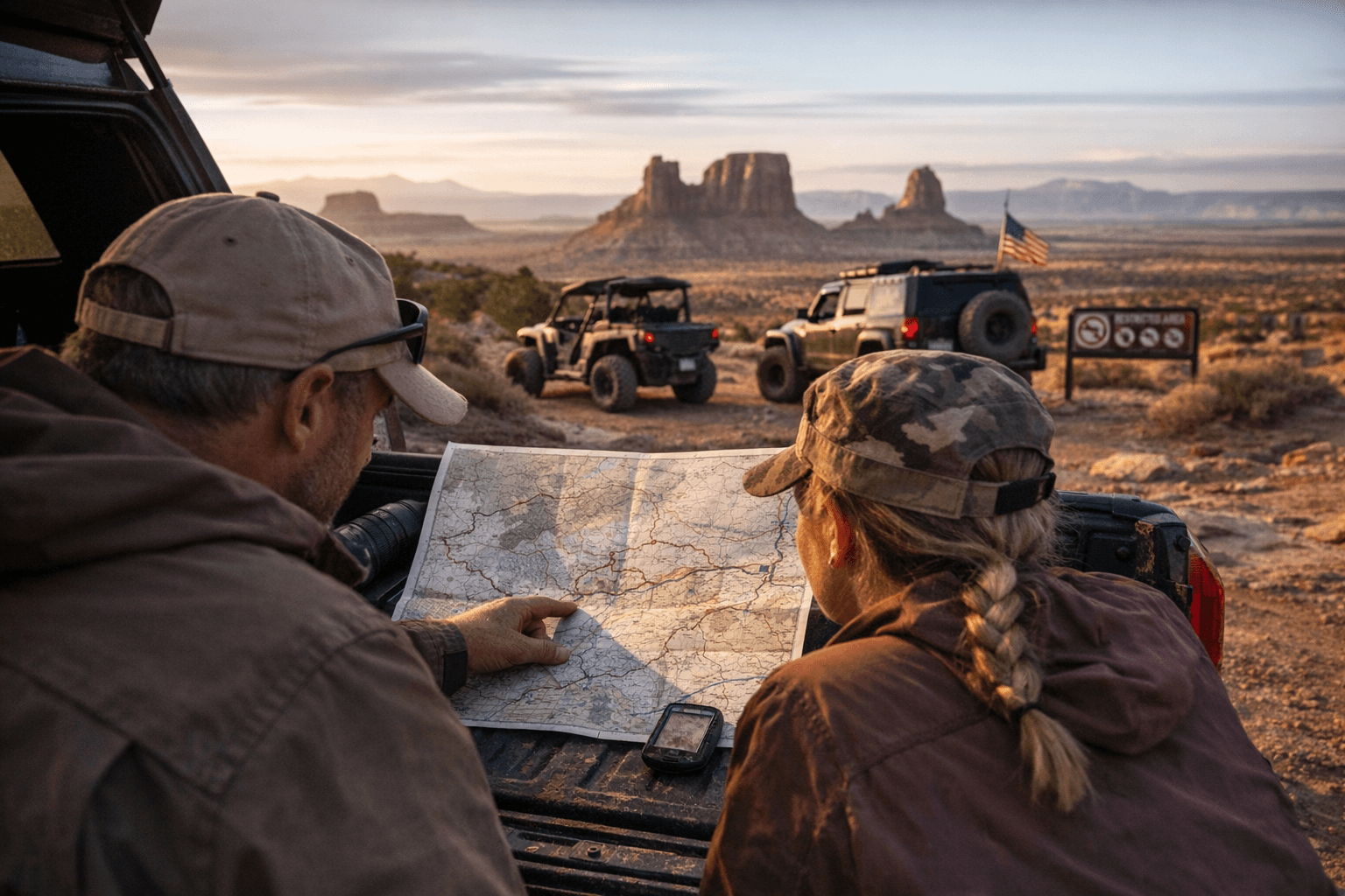
Maps across BLM, USFS and tribal lands in the Four Corners do not speak the same language, and misreading them can strand you, damage cryptobiotic soil, or put you in violation of closures around archaeological sites. Know which map you are looking at before you drive, hike, or camp: that single-page difference can be the difference between a legal run and a costly mistake.
Bureau of Land Management travel maps often show “designated routes only” inside specific management areas and use numbered, color-coded routes; check the legend for motorized versus non-motorized use. BLM manages much of the Paradox Basin, canyon country around Cortez, and large swaths near Moab, so BLM route rules will drive many decisions in those regions. U.S. Forest Service maps typically show forest roads with road numbers and maintenance levels, and mark singletrack trails separately; some routes are gated or seasonal. Navajo Nation and other tribal park maps are separate and frequently carry distinct access rules, including entry fees, permits, or guided-only travel in places such as Monument Valley.
Recognize map symbols. Solid lines usually indicate maintained roads while dashed lines often mean two-track or unimproved routes. Color codes vary by agency but green or blue often mark recreation trails and red or orange commonly signals high-clearance or 4x4-recommended roads. Shaded polygons show Wilderness Study Areas (WSAs), ACECs (Areas of Critical Environmental Concern), or seasonal closures where off-route travel is prohibited. Gate icons mean controlled access; respect gates and private land boundaries.
Match vehicle capability to route class. Highway/paved roads are safe for standard cars. Graded dirt is usually passable by most cars when dry. Two-track or primitive routes are best with high-clearance and four-wheel-drive. Technical 4x4 trails require locking differentials, recovery gear, and experience. Use BLM mileage between junctions to estimate fuel and time, and cross-check agency maps with a topographic map such as USGS or a digital topo.
Practical navigation steps matter. Download offline maps and satellite imagery from Gaia GPS, Avenza, or OnX before you go. Track your route with a GPS log and share your planned route with someone at home; carry a satellite messenger such as Garmin inReach or a PLB. Verify current road status on BLM field office pages for Utah, Colorado, New Mexico and Arizona, National Forest district pages, Navajo Nation Parks pages, and county road-status or sheriff pages.
Respect access rules and the landscape. Confirm tribal permit requirements, check dispersed camping and fire restrictions, and avoid rock art, ruins, and cairns. Pack extra fuel, water, warm layers, traction aids and recovery gear, and plan for winter hazards like ice on slickrock and flash floods during storms. Leave no trace and avoid driving over cryptobiotic soils.
Reading and cross-checking BLM, USFS and tribal travel maps before you go keeps you legal and preserves the places you love. Verify route classification and seasonal status, download map redundancies, and protect cultural sites so the Four Corners stays open for the next trip.
Know something we missed? Have a correction or additional information?
Submit a Tip