New National Maps Put Billion-Dollar Values on San Francisco Downtown Freeways
Bloomberg's new national maps, released in early March 2026, estimate downtown freeway rights-of-way in 142 U.S. cities - including San Francisco - "could be worth billions."

San Francisco planners and elected officials are now weighing fresh economic math for downtown corridors after Bloomberg released a package of national maps and an analysis in early March 2026 that estimates reclaimed freeway right-of-way "could be worth billions." The package focuses attention on the city's central ramps and spans without assigning a single dollar figure in the public excerpts.
The Bloomberg mapping covers 142 U.S. cities and pairs interactive maps with city-level estimates to quantify downtown highway land. As reported by Bloomberg, the project "maps the economic toll that downtown freeways exact on 142 U.S. cities and tallies what that land might be worth if developed." The package, Bloomberg says, combines interactive maps with city-level estimates, "turning decades of carved‑out right‑of‑way into dollars and acres that are easy to compare."
For San Francisco the report arrives against a history of freeway removals that reshaped the waterfront and mid‑city. The Embarcadero and the northern Central Freeway were removed decades ago, and those projects "opened land for housing and parks." Bloomberg's mapping, the reporting notes, "hands local officials a clear economic argument to weigh alongside congestion forecasts and neighborhood impacts" as supervisors and the Planning Department consider long-term options for downtown corridors.
The maps do not settle familiar policy disputes. The reporting cautions that "The new maps do not resolve the political tradeoffs. Traffic modeling, displacement risks, environmental cleanup and financing remain contentious topics." City agencies including SFMTA, Public Works and the Planning Department would still need traffic forecasts, brownfields assessments and detailed financing plans to move from valuation to project proposals.
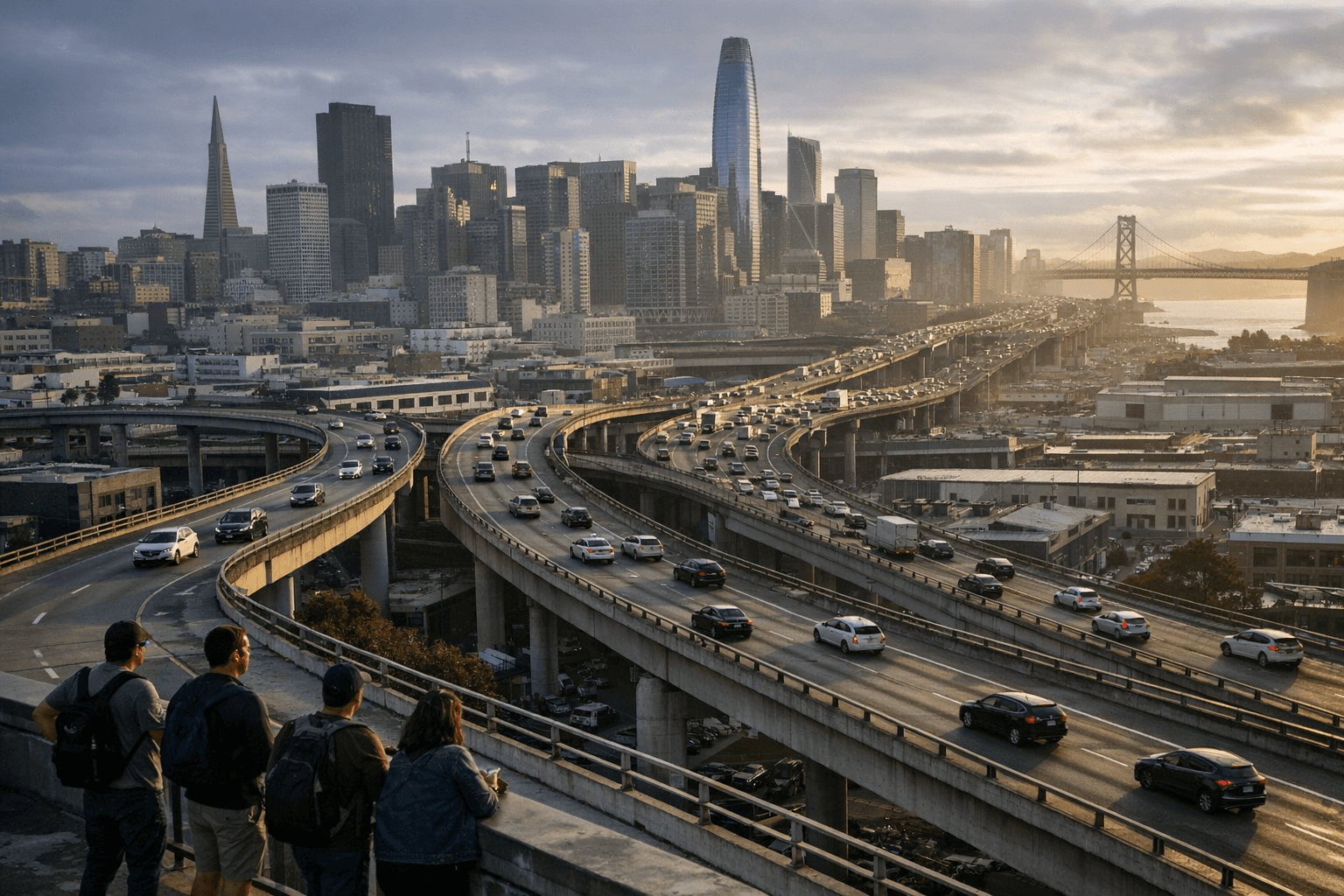
The analysis reframes conversations about urban highways. According to the reporting, "The debate over whether to keep, cap, or reinvent downtown highways is now framed as much in dollars per acre as it is in lanes per hour," a shift that could change how Mayor's Office and Board of Supervisors briefings weigh transportation performance against potential development revenue and park space.
Local republishers moved quickly after Bloomberg's release. Hoodline and a NewsBreak replica ran the story under the headline "New Maps Slap Billion‑Dollar Price Tag on San Francisco Freeways"; the NewsBreak page credited Emily Johnson and its captured snapshot showed the item posted "About 12 hours ago" alongside an AI Assisted Icon. Those republications echo Bloomberg's interactive approach but do not add new valuation figures for San Francisco.
The core takeaway for San Francisco is concrete yet incomplete: Bloomberg's early‑March 2026 maps convert long-standing highway corridors into comparative "dollars and acres," offering a new economic frame for debates about the Embarcadero, the northern Central Freeway footprint, and downtown ramps, even as traffic forecasts, displacement risks, cleanup costs and financing remain unresolved.
Sources:
Know something we missed? Have a correction or additional information?
Submit a Tip