Northern California winter storm watch warns major travel disruptions
A winter storm watch covers much of northern California, threatening heavy mountain snow and potential commute-disrupting conditions across the Sierra Nevada.
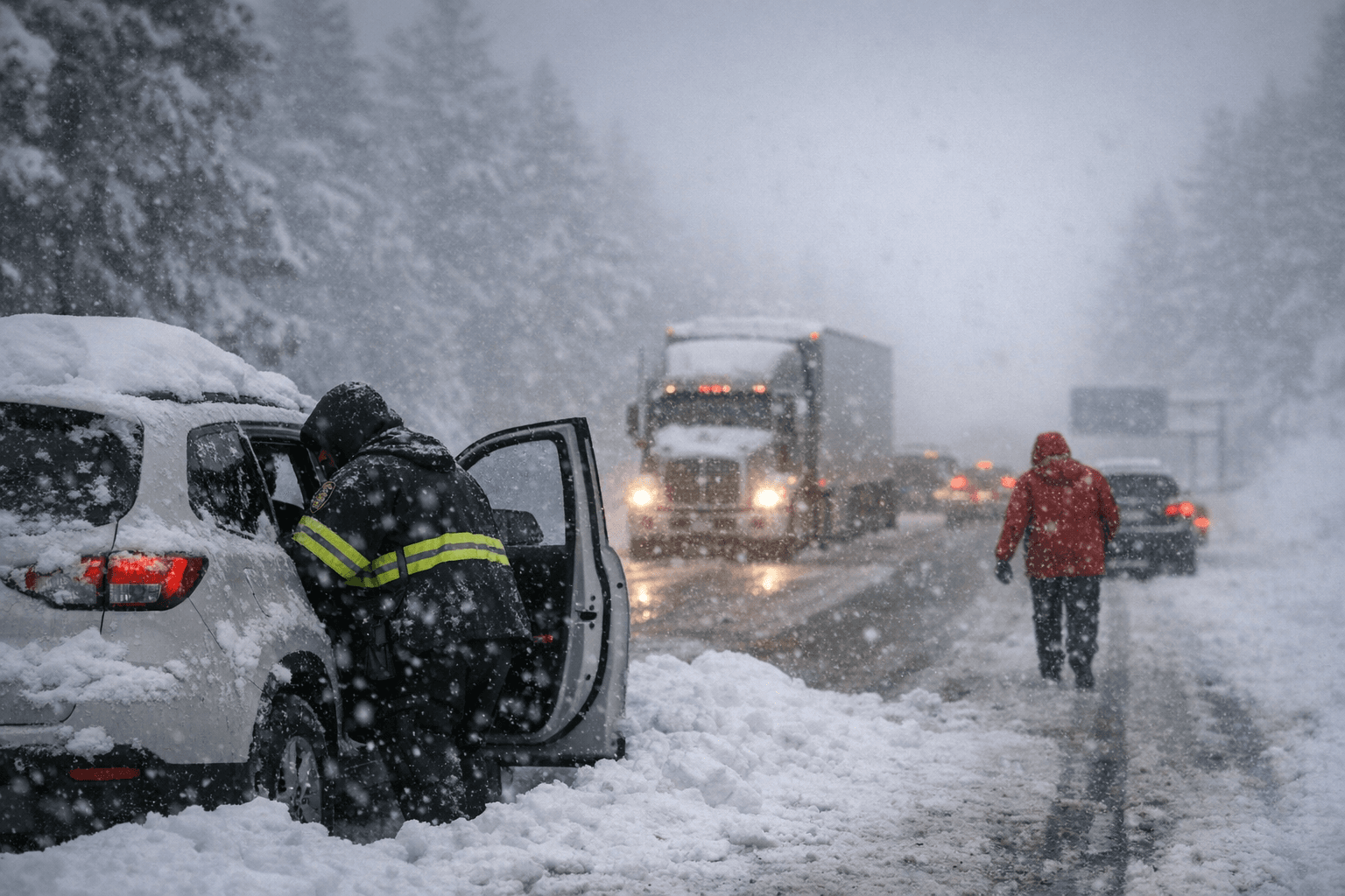
The National Weather Service warned travelers to expect "major travel impacts" as a winter storm watch covers much of Northern California during the Presidents Day travel period. The agency urged "extreme caution" and said the incoming system could drop heavy snow across the Sierra Nevada, disrupt access to popular ski areas, and spread hazardous conditions into western Nevada and southern Oregon.
National Weather Service meteorologist Dakari Anderson of the Sacramento office said Saturday through Sunday morning is the "best travel window" ahead of the incoming cold weather system. Anderson said conditions were relatively quiet Saturday but that "things are expected to pick up Sunday afternoon" as the storm intensifies and snow levels fall.
The forecast centers snowfall estimates on elevation. Communities between 3,000 and 4,000 feet, roughly 914 to 1,219 meters, are expected to receive between 1 and 2 feet, or about 30 to 60 centimeters. Higher elevations could see substantially more; some locations may record 6 to 8 feet, about 1.8 to 2.4 meters. Anderson cautioned that "Our highest (snow) accumulations are going to be in those kind of more hard-to-reach places, but we're still going to see some of those heavier amounts in communities that are populated."
Blue Canyon, a sparsely populated unincorporated community at about 4,695 feet, or 1,431 meters, roughly 51 miles west of Lake Tahoe, was cited as an example of a high-elevation spot that could see 6 to 8 feet. Forecast guidance from the agency projects snow levels near 5,000 feet on Sunday into Sunday evening, lowering to 4,500 feet Sunday night, down to 4,000 feet on Monday, and possibly dropping as low as 2,000 feet by Tuesday morning. That progression raises the possibility that valley and foothill communities could see wintry precipitation later in the event.
The NWS also warned that "Travel may be very difficult to impossible. The hazardous conditions could impact the Monday morning and evening commutes." As a precaution, the agency advised motorists: "If you must travel, keep an extra flashlight, food, and water in your vehicle in case of an emergency." Local officials amplified the warning. The City of South Lake Tahoe posted on Facebook that drivers on Monday should "expect delays, possible road closures, and whiteout conditions."
The potential policy implications are immediate. Holiday travel patterns concentrate traffic on a handful of mountain corridors and resort access roads, increasing the likelihood of multi-vehicle incidents, prolonged closures, and strains on local emergency responders. Transportation authorities will face decisions about chain controls, temporary closures, and resource allocation for snow removal, while local governments must balance public-safety orders with economic impacts on resort operations and communities reliant on weekend tourism.
For residents and travelers, the most consequential choices will be whether to postpone nonessential trips and how to prepare if travel is unavoidable. With a narrow "best travel window" identified by the forecast office, officials said planning around that period could reduce exposure to the worst conditions. As the event unfolds, road conditions and official travel advisories will determine the degree to which the storm affects commutes and recreation access across the Sierra Nevada.
This article was produced by Prism’s automated news system from verified source data, official records, and press releases, then run through automated quality and moderation checks before publishing. The system is built and supervised by the people who set the standards it runs under. Read our full AI policy.
Did this article answer your question?


