Oklahoma State EOC Activates as 58 mph Guymon, 54 mph Hooker Gusts
Oklahoma's emergency operations center activated as forestry crews staged in Guymon and gusts of 58 mph in Guymon and 54 mph in Hooker raised wildfire danger.
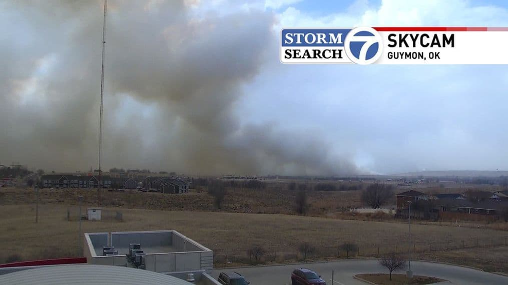
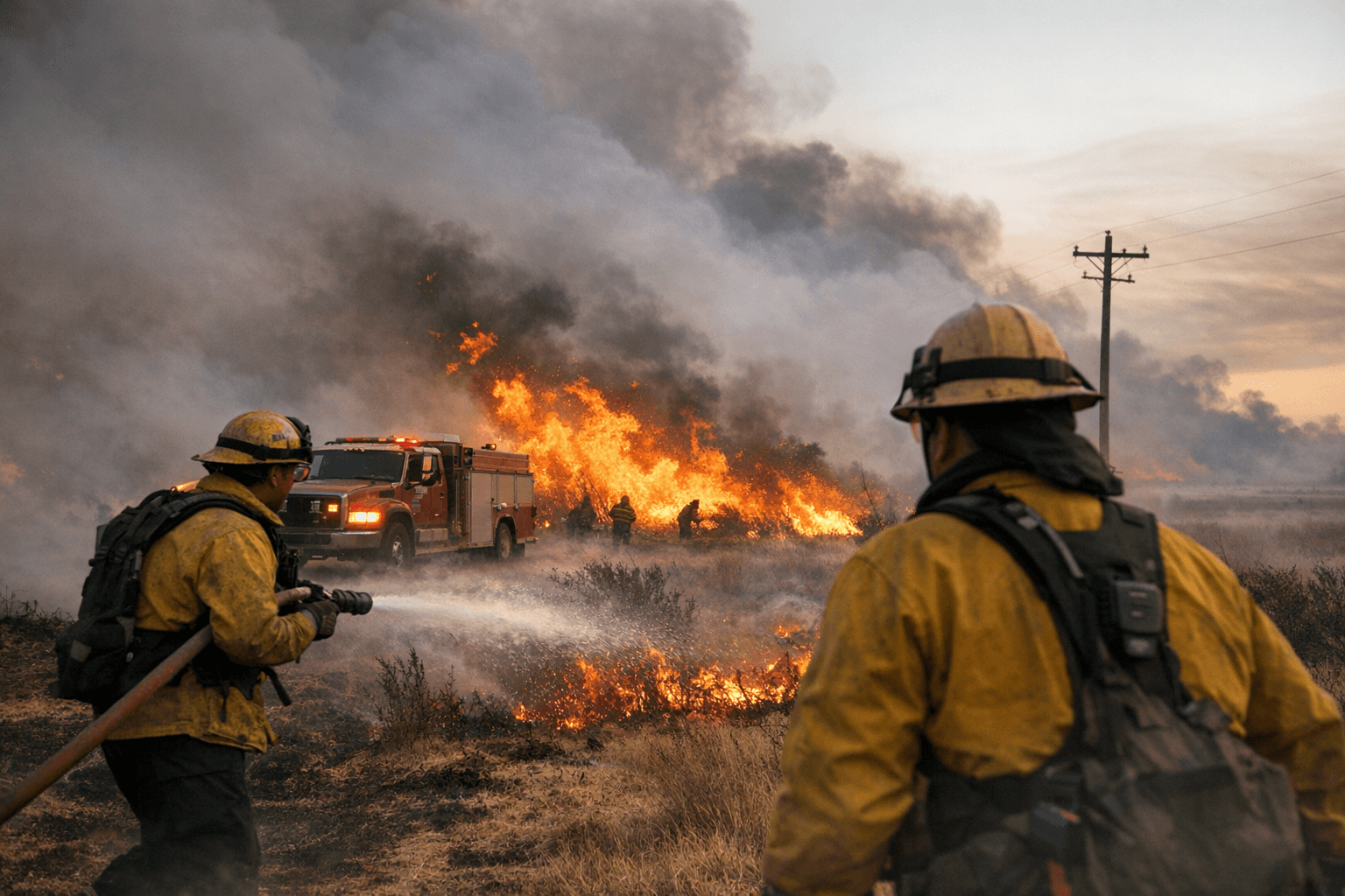
The Oklahoma State EOC activated for critical fire weather statewide as forestry fire suppression teams staged in Guymon amid a Red Flag Warning until 8 p.m., and gusts hit 58 mph in Guymon and 54 mph in Hooker, heightening wildfire risks. Local pre-positioning in Guymon remained in place through the Red Flag window as officials monitored rapid-fire potential.
KVII / ABC7 Amarillo warned that Red Flag Warnings, High Wind Warnings, and Wind Advisories are now in effect as critical to extremely critical fire weather conditions are expected across the Texas and Oklahoma Panhandles and eastern New Mexico. KVII said Red Flag Warnings are in effect Tuesday from about 10 a.m. to 8 p.m. CST across most of the Texas and Oklahoma Panhandles, where conditions are expected to meet Red Flag criteria of strong winds, low humidity and dry fuels. KVII added that High Wind Warnings are also in place from approximately 9 a.m. until 7 p.m. Tuesday for the Texas and Oklahoma Panhandles and that wind advisories cover the far southeastern Panhandle, including Cottle, Childress, Collingsworth, Hall, Donley, and Wheeler counties.
KOCO graphics and on-air briefings showed evolving day-to-day risk maps. KOCO's Feb. 17 fire danger graphic rated much of western Oklahoma and the Panhandle as the highest categories — with a 4 in far western Oklahoma along the Texas border to Woodward and the Panhandle — while the Feb. 18 graphic placed the Panhandle at a 3 out of 5 and western and central Oklahoma at a 2. KOCO Meteorologist Jonathan Conder said "the red flag warning is in effect from 10 a.m. to 8 p.m. Tuesday," and KOCO warned that "the fire danger will linger into Thursday as the dry, warm and windy conditions continue."
KVII spelled out the meteorological threat and operational constraints: "Very strong winds, dry air and warm temperatures combine to create a dangerous, quick-spreading wildfire environment." KVII noted that "the wind threat could also complicate firefighting. Very strong winds may limit aerial operations if sustained wind speeds exceed safe thresholds for aircraft, and ground resources could be challenged by the potential for rapid fire growth. High winds may also down power lines or damage infrastructure, which can ignite new fires."
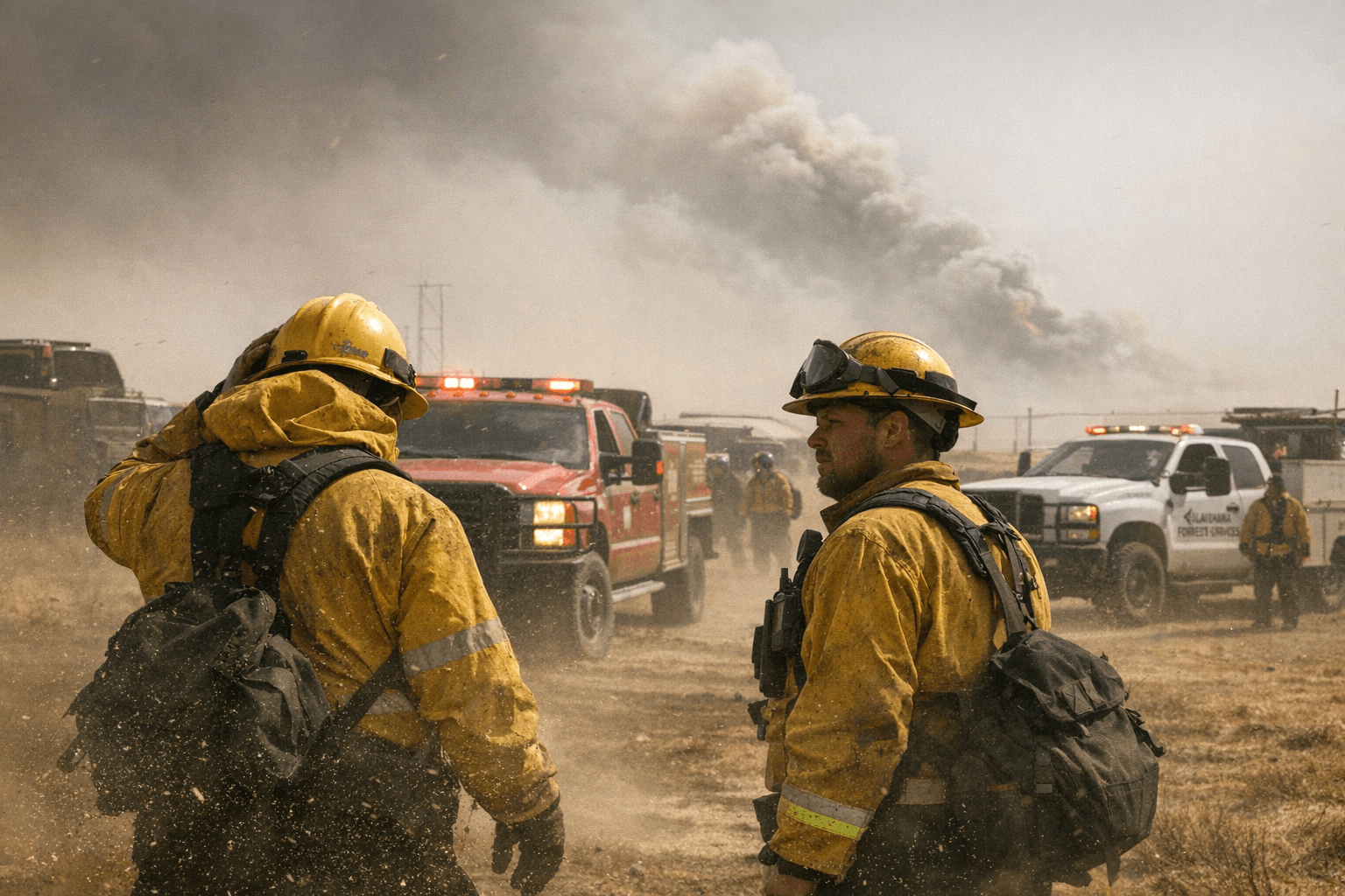
Public safety guidance from KVII urged residents to take specific precautions: "It's highly advised to avoid outdoor burning or open flames, postpone activities that can cause sparks, such as welding or brush cutting, and secure loose metal and trailer chains that could strike pavement and spark. People are also advised not to park vehicles on dry grass, to stay aware of any new fire starts and report them immediately, and to have an evacuation plan ready if a fire develops nearby."
KOCO cautioned that "while the red flag warning was only issued in western Oklahoma, a fire can pop up in any part of the state because of the winds," and its materials include an unexplained fragment reading "Cedar trees [...] Cedar trees." Officials and agencies continue to watch gust reports and warning polygons as conditions evolve.
Know something we missed? Have a correction or additional information?
Submit a Tip