Perry County contains nearly 60,000 acres of Hoosier Forest, riverfronts, amphitheatre
Perry County holds nearly 60,000 acres of the Hoosier National Forest, extensive Ohio River access and cultural assets that shape outdoor recreation and local economic opportunity.
Of the Hoosier National Forest’s 202,000 acres, nearly 60,000 acres lie in Perry County, a concentration of public land that anchors the county’s outdoor economy and planning priorities. The county’s planning documents also record that “More than one-fourth of the county’s total land area is a publicly owned recreational area,” a fact with direct implications for land use, tax policy and tourism development.
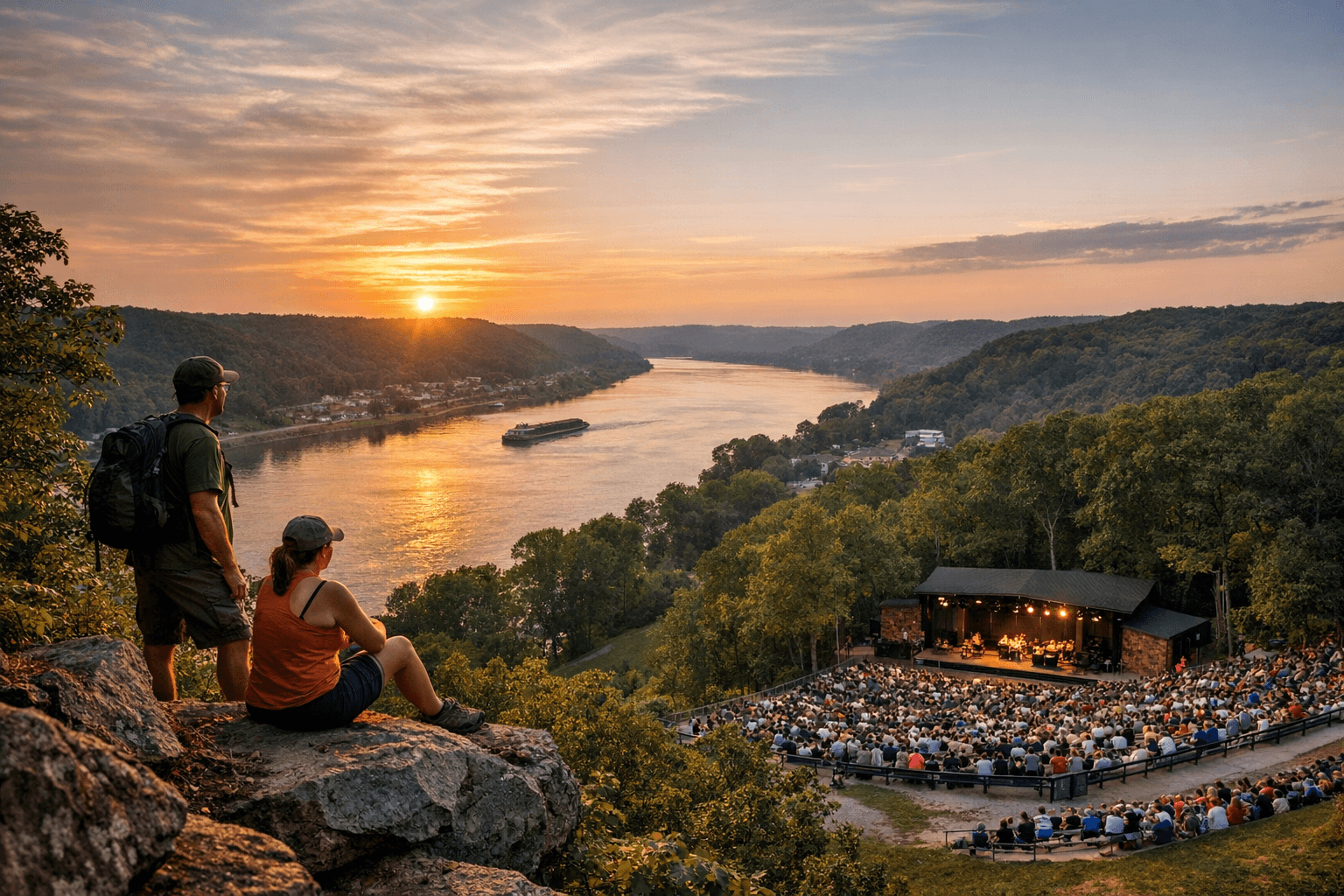
The forest portion in Perry County includes five man-made lakes and numerous publicly accessible tracts that support hiking, bike riding and camping. The Comprehensive Plan states, “The majority of these areas are open to the public for hiking and bike riding. There are also several areas available for camping. The Hoosier National Forest’s five man-made lakes provide for various recreational activities.” Local access points include Hoosier National Forest access near Tell City, while county materials also note “numerous public access sites to the Ohio River for boating and fishing” and “a public fishing site on the Anderson River near Troy.”
The Perry County Convention & Visitors Bureau lists key outdoor activities in its materials, “including boating, fishing, hunting, hiking, camping, mountain biking,” language that underscores the mix of river- and forest-based recreation promoted to visitors. Cultural amenities are noted alongside natural resources: the original county briefing highlights an expanded Lincoln Amphitheatre and local festivals that support small businesses and tourism, though the materials supplied do not include dates, capacities or programming details for the amphitheatre or festival names and schedules.
Historic context in county records frames today’s assets. Perry County was “named after Oliver Hazard Perry (a naval hero from the war of 1812)” and “was organized in 1814 from sections of Warrick and Gibson Counties.” Early settlements at Troy, Rome, Derby and Cannelton clustered along the Ohio River; county documents record that by 1793 “several families were living near the mouth of the Anderson River.” The county’s traditional economy—industry, lumbering and farming—remains part of the backdrop while “the county’s rugged terrain, once seen as a hindrance to development, is now seen as an asset for its recreational benefits.”
For local officials and residents, the concentration of public recreational land invites policy choices on infrastructure, maintenance funding and economic development strategies. County planners must balance forest and river access with road maintenance, parking and public-safety provisions; tourism promotion by the Convention & Visitors Bureau should be matched by clear inventories of facilities. The Perry County Comprehensive Plan and the Perry County Historic Sites and Structures Inventory prepared by the Indiana Landmarks Foundation are the primary documents cited in the materials reviewed; maps include NAIP 2014 aerial imagery.
Next steps for civic oversight and practical planning include confirming the five lake names and access rules, identifying specific Ohio River boat ramps and Anderson River fishing-site details, and obtaining the Lincoln Amphitheatre expansion timeline and festival schedules. Those details will determine how recreation translates into jobs, small-business revenue and infrastructure needs across Perry County.
Know something we missed? Have a correction or additional information?
Submit a Tip