Practical Guide to Hiking and Planning in Dolores County
This guide explains how to use Komoot’s curated collection of local hikes to plan safe, efficient outings from Dove Creek, Rico and other gateways in Dolores County. You’ll learn what each route listing includes, how to navigate with GPX/KML exports, the guide’s limits for real‑time safety, and the local economic and policy context residents should consider.
1. What the Komoot Dolores County guide is and why it matters
Komoot’s curated page collects roughly a dozen–two dozen local routes; the collection groups 17 routes specifically for Dolores County. The selection spans easy walks, day hikes and multi‑hour outings that showcase the county’s sage‑covered plateau, nearby canyons and forested high country, making it a compact, practical resource for residents and visitors alike.
2. Route-level details you’ll find on each listing
Each route entry typically lists length, an estimated time and a difficulty level as provided by Komoot users and editors, and often includes typical elevation gain. These structured fields let you compare options quickly, choose shorter, lower‑gain routes for half‑day outings or the longer options when you have more time.
3. User photos and short trip notes as condition indicators
User-contributed photos and short trip notes show recent conditions such as trailhead parking, muddy sections, or snow on high routes; these on-the-ground updates are valuable condition indicators. Because multiple users contribute, you can often see a pattern, if several recent notes mention a washed-out parking area or late‑season snow, treat that as a meaningful signal for planning.
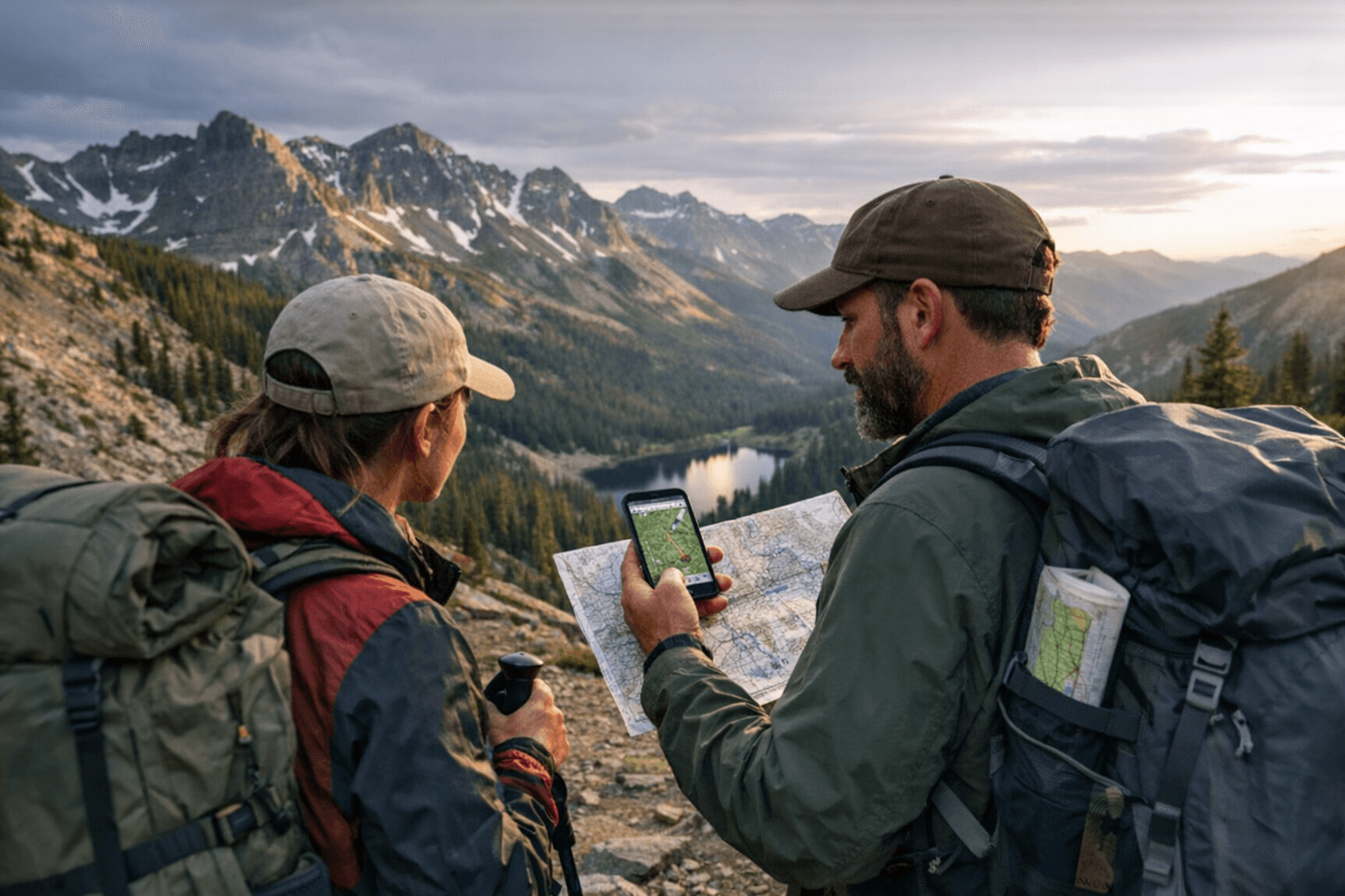
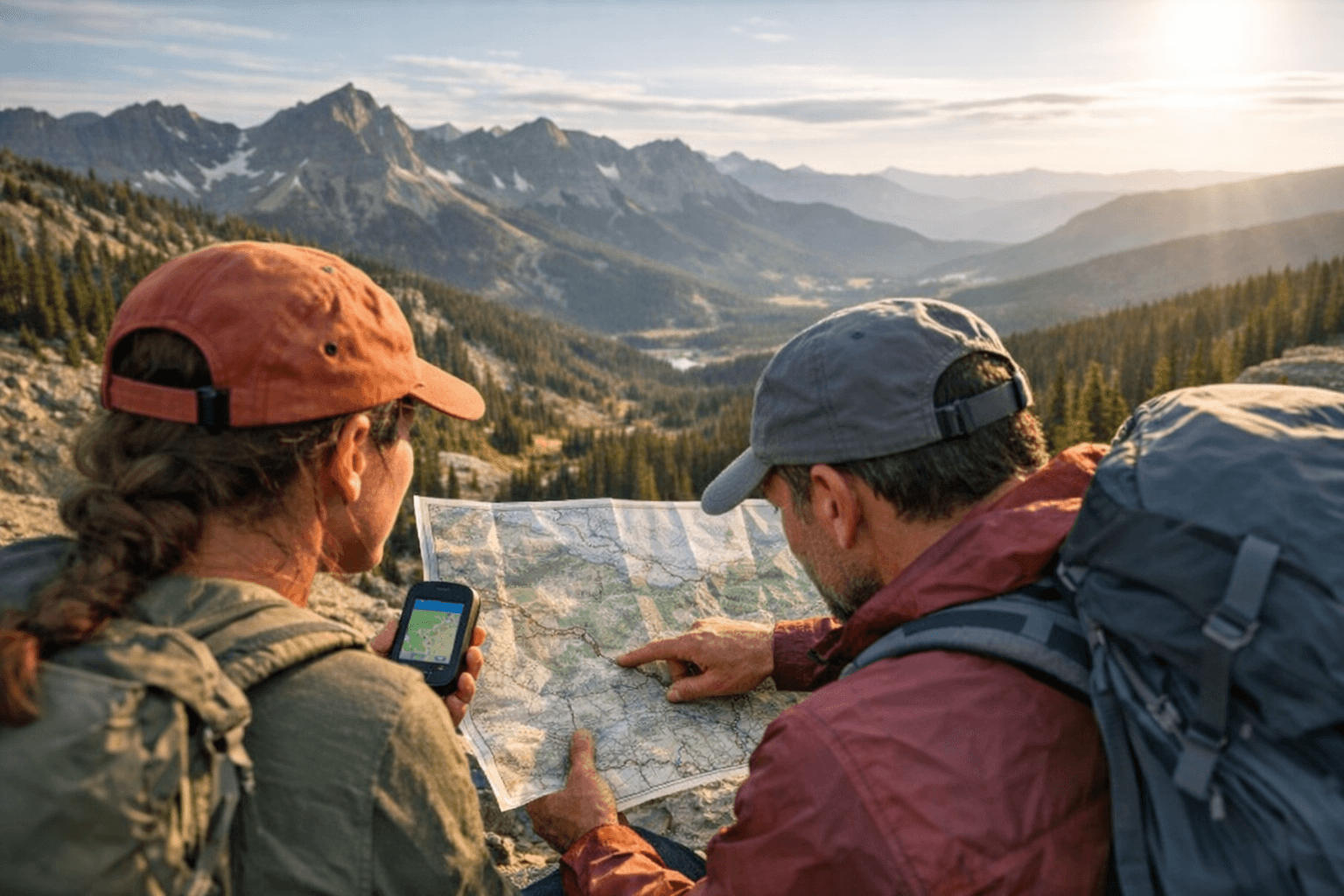
4. Navigation and data exports: GPX and KML
Komoot provides GPX/KML export and in-app navigation so you can load routes onto phones or dedicated GPS units before you go. Exporting a GPX file gives you offline navigation capability, important in Dolores County’s more remote stretches where cell service is intermittent.
5. How the guide supports day‑trip planning from local gateways
Residents commonly use the guide to plan day trips from hubs such as Dove Creek and Rico, using route length and time estimates to fit hikes around work schedules and weather windows. The compact list helps you build half‑day and full‑day options without scouring multiple sites, making it practical for weekend planning and last‑minute outings.
6. Surface and access notes that affect logistics
Beyond distance, the guide’s user notes often reference surface conditions, rocky singletrack, two‑track approaches, or muddy parking that can determine vehicle choice. Knowing surface and parking conditions in advance can prevent getting stuck or needing a high‑clearance vehicle when trailheads are remote.
7. Use versus limitations: planning tool, not an official advisory
Komoot’s guide is evergreen and periodically updated by users, but it is intended as a planning tool rather than a real‑time trail closure or safety advisory. For up-to-the-minute closures, fire restrictions or regulatory changes, you must consult the managing agency before heading out.
8. Which land managers to check before hiking
Routes in Dolores County commonly cross or abut lands managed by the U.S. Forest Service (USFS), Bureau of Land Management (BLM) and Colorado Parks & Wildlife (CPW). Contact or check the websites of the relevant agency for current restrictions, prescribed burns, trail closures or permit requirements that Komoot will not reflect in real time.
9. Step 1, Select a route that matches time and ability
Start by matching route length, estimated time and elevation gain to your fitness and daylight window; Komoot’s difficulty labels provide a quick first filter. When in doubt, pick a shorter loop or an out‑and‑back with clear turnbacks so you can adjust if conditions slow your pace.
10. Step 2, Download navigation and offline maps
After selecting a route, export the GPX/KML file to your phone or GPS and preload offline maps if you expect limited cell service. Verify your device’s battery is charged and carry a power bank, navigation failures are a common cause of avoidable rescues in remote areas.
11. Step 3, Verify current conditions with agencies and weather
Before departure, check the appropriate land manager status pages and the local forecast for temperature swings and precipitation that affect trail surface and snowpack. Also check recent Komoot trip notes for parking or access issues reported within days of your planned outing.
12. Step 4, On‑trail practices and reporting back
On the trail, follow Leave No Trace principles and local regulations; if you encounter hazards or new trail conditions, upload photos and notes to Komoot to help the next visitor. Your updates improve the guide’s value and provide the “recent condition” signals that other residents rely on.
13. Local economic and community implications
Dolores County’s news cycles often center on seasonal recreation and tourism, and practical route guides like Komoot’s help convert web searches into day‑trip spending at local stores, guides and lodging. For a small, rural county, accurate trail information can increase repeat visitation and lengthen the season for businesses that serve outdoor users, while also concentrating pressure on limited trail maintenance budgets.
14. Policy and long‑term trends residents should watch
Expect ongoing demand for digital route data and near‑real‑time condition reporting, which increases pressure on agencies to coordinate closures and provide easily accessible notices. Over the long term, balancing increased visitation with funding for trail upkeep, invasive‑species control, and wildfire mitigation will be key policy priorities for the county and managing agencies.
15. Practical takeaways for Dolores County residents
Use Komoot’s 17-route collection as a starting point for planning, export GPX files for offline navigation, and always verify current closures or fire restrictions with USFS, BLM or CPW. By combining crowd‑sourced updates with official agency checks, you’ll maximize safety, support local recreation-driven economic activity and contribute to a shared information ecosystem that benefits the whole community.
Sources:
Know something we missed? Have a correction or additional information?
Submit a Tip