Ranger Road megafire surges across Oklahoma panhandle into southern Kansas
A fast-moving blaze ignited in Beaver County has scorched up to hundreds of thousands of acres, destroyed homes near Tyrone and forced thousands to flee in Kansas.
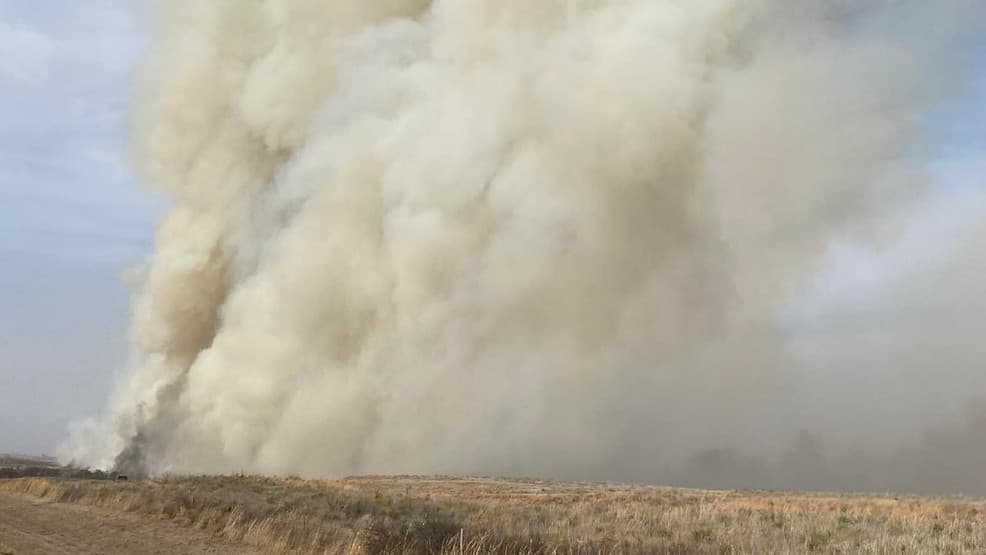
A wildfire that ignited in Beaver County, Oklahoma, exploded northeast across the panhandle into southern Kansas, flattening homes near Tyrone and forcing mandatory evacuations in Englewood and Ashland, Kansas, officials and media outlets reported. Satellite analyses and state feeds give widely varying totals for the burn area, from early estimates of 145,000 acres to later satellite-derived figures of roughly 283,000 acres.
The Ranger Road Fire began on Feb. 17 and, according to Satlib/Colorado State reporting, “Within just a couple of hours, the Ranger Road Fire grew to 15,000 acres.” CNN described the blaze as now a megafire and wrote that “it exploded in size,” saying it “has burned at least 145,000 acres in Oklahoma and Kansas since starting early Tuesday afternoon. That’s about the size of Chicago.” CNN also reported that during the period of most extreme growth the fire “on average consumed an area equal to three to four football fields every second.”
Those dramatic growth rates came amid extreme fire-weather conditions. Fox Weather warned that “with wind gusts up to 50 mph and relative humidity below 15%, these uncontained fires - and any new ignitions - could spread rapidly.” Satellite and incident reports cited gusts even higher in some places. IQAir and Satlib relayed fire-official accounts that gusts exceeded 65 mph in parts of the burn area, a level that has limited aerial firefighting and complicated suppression efforts.
Human impacts were immediate. CNN cited KAKE reporting that the blaze “forced the evacuations of thousands of people in Englewood and Ashland, Kansas,” and a photo caption included in CNN coverage stated that “a fire near the Oklahoma town of Tyrone destroyed multiple homes on Tuesday, February 17.” BBC reported that law enforcement closed roads as officials began evacuations in southwest Kansas and northwest Oklahoma. IQAir said the fire crossed the Oklahoma-Kansas border and affected communities along Highways 64, 270 and 283 and burned near the Cimarron River, with impacts in Clark and Meade counties in Kansas.
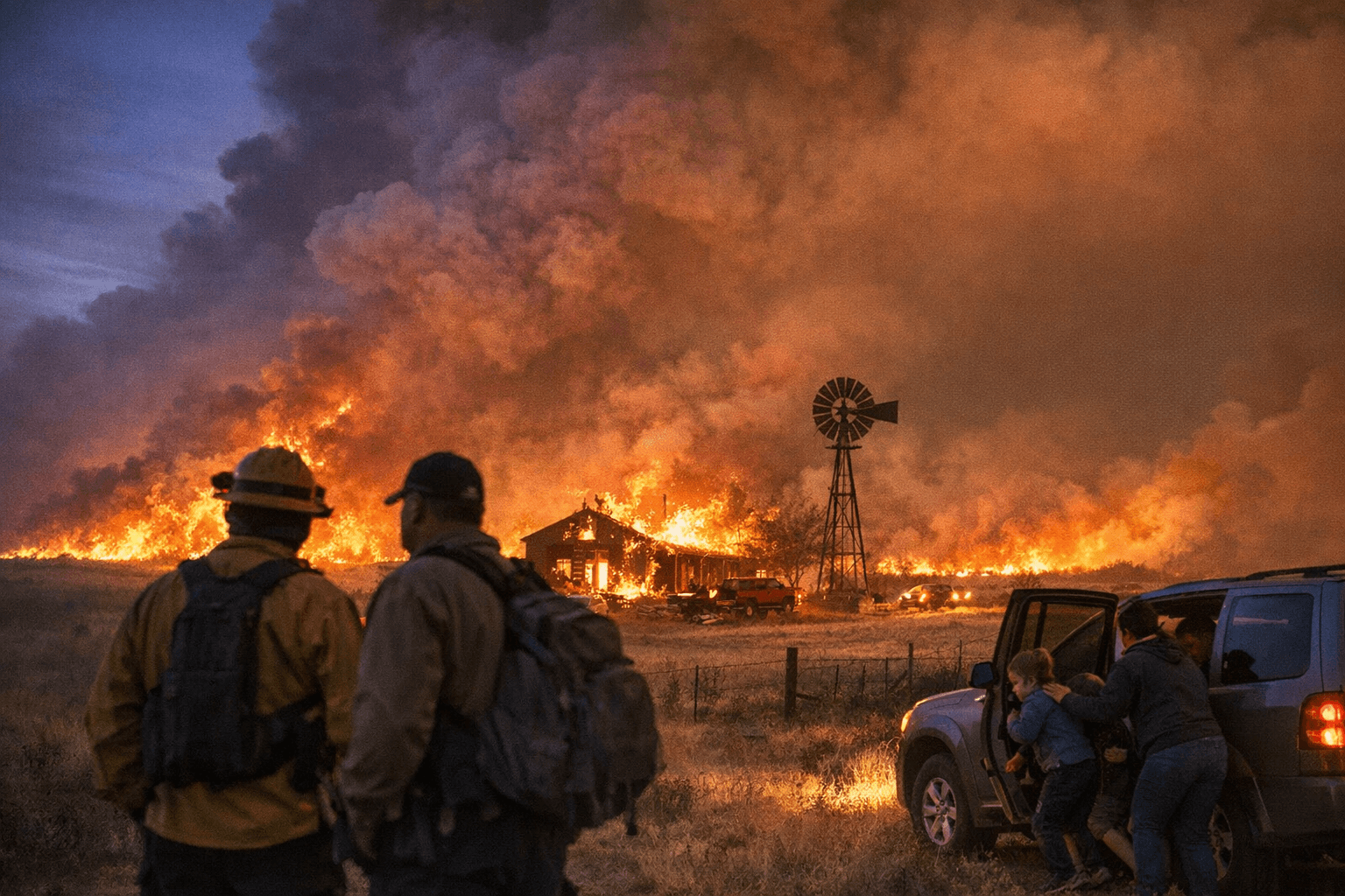
State and federal authorities moved to respond amid the confusion over size and containment. Fox Weather reported that Oklahoma Governor Kevin Stitt declared a state of emergency for Beaver, Texas and Woodward counties. Agencies cited different containment figures tied to specific timestamps: CNN quoted the Oklahoma Forestry Service as saying the fire was 0% contained “as of Wednesday morning,” Satlib reported the blaze was 15% contained and had burned 283,283 acres “as of February 18,” and IQAir listed containment at 20% as of Feb. 20.
National Weather Service offices issued fire weather watches for the region, warning that critical conditions could persist for 12 to 72 hours and that nearly 12 million people across parts of the Southern Plains were under elevated fire-weather risk, according to Fox Weather maps. Multiple concurrent fires in the plains - including the Stevens/Side Road and County Road 169 fires and several Texas Panhandle blazes - stretched firefighting resources and complicated a coordinated aerial response.
The scale and rapid spread of the Ranger Road Fire mean damage assessments and official acreage totals remain fluid. Satellite imagery time-stamped by Satlib and CIRA captured the plume and burn scar progression on the evening of Feb. 17; incident command and the Oklahoma Forestry Service remain the primary sources for updated acreage, containment and structure-loss figures as crews work to secure lines and relocate threatened communities.
This article was produced by Prism’s automated news system from verified source data, official records, and press releases, then run through automated quality and moderation checks before publishing. The system is built and supervised by the people who set the standards it runs under. Read our full AI policy.
Did this article answer your question?