Safety and Access Guide for San Juan National Forest Near Dolores County
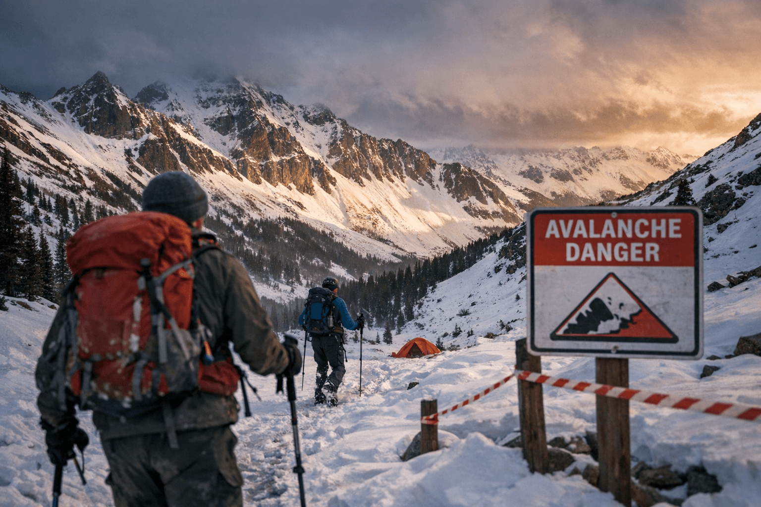
Kilpacker, the upper Dolores watershed and Wolf Creek corridor face winter storms, high-elevation snow and avalanche risk; San Juan and BLM lands have different camping limits and firearm rules.
Kilpacker, the upper Dolores watershed and the Wolf Creek corridor are within the San Juan National Forest footprint near Dolores County and the original guide highlights seasonal hazards including winter storms, high-elevation snow and avalanche risk. Visitors planning trips on these trailheads should be aware the management rules vary sharply by jurisdiction and by unit.
Camping rules differ depending on land manager. On the San Juan National Forest it is prohibited to camp for more than 28 days within a continuous 60-day period; after 14 days, you must move your camp or equipment three air-miles from the previous site. On BLM Tres Rios Field Office lands, you must move your camp 30 miles away after 14 days and not return for 30 days, and on the BLM Tres Rios Field Office lands, a campsite may not be left unattended for longer than 48 hours. These side-by-side restrictions affect stays at Kilpacker and dispersed sites in the upper Dolores watershed and Wolf Creek corridor.
If weather forces an evacuation from camp, follow agency guidance: “If you must leave your camp for safety reasons, such as a heavy snowstorm – please notify the local FS/BLM office.” The San Juan materials also state, “You are responsible for removal of equipment and trash.” Firewood gathering does not require a permit in the source wording: “A firewood permit is not necessary to gather wood for your campfire on the Forest or BLM.”
Firearm and target-shooting rules are specific and must be observed on San Juan and BLM lands. The posted rules state firearms “May not be discharged in or within 150 yards of a residence, building, campsite, developed recreation site or occupied area or across or on a road or body of water,” and “No shooting from or across a public roadway (or trail.).” The guidance repeats other requirements: “Must always be carried in plain sight-even in your vehicle-with a conceal/carry permit,” “Pickup all shells and items used for target practice,” “Do not discharge a firearm into a cave,” and “Do not use trees or other vegetation as targets.”
Hunting and mechanical-access rules intersect in wilderness areas popular with Dolores County hunters. “Hunting is legal within the Weminuche, Lizard Head, and South San Juan Wildernesses, as well as BLM Wilderness Study Areas; however, these areas are closed to motorized vehicles and equipment, including chainsaws, ATVs, UTVs and mechanized vehicles, bicycles and deer carts.” Hunters are reminded: “You must be prepared to remove your game on foot or horseback,” and “You must have permission to hunt on tribal lands. Crossing permits are required to cross over tribal lands to access National Forest System lands.” Southern Ute Tribe headquarters in Ignacio can be reached at (970) 563-0100 for tribal permissions.
Federal policy excerpts frame narrow exceptions to the baseline ban on mechanized transport in wilderness. The U.S. Forest Service fragments begin with “MECHANICAL TRANSPORT IN WILDERNESS” and say to “Accomplish management activities with nonmotorized equipment and nonmechanical transport of supplies and personnel.” Exceptions are enumerated in the fragments: approved use only for emergencies including “fire suppression, health and safety, law enforcement involving serious crime or fugitive pursuit, removal of deceased persons, and aircraft accident investigations,” for aircraft or motor boat uses established before wilderness designation, for “exploration and development of valid existing mineral rights (FSM 2323.7),” for “Access to surrounded State and private lands and valid occupancies (FSM 2326.13),” and to meet minimum needs for protection and administration with the minimum tool necessary.
Maps and local contacts for planning are available through San Juan Public Lands. The materials list “Rocky Mountain Huntin’ Maps $13.95” and map “Units 74, 75, 751, 77, 78.” “A limited supply of Apogee ($9.95) & USGS ($8.00) topo Quad maps are sold at the San Juan Public Lands Offices (970)-247-4874.” For route and access questions remember the local recreation guidance: “Bring proper safety equipment, including helmets, both mountain biking, and gravel biking can be dangerous even for experts,” and “For safety, enter fully prepared beforehand because getting anything else while on the trail is rather difficult.” Accessibility varies: “Because this is a vast tract of land, accessibility will depend what area you are going to,” with “Some areas are accessible like Andrews Lake” and “Some areas there are no accessible developments”; “Talking to locals or internet research is highly encouraged.”
Before you go, “Check trailhead postings for additional restrictions.” For maps and office assistance call the San Juan Public Lands Offices at (970)-247-4874 and for tribal crossing permissions contact Southern Ute Tribe headquarters at (970) 563-0100.
Know something we missed? Have a correction or additional information?
Submit a Tip