Spring heat fuels tornadoes, flooding threats across much of U.S.
A level 4 tornado risk and flash-flood threat stretched from Oklahoma to the Midwest as spring heat pushed temperatures near 90 degrees.
The most dangerous storm zone Friday stretched from the Central/Southern Plains into the Middle Mississippi Valley, where the NOAA Storm Prediction Center posted a Moderate Risk of severe thunderstorms and warned of damaging winds, hail and a few tornadoes. At the same time, the Weather Prediction Center flagged a Slight Risk of excessive rainfall from Oklahoma through portions of the Midwest, as more than 51 million people from Texas to Wisconsin were under severe-weather threat Friday evening.
Forecasters said the setup was primed to worsen as a strong cold front pushed eastward toward the Eastern Seaboard by Sunday. The rainfall outlook was tied to a moist and unstable air mass fed by a robust low-level jet streaming north off the western Gulf, a combination that can quickly turn afternoon heat into late-day thunderstorms and flash flooding. In areas where ground is already saturated, the Weather Prediction Center said rainfall could exceed flash-flood guidance within 40 kilometers of a point, raising the odds of sudden flooding on roads and in low-lying neighborhoods.
The danger was amplified by the kind of spring whiplash that has already gripped much of the country. Some states were seeing temperatures as high as 90 degrees even as April storms were building, adding fuel to instability and helping storms form with little warning. Residents in the risk corridor were urged to have multiple ways to receive warnings, know where to shelter, and avoid driving through water-covered roads when storms begin to move through.

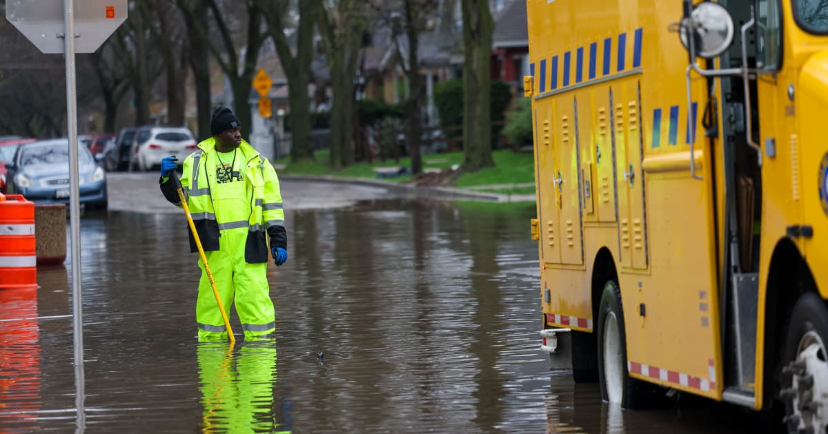
The threat came after a multiday outbreak earlier in the week that exposed how punishing the pattern has become. More than 125 million people faced some severe-weather risk earlier in the week, and a separate outbreak on April 13 and 14 produced 39 confirmed tornadoes, including an EF3, along with 785 hail reports and two reports of 6-inch hail. Flooding also hit communities in Wisconsin, Michigan and Ohio, forcing some places to deal with repeated rounds of storms and cleanup.
That sequence, from tornadoes to hail to flooding, has made the setup more dangerous than a single storm line. A front colliding with spring warmth and Gulf moisture can produce a fast-changing mix of hazards across a wide swath of the country, with the highest risk shifting east through the weekend as the system reaches the Eastern Seaboard.
This article was produced by Prism’s automated news system from verified source data, official records, and press releases, then run through automated quality and moderation checks before publishing. The system is built and supervised by the people who set the standards it runs under. Read our full AI policy.
Did this article answer your question?