UK Temperatures Set to Reach 26C This Wednesday
A brief but record-nudging warm spell is pushing UK temperatures to 26°C today, the warmest early April in six years, before a 10-degree plunge hits Thursday.

Wednesday has delivered an extraordinary early spring warmth to much of the UK, with temperatures reaching as high as 26°C (79°F) across central and southeast England, making it the hottest start to April the country has seen since 2020.
The surge follows Tuesday's peak of 24.8°C recorded at Mona on Anglesey in Wales, which the Met Office confirmed as the warmest April 7 on record and the highest temperature of 2026 so far. Wednesday's lighter winds across central and southeast England are pushing the mercury even further, well above the seasonal average of 12°C to 15°C that typically characterises early April.
Met Office meteorologist Greg Dewhurst described the conditions as "unusually warm" for the time of year, attributing the heat to a sustained southerly airflow. "The wind is coming in from a southerly direction, and with not many clouds around, it should be well above the early April average," he said. "The last time we saw similar temperatures this time of year was in 2020, when we reached 26°C in Cornwall."
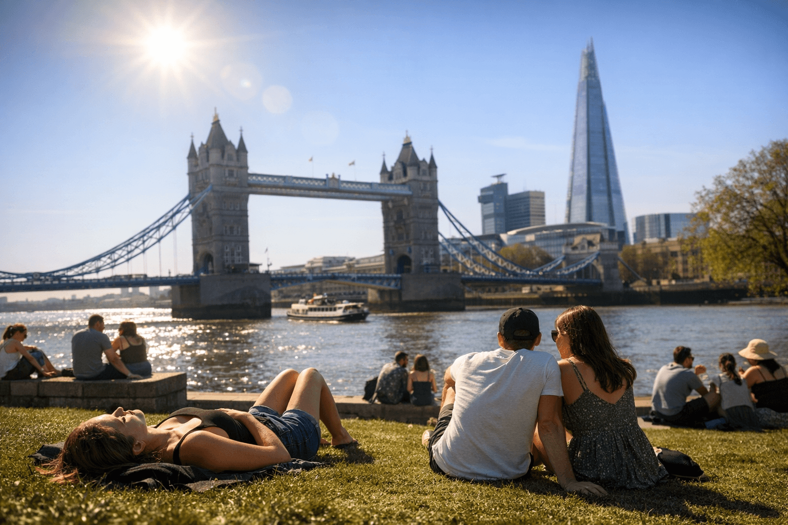
At its afternoon peak, London is forecast to outstrip both Cairo and Athens in temperature. The warmth has been broadly felt across England and Wales, with sheltered areas of northwest Wales also seeing highs of 24°C to 25°C over the past two days. A "very high" red pollen warning remains in force across England and Wales for approximately a week.
Despite the headlines, the warm spell will not officially qualify as a heatwave. Under UK meteorological criteria, a heatwave requires temperatures to meet or exceed location-specific thresholds for at least three consecutive days, a benchmark this brief episode does not meet.
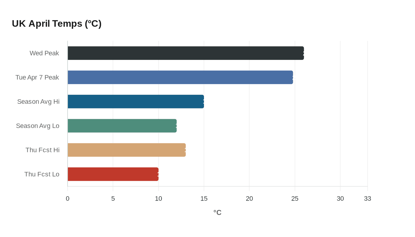
The warmth is also set to be sharply short-lived. Met Office Chief Forecaster Paul Gundersen said the country could expect "a marked drop in temperatures and more unsettled conditions developing later this week," with some areas seeing daytime highs fall by around 10°C between Wednesday and Thursday. Nationally, temperatures are forecast to drop back to between 10°C and 13°C from Thursday, with cooler air pushing in from the northwest accompanied by showers and stronger winds. Northern Ireland and northwest Scotland have largely missed the warm spell altogether, with cloudier skies and rain persisting throughout.
The broader context adds weight to what might otherwise seem like a brief meteorological curiosity. The Met Office has forecast 2026 will be one of the four warmest years on record globally, at an estimated 1.46°C above pre-industrial levels. By the weekend, more typical April conditions, sunshine mixed with showers, are expected to return across much of the country.
This article was produced by Prism’s automated news system from verified source data, official records, and press releases, then run through automated quality and moderation checks before publishing. The system is built and supervised by the people who set the standards it runs under. Read our full AI policy.
Did this article answer your question?

