Very cold week ahead with multiple snow systems impacting McDowell County roads
Very cold conditions and multiple snow systems will affect McDowell County roads, with Tuesday-Wednesday and Friday-Saturday systems likely to bring accumulating snow.
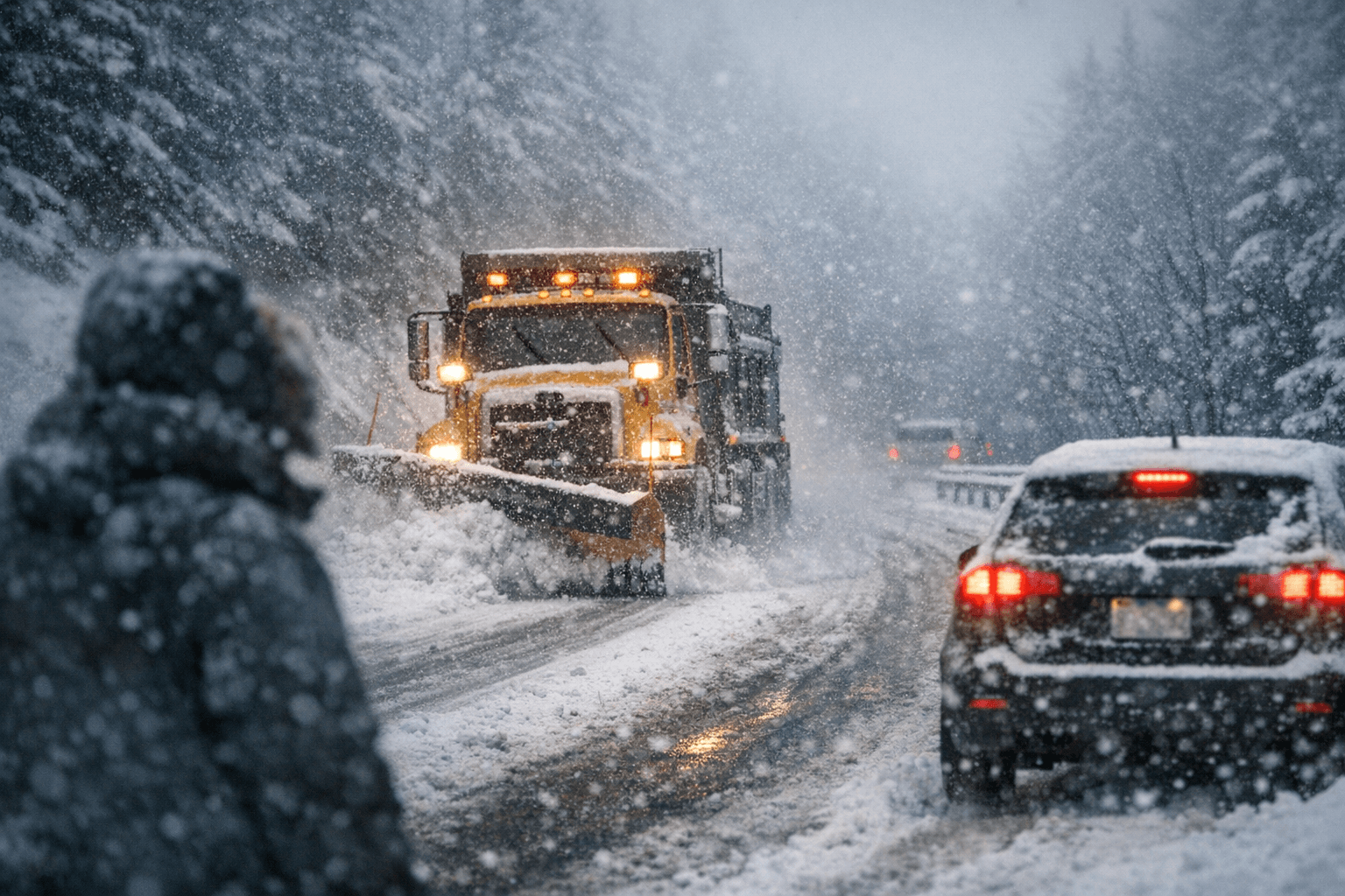
Southern West Virginia will remain very cold through the next week." That warning from a WOAY-TV weather story published Feb. 1, 2026, sets the tone for McDowell County as crews and commuters brace for renewed snowfall and slick roads.
The report, headlined "Cold Temperatures Remain With More Potential Systems Next Week," notes that "Temperatures could only hit at or just above freezing on only a couple of days in this next week." The forecast adds that "(well below freezing overnight in many mountain locat" will be a feature across higher elevations, increasing the risk of icing on untreated surfaces.
Local impacts center on two arriving systems that meteorologists say could complicate travel. "We are also tracking multiple systems to make their way through the region." "Here is a look at system #1, which looks to come Tuesday evening into early Wednesday morning." That first pulse is expected to bring accumulating snow; "Snow totals are not yet known, but snow is likely to accumulate as temperatures will remain very cold across the region." Drivers should note that "The Wednesday morning commute needs to be watched, as this new snow could complicate existing road conditions even further." In practical terms, thin layers of fresh snow or ice can reduce traction on McDowell County secondary roads and bridges that already experience slow melt during prolonged cold stretches.
A second system looms later in the week. "[...] Another system looks to make its way to West Virginia on Friday evening/Saturday morning, and this one has potential to be bigger than the one Tuesday/Wednesday." Forecasters cautioned that "Again, snow totals are not yet known, but accumulating snow does appear possible across some parts of West Virginia on these days as well." They added that "We will continue to monitor the development of this late week/weekend system."
Temperatures through the next seven days stay stubbornly low. "Looking at the temperatures through the next 7 days. 34 degrees, or just above freezing temperatures could swoop through some of us on Tuesday and Friday, but that won’t stop the snow from falling." That pattern means even brief warm-ups to near-freezing will not prevent snow accumulation where precipitation falls.
The WOAY-TV forecast encourages ongoing caution. "Snow appears likely Tuesday/Wednesday, as we watch the development of another system heading into the weekend!" Residents can follow local road reports and county maintenance updates, and plan extra time for travel, especially for essential workers and deliveries that keep local businesses moving.
Tanner Beam is listed under related materials for the forecast. "Watch the full forecast below!" and "Stay tuned for later updates!" as forecasters refine snowfall amounts and timing. For McDowell County motorists and public service officials, the immediate takeaway is to prepare for icy overnight conditions and to monitor the Wednesday morning commute and the late-week system for potentially larger impacts.
Sources:
Know something we missed? Have a correction or additional information?
Submit a Tip