Weekend forecast warned rain then possible snow mix for Bamberg County
Forecast on Jan. 15 shifted from mild to rain Saturday night into Sunday, with a possible rain-snow mix and lows near the mid-20s F. Residents were urged to monitor conditions for travel impacts.

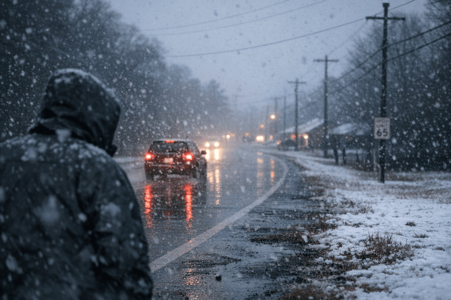
A mid-January mild stretch gave way to a forecast update on Jan. 15 that signaled a colder, wetter weekend for Bamberg County. The point forecast showed rain likely beginning Saturday night and continuing into Sunday, with colder air arriving Sunday and a transition to a rain-snow mixture possible before temperatures fell below freezing. Sunday night was expected to be much colder, with lows near the mid-20s F.
Forecasters included both hourly and text forecasts for the Bamberg point and flagged a hazard period during the Saturday night into Sunday timeframe, noting timing for potential impacts. That combination of wet roads and temperatures falling to the 20s raises the risk of slick conditions on county roads, low-lying bridges and rural routes that are slower to dry or treat.
The most immediate local impacts would be on travel and morning routines. Rain mixing with and changing to sleet or wet snow can reduce visibility and accumulate briefly on untreated surfaces, creating hazards for school buses, delivery vehicles and commuters. Even a short period of mixed precipitation can slow routes in a county where many trips cover longer rural distances and where treatment resources are more limited than in larger metro areas.
There are also household and economic considerations. A sharp overnight temperature drop raises heating demand; residents relying on electric heat, propane or fuel oil should expect heavier usage and plan for deliveries if supplies are low. Farmers and people who keep outdoor plumbing or livestock should take routine winter precautions, as lows in the mid-20s increase the risk of frozen pipes and stress for outdoor animals.
Local officials and service providers were encouraged to monitor updates closely, adjust treatment plans for roads as conditions evolve, and consider schedule changes for school or county operations if precipitation timing worsens. The forecast page’s hourly breakdown can help residents time travel to avoid the worst window and decide whether to delay nonessential trips.
For Bamberg County readers, the takeaways are practical and immediate: expect a change from mild to colder and wetter conditions over the weekend, watch the hourly forecast for shifts in timing, prepare for a temperature plunge Sunday night into the mid-20s, and plan accordingly for travel, heating and care of vulnerable neighbors and animals. Further updates to the forecast will clarify how far the cold will push inland and how much precipitation may accumulate.
Sources:
Know something we missed? Have a correction or additional information?
Submit a Tip
