Winter storm brings slick roads to Owsley County ridges
A returning winter system on Jan. 16 left light snow on ridges and slick spots in Booneville and higher hollows, affecting travel and road safety.

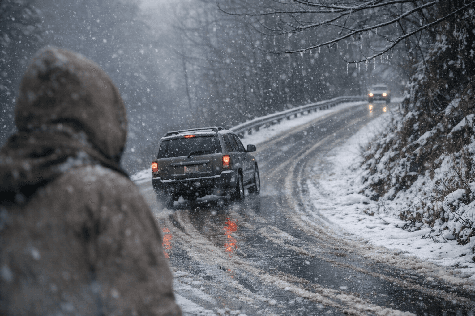
A slow-moving cold front that moved through eastern Kentucky on the evening of Jan. 16 brought a mix of rain and snow to Owsley County, producing slick spots on untreated surfaces and light accumulations on higher ground. The National Weather Service in Jackson issued a special weather statement at 6:40 a.m. EST warning that most areas would see minimal accumulation but that ridges, the elevated border region near Virginia, locations along and north of I-64, and higher spots in nearby Jackson County were most likely to pick up measurable snow.
Booneville and other communities in Owsley County were included among the list of affected locations named in the NWS statement. The bulk of the main snow band cleared late that night, though the forecast had called for additional snow showers and squalls to be possible through Saturday, Jan. 17. Higher-elevation spots in the region faced the greatest potential for a couple of inches of accumulation; most valley and lowland roads saw only light wetting or brief slick conditions.
Local impacts were concentrated on bridges, overpasses and untreated secondary roads, where the NWS warned slick spots were most likely to form. Motorists were advised to allow extra time for travel on night and early-morning commutes following the system. No official reports of road closures or major incidents were included in the advisory; the statement focused on travel hazards and differential accumulation by elevation.
The episode highlights how even modest winter returns can disrupt rural travel in Owsley County. Ridge-top and holler roads that are narrow and less frequently treated are more vulnerable to icing, and the uneven pattern of snow across short distances can complicate travel decisions for residents, school districts and emergency responders. Coordination between the National Weather Service, Kentucky Transportation crews and county road departments remains central to minimizing risk when these systems arrive.
For residents, the takeaways are practical: expect variable conditions between hollows and ridge lines, exercise caution on bridges and overpasses while temperatures remain at or below freezing, and plan extra travel time during and immediately after brief winter events. Community leaders and officials may also use such returns to winter as an opportunity to review local preparedness and communication channels so that information about road treatments and school or service adjustments reaches residents quickly.
As the county moves beyond this brief event, monitoring of official weather releases and local road advisories remains the best way for residents to stay informed about lingering slick spots or any follow-up snow showers.
Sources:
Know something we missed? Have a correction or additional information?
Submit a Tip