Winter storm slams 17 states, grounds flights and knocks out power
A fast-moving storm struck wide swaths of the U.S., forcing travel shutdowns, localized blackouts and major mountain snow that could aid water supplies.
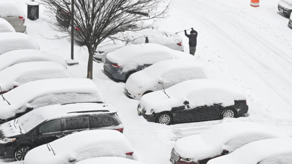
A powerful winter storm that swept across the western and northern United States on Feb. 18 left heavy snow, blizzard conditions in parts of the northern Plains and widespread travel disruption from airports to interstate highways. The National Weather Service issued winter-storm warnings across 17 states, with blizzard warnings in Montana, South Dakota and Minnesota, and forecasters said more than 170 million people were in the storm’s path.
The system combined heavy snow, strong winds and mixed precipitation and was expected to march eastward through the week. The NWS warned that the event would remain dangerous as it moved, and that motorists should carry emergency supplies. Flight tracking data cited by PBS showed “More than 800 flights within, into, or out of the United States were delayed or canceled for Friday in advance of the storm, including at airports in Dallas, Atlanta, and Oklahoma, according to the flight tracking website FlightAware.”
Mountain zones faced the most dramatic totals. Forecasts pointed to multi-foot accumulations in the Sierra Nevada, with some models calling for over five feet locally in the immediate storm window. AccuWeather’s Bernie Rayno warned that the wider pattern could pile up even more: “When this pattern finally wraps up late next week, parts of the Sierra Nevada will end up with 12-16 feet of snow.” The National Weather Service cautioned that gusts could reach 100 mph in the greater Lake Tahoe area, heightening avalanche risk and producing whiteout conditions.
State preparedness measures were visible in the Southern Plains, where authorities tried to blunt what they expected to be a rapid deterioration in travel conditions. Oklahoma pretreated roads with salt brine, the highway patrol canceled days off for troopers and coordinated with the National Guard. As the NWS office in Norman put it, “Travel is going to become more and more treacherous starting late Friday afternoon and lasting through the rest of the weekend.”

In the Upper Midwest the storm already produced measurable impacts. Northern Minnesota logged between about 4 inches in parts of the northwest and 10–13 inches along the North Shore, with the Iron Range reporting 6–9 inches, according to NWS office reports aggregated by local station KAXE. Utilities faced notable damage: Minnesota Power reported close to 200 outage orders overnight that affected roughly 6,500 customers, and about 3,500 customers remained without power in St. Louis and Lake counties as of 10 a.m. on Feb. 18. Local crews reported broken poles and trees on wires after gusts peaked near 60 mph in northeastern Minnesota.
The storm’s economic footprint is uneven. Airlines and airports face immediate operational costs from the wave of cancellations and delays, while state and local budgets absorb overtime and mobilization expenses for road crews, troopers and the National Guard. Utilities confront repair bills and lost commercial activity where outages persist. Conversely, hydrologists and water managers noted a potential upside: heavy Sierra Nevada snowfall will strengthen a snowpack that regional officials say has been running below average after a warm, dry stretch in recent weeks, a short-term benefit for reservoirs and spring runoff.
Forecasters cautioned that the event was part of a broader pattern of extreme winter swings and urged residents across the affected corridor to monitor local NWS advisories. The storm was forecast to bring a hazardous mix of snow, sleet and freezing rain from the Southern Rockies to New England through Monday, followed by a blast of extremely cold air from the Southern Plains into the Northeast.
This article was produced by Prism’s automated news system from verified source data, official records, and press releases, then run through automated quality and moderation checks before publishing. The system is built and supervised by the people who set the standards it runs under. Read our full AI policy.
Did this article answer your question?


