Durango's Animas River Trail Marks 50 Years, Seeks Final Three-Mile Link
Durango's nine-mile Animas River Trail took 50 years and $35M to build; three miles to Three Springs now hinge on a single land negotiation.
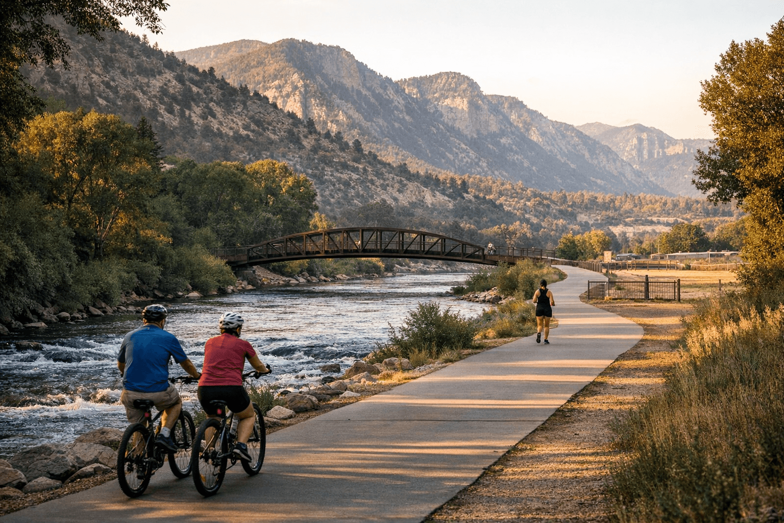
Walk across any of the eight pedestrian bridges laced through Durango's river corridor and you're standing on five decades of incremental ambition. The Animas River Trail stretches nearly nine miles from Oxbow Park and Preserve south to the Dallabetta Park trailhead near River Road and La Posta Road, and it took roughly $35 million and half a century to build it that far. Three miles and one unresolved land negotiation separate it from completion.
Councilor Jessika Loyer made the case directly: "It's truly one of Durango's most defining assets. It connects neighborhoods, nature, the community in a way I think very few towns do."
Of the $35 million invested, approximately $4 million (18 percent) came from grants. The remainder accumulated through municipal budgets spread across generations of city leadership, reflecting the trail's dual role as both recreation corridor and transportation spine. Durango residents can now commute on foot or by bike between neighborhoods that once had no continuous paved connection along the river.
Sweetie Marbury, a longtime resident and former city councilor, described the community's attachment in four words: "Lovely, winding, soothing and peaceful."
The unfinished piece is formally called the SMART 160 Trail, short for Safe, Multi-modal, Aesthetic, Regional Trail. The planned three-mile extension would push the trail from its current southern terminus near the Sale Barn trailhead to the Three Springs neighborhood, bringing the total length to roughly 12 miles. About one mile of that extension is already built. The city has divided the remaining stretch into four construction segments and anticipates funding one per budget year.
Assistant Parks Director Scott McClain explained why a trail this popular took this long to finish. "There were pieces that we had to wait until a private property owner was in place, or that property ownership changed, until we could get an easement to connect A and B," McClain said. "The section down there between Harley-Davidson and the (Durango) Mall was one of those sections where we had trails filled out through there and north of there, but had a gap that we couldn't connect for a number of years."
The northern section near Animas City posed different complications. The area was already developed when construction pushed through, and while residents broadly supported the trail, many raised concerns about privacy along their properties.
The remaining sticking point is Segment 4, where negotiations with a private property owner over an acceptable alignment are still ongoing. The city entered talks with property owner John Gilleland in 2024, and those discussions have yet to produce a resolution.
Completing the link would close a gap that has kept Durango's fastest-growing residential area disconnected from the rest of the trail network for years. Until that paperwork clears, the "crown jewel" is still one link short of the chain.
Know something we missed? Have a correction or additional information?
Submit a Tip