Four Corners adventure reveals the Colorado Plateau's geologic drama
The Four Corners looks like a scenery tour, but the real guide is the rock. Read the plateau’s layers and you can plan hikes, read storms, and spot land still in motion.
Cliffs, fins, canyon walls, and mesa tops across the Colorado Plateau show where the rock was laid down, lifted, and cut apart. That is why one day in the Four Corners can feel dry and exposed and the next can turn cool, windy, and storm-prone. In this corner of Arizona, Utah, Colorado, and New Mexico, geology is the trip plan.
The plateau sets the stage
The Colorado Plateau covers about 130,000 square miles. Typical plateau tops stand at 5,000 to 7,000 feet, with mountain summits reaching nearly 13,000 feet. The region’s mean elevation is about 6,352 feet, but canyon bottoms drop below 2,461 feet and peaks climb above 12,600 feet, so trail conditions can shift sharply over a short drive or a single ridge crossing.
A morning in a high-desert valley can give way to colder air on a rim, more wind on an exposed slickrock route, or a fast-moving thunderstorm over a canyon country skyline. The plateau is centered on the Four Corners area while stretching into a small part of Nevada as well. Much of the Southwest’s major river systems are cut into an immense basin surrounded by highlands, which is why the landscape looks so broad and broken at the same time.
Why the land looks the way it does
The signature shapes of the Colorado Plateau come from a long sequence: sedimentary rocks were deposited near sea level, the whole region rose, and erosion carved what you see now. Once you start noticing those forms, trail choice changes. Wide mesa tops usually signal more open navigation, while narrow fins and breaks can mean more route-finding, more exposure, and more attention to footing.
The big picture is old, but the land is still changing. The plateau began rising about 20 million years ago, and a major uplift period tied to the Laramide orogeny ran roughly 70 to 40 million years ago. Clarence Dutton first imagined the Grand Staircase in the 1870s as a giant stairway of rock layers stepping up from the Grand Canyon toward Bryce Canyon National Park, and that idea still helps make sense of the regional profile.
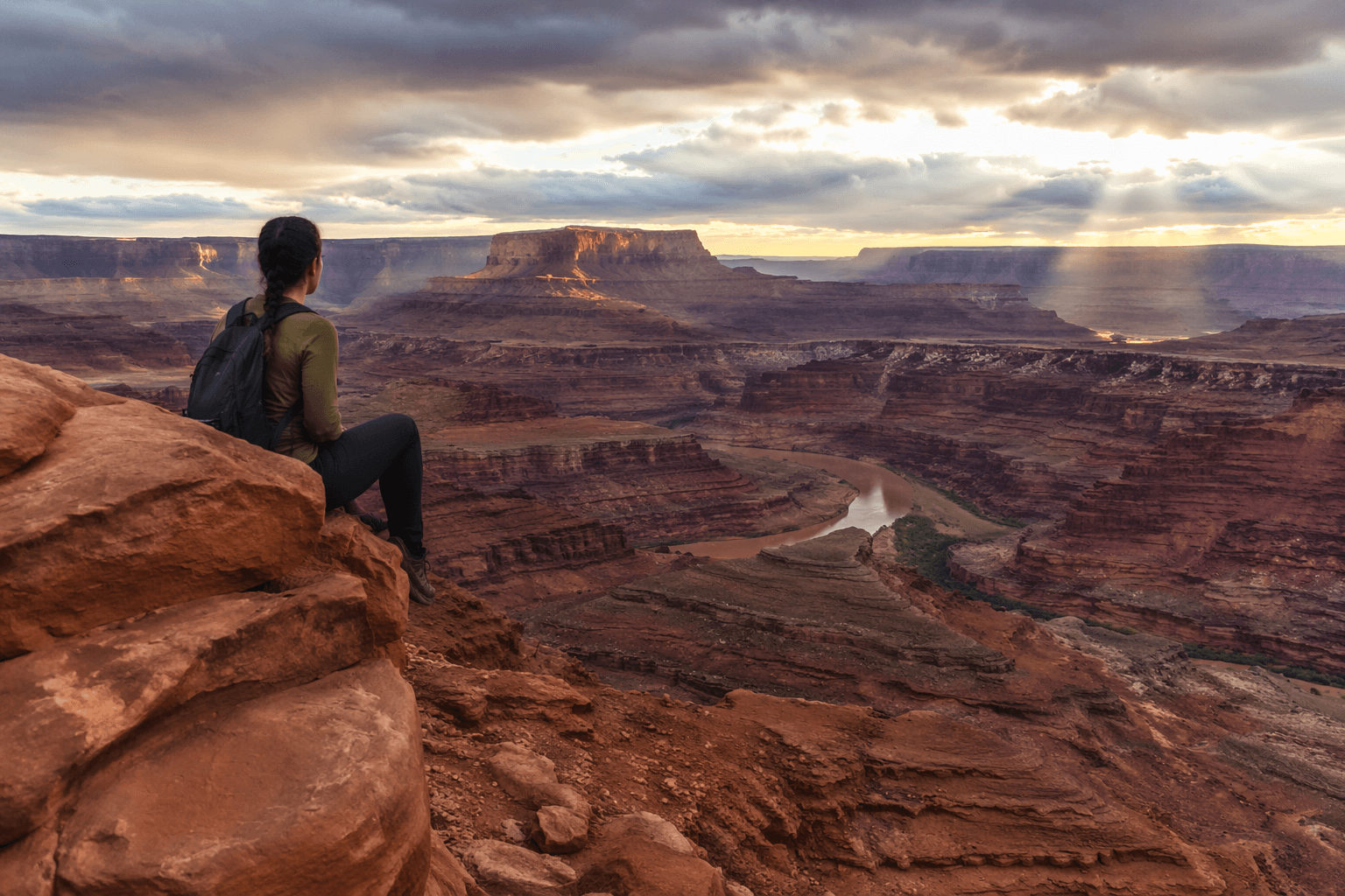
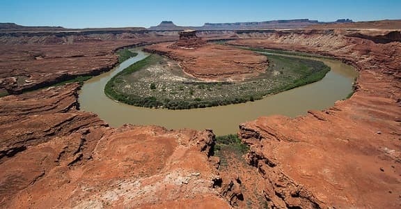
Canyonlands: a layer cake cut by rivers and storms
Canyonlands National Park shows this drama in especially clear form. The park covers more than 300,000 acres and is split into Island in the Sky, The Needles, The Maze, and the Green and Colorado rivers. The park exposes roughly 150 million years of geologic history, and Island in the Sky alone sits on a 2,000-foot-high mesa that gives you a broad, elevated look at the region’s carved margins.
The Green and Colorado rivers began slicing into the geologic layer cake, and they are still part of the park’s shaping forces. Summer thunderstorms add another layer of movement, bringing heavy rains that scour the landscape. Softer rock dissolves or washes away faster, harder rock holds on longer, and that difference creates the shelves, stair-step canyon walls, and deep breaks that make route choice so important here. Major rock falls and landslides show the landscape is still active.
For travelers, that means Canyonlands is best approached with patience and a close look at the map. Island in the Sky offers the big mesa perspective, The Needles is known for its broken, spired terrain, and The Maze is built for people who are comfortable with remoteness and careful planning.
Arches is where erosion gets personal
If Canyonlands shows the scale of erosion, Arches National Park shows its precision. The park has the densest concentration of natural stone arches in the world, with more than 2,000 documented arches ranging from narrow slivers to spans greater than 300 feet.

The rock here is fragile. Arches receives only about 8 to 10 inches of precipitation per year, but that limited moisture still drives year-round erosion. Rainwater seeps into Entrada Sandstone fins and dissolves the natural cement that binds the rock, slowly widening cracks and weakening supports until an arch, window, or cliff edge takes its next shape. That geologic story has unfolded over about 65 million years.
On the ground, that means the most interesting hike is not always the one with the biggest landmark at the end. It may be the route where you start to notice how a fin narrows, where the shade falls, how a sandy wash differs from a slickrock bench, and why a route feels open in one section and exposed in the next.
How to read the plateau before you go
In the Four Corners, geology is practical fieldcraft. Sandstone cliffs usually mean different footing and drainage than sandy washes. Fins can hint at narrower passages and more route-finding. Mesa tops often feel broad and open, while canyon bottoms can trap heat, shade, or storm runoff depending on the day. The landform you see on the map often tells you more than the trail name does.
- High rim country can be cooler, windier, and more exposed than the valley below.
- Canyon walls built from harder rock may hold ledges and steps, while softer layers break down faster.
- Thunderstorms can reshape a route quickly, especially where runoff funnels through washes and drainages.
- Slickrock and sandstone fins demand different attention than dirt trail, because the terrain itself is part of the route.
A few useful cues stand out across the plateau:
This article was produced by Prism’s automated news system from verified source data, official records, and press releases, then run through automated quality and moderation checks before publishing. The system is built and supervised by the people who set the standards it runs under. Read our full AI policy.
Did this article answer your question?

