Montezuma Land Conservancy Completes Five-Mile West Mancos River Conservation Corridor
A 24-year effort just locked in five miles of the West Fork Mancos River for good, with the final 165-acre parcel sealed on March 31.

The West Fork of the Mancos River east of Jackson Gulch Reservoir is the kind of water that rewards patience: a cold, high-desert riparian run where streamside willows filter spring runoff and native fish hold in the riffles through summer. For the anglers and hikers who know it, the watershed just earned a permanent guarantee.
On March 31, the Montezuma Land Conservancy sealed the final conservation easement in a corridor project that has been assembling since 2002, adding a 165-acre parcel owned by Terri Taylor and Roger Nagel to five existing easements. The result: more than five miles of contiguous, protected West Fork riverbank covering roughly 1,168 acres of riparian habitat, grazing land, and watershed that no future owner can subdivide or develop.
The completion marks MLC's 96th conservation easement in Southwest Colorado and the culmination of what deputy director Molly Mazel called "a huge win for the Mancos watershed as a whole." Mazel said the connected corridor "leaves the wildlife undisturbed and able to thrive," language that translates directly to the river conditions anglers and birders depend on: stable banks, intact riparian vegetation, and water quality uncorrupted by residential runoff or fragmented land use.
The Taylor-Nagel parcel was the keystone piece. By permanently waiving development rights on their 165 acres, the two landowners closed a gap that would otherwise have broken the corridor's continuity, leaving an unprotected window between the five upstream easements. MLC funded the transaction with a $55,000 grant from the Keep It Colorado Conservation Easement Transaction Cost Assistance Program, a relatively modest public investment given that it locked in permanent protection for a five-mile river stretch.
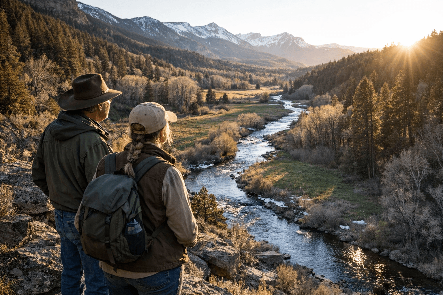
For anyone wading the West Fork this season, the practical difference is a watershed now managed for long-term health rather than short-term development value. The corridor's riparian vegetation moderates stream temperature during summer low flows, which matters directly to fish survival. Protected streambanks reduce erosion and keep sediment loads down. And easements block the kind of parcel-by-parcel fragmentation that can quietly eliminate access and change the character of backcountry approaches over time, the sort of incremental loss that often goes unnoticed until it has already happened.
The Mancos watershed has drawn attention from conservation groups and state grant programs for years because of its ecological value and its role in local ranching tradition. MLC's now-complete corridor sits at the intersection of both: the easements preserve seasonal grazing access alongside wildlife habitat, maintaining the agricultural character that defines this stretch of Montezuma County. The 24-year timeline from first easement in 2002 to the March 31 closing reflects how long patient, parcel-by-parcel assembly actually takes, and how much of that patience ultimately rests with landowners willing to permanently trade development rights for preservation.
This article was produced by Prism’s automated news system from verified source data, official records, and press releases, then run through automated quality and moderation checks before publishing. The system is built and supervised by the people who set the standards it runs under. Read our full AI policy.
Did this article answer your question?

