Camera Traps Reveal Rare Wildlife Across Asia's Annamite Mountains
A 2025 Fauna & Flora survey produced 30,000+ camera trap stills across the Annamite Mountains, documenting 42 species and the first confirmed breeding of the critically endangered large-antlered muntjac in Cambodia.

Among the 30,000-plus stills produced by Fauna & Flora's year-long camera-trap survey of the Annamite Mountains in 2025, one frame carried more weight than any other: a large-antlered muntjac fawn, confirming for the first time that this critically endangered deer is not just passing through Cambodia's Virachey National Park but actively breeding there.
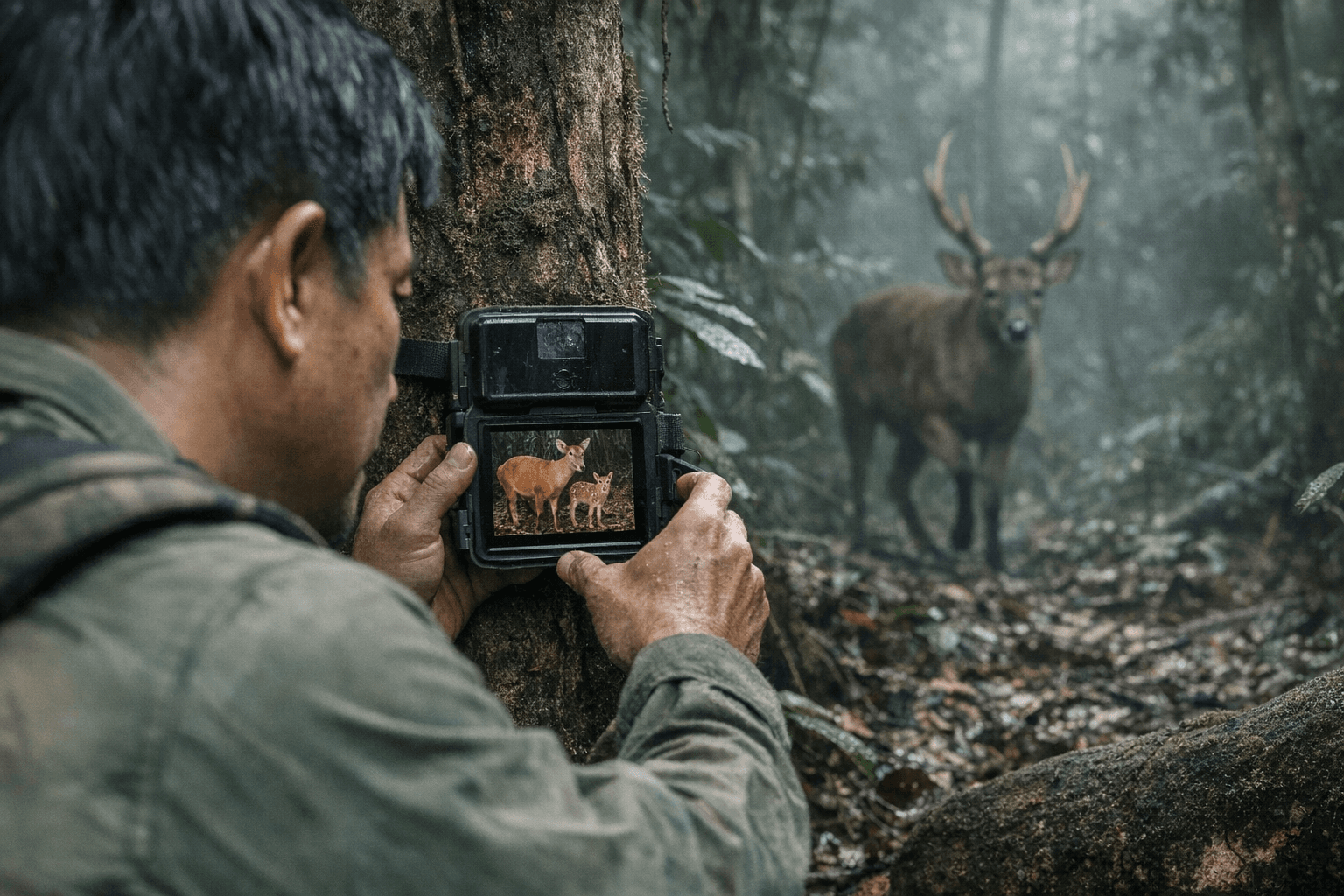
That single image encapsulates what remote cameras can accomplish where no field photographer ever could. No human observer could have waited quietly enough, or long enough, in the remote karst forest of northeastern Cambodia to catch that fawn in frame. Over the course of 2025, more than 80 camera units deployed across seven distinct grid zones documented 42 key species, including 32 mammals, 9 birds, and one invertebrate, with nine of those species recorded in Cambodia for the first time. The full haul included clouded leopards, marbled cats, sun bears, Asian elephants, Sunda pangolins, red-shanked douc langurs, and dhole, many captured at night, in rain, under conditions that would end any conventional shoot immediately.
The Annamite range stretches 1,100 kilometres through Laos, Vietnam, and northeast Cambodia. Virachey alone covers more than 3,000 square kilometres of terrain so dense and remote that the range has been nicknamed the "Amazon of Asia." Fauna & Flora coordinated the survey in partnership with Cambodia's Ministry of Environment and Ratanakiri provincial environment departments. Indigenous and local communities handled the logistics that no external team could have managed alone: identifying camera locations through direct knowledge of animal movement, hauling equipment through bamboo and tropical evergreen forest at varying altitudes, and retrieving memory cards from the most inaccessible zones of the park.
Getting those shots required placement decisions that scale directly to any level of camera-trap work. Cameras were positioned at game trails, water sources, and natural terrain pinch-points where movement is channeled rather than open-ended. The seven-grid deployment spread units across multiple altitude bands and habitat types, ensuring the data reflected genuine species distribution rather than accessible-terrain bias. No baiting was used; in a multi-species biodiversity survey, attractant use distorts presence data and creates artificial congregation near camera stations. Cameras were oriented north or south where possible to prevent false passive infrared triggers from dappling sunlight, and fixed to trees to minimize ground-level disturbance. A burst sequence of three frames per trigger captured behavior across a short window rather than a single frozen moment, which is exactly how researchers could assess the muntjac fawn's developmental stage from the image alone.
Data management was built into the retrieval workflow from the start. Each card was tagged with grid ID, station number, date, and GPS coordinates before files entered species-identification review. With 30,000-plus images to process, anything less than that systematic tagging turns a scientific asset into an unsortable archive.
For a weekend-scale deployment, the same principles simplify without losing rigor. Mount a PIR-triggered trail camera at knee-to-hip height on a tree roughly 15 to 20 feet back from a clear run, angled slightly downward. IP67-rated housings handle rain; direct sun into the lens generates false fires, so orient accordingly. Set trigger delay to 5 to 10 seconds on an active corridor and longer on opportunistic stations to protect battery life. Format SD cards in the camera rather than on a computer to prevent file-system conflicts, and log each deployment's GPS point and date in a spreadsheet from day one.
The community challenge: choose one site, deploy one camera, and run it for 30 days. When you pull the card, document not just what species appeared but what the timing tells you about activity patterns and habitat use, then share your images and setup decisions alongside what the month of passive observation revealed that any number of hikes through the same landscape never would have. The muntjac fawn in Virachey was found because a camera ran long enough in exactly the right place. That principle scales to any forest, park, or greenway you can reach on a weekend.
Know something we missed? Have a correction or additional information?
Submit a Tip